Hoka One One is Now in Town

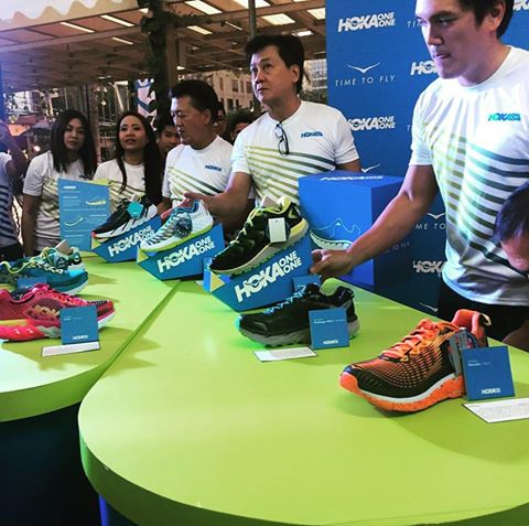
I’ve always been hearing about how Hoka One One is such a go-to brand when it comes to running shoes.  I got a taste of the effectiveness of the shoes when I finally got a Hoka Speed Instinct in Singapore 3 weeks ago.  It’s really soft on the feet, smooth on the ground and despite its bulky look, it’s just 8.4 oz.  Well, now we don’t have to buy our Hokas in other countries now as Runnr has brought in the brand last March 16, 2017 with a Launch at Runnr Bonifacio Global City.

Hoka One One

Toby Claudio of Quorum Group Talks About Hoka One One

Toby Claudio of Quorum Group Talks About Hoka One One

“We are excited to be the official distributor of HOKA ONE ONE in the Philippines. The arrival of this amazing shoe brand in the country has long been anticipated by our local roster of triathletes, ultra- distance runners and marathoners,” said Toby Claudio, President of Quorum International Inc. and Founder of RUNNR. “As the leader in the local sports retail industry, we continue to support the growing Filipino running community by bringing in the best global brands.”

I almost missed out on the launch but decided last minute to join the launch since I believe in the prospect of this brand and I’ve always been supporting the brands under the Quorum Group and SRI.  I’ve been to numerous launches of Quorum Group and I always look forward when Toby Claudio speaks about the brand, whether it’s a running shoes, a socks, an accessory or even just an insole.  Toby knows his product and you don’t even need a press kit to write about the product.  Hoka One One is an amazing shoes that makes a maximalist shoes feel like a speed shoes.

Friends!

Friends!

He also mentioned that he met the Hoka owners 5 years ago and the brand could have come in earlier.  That got me thinking, What if Hoka One One came 5 years ago?  At that time, running was at a boom and the long distance runs / triathlons were just starting to peak.  I think it would still be a great brand at that time but I think the impact is much felt now with trails and ultras being more prominent in the running scene.  The Hoka launch also came with a touch of nostalgia as I got to see a lot of running friends I haven’t seen in a while.  Incidentally, these were friends I’ve grown into the community over the last 5 years too.  Really a lot of long time no sees here and there and I’m glad to see them again.  I guess that’s how excited the running community is with the Hoka Brand.  There’s been an even long queue for those who bought their shoes at the launch.

Welcome Hoka One One

Welcome Hoka!

Welcome Hoka!

RUNNR has been the Philippines’ leading running specialty store and they are the perfect partner to bring in the HOKA ONE ONE®, the award-winning running shoe brand that is making significant global strides with its maximalist sole design in the country.  Last March 16, 2016, It was finally time to fly Manila for the world renowned brand.

HOKA ONE ONE started in 2009 when Ultra Marathon champion Nico Mermoud realized he needed shoes to help him run downhill fast while reducing the shock that took a toll on his legs. Mermoud then partnered with fellow athlete Jean-Luc Diard in engineering a shoe that had more cushion than traditional running shoes and a uniquely carved geometry that encouraged an efficient foot strike – thus the revolutionary, lightweight running shoe brand was born.

Over the years, HOKA has become one of the most acclaimed running shoe brands in the world, winning accolades from Competitor Magazine, Triathlete and Runners’ World. The continuous growth of HOKA can be attributed to runners of all types embracing the brand’s goal of delivering lightweight, well- cushioned shoes with an exceptional ride.

Recognizing the demand of the growing Philippine running community for quality and high-performing products, RUNNR, a member of the Quorum Group of Companies, will exclusively carry the HOKA shoe line in the Philippines, adding yet another premium item in its already impressive mix of running products.

Philippines, it’s about time we experience HOKA ONE ONE. Why run when you can fly? Visit RUNNR at Bonifacio High Street, Trinoma, Alabang Town Center and Cebu and grab a pair now!

My Hoka One One Experience

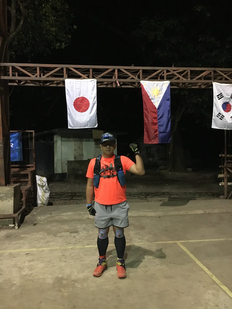
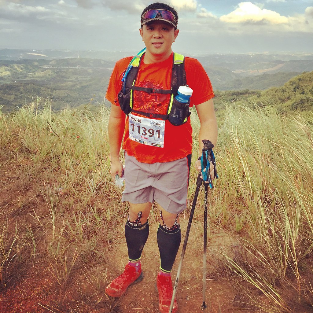
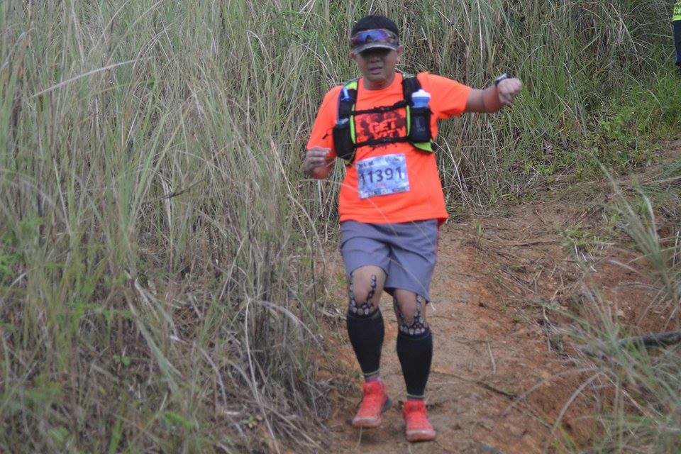
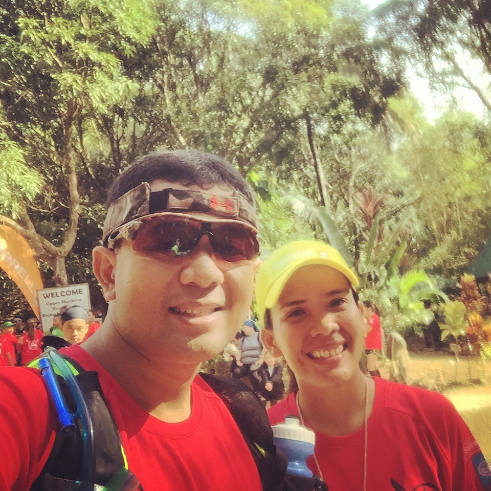
I’ve known that HOKA is coming to town since last year. I was too excited that when there was a sale in Singapore I got myself one and not being able to wait 3 weeks later.  I got a Hoka One One Speed Instinct, which is a trail shoes. When I wore it the first time, it was love at first stride.  It was really soft and comfortable for the feet.  Over the years, I’ve always been wearing minimalist shoes because maximalist shoes always meant that the shoe would be heavy.  The Hoka One One looks bulky right? Well, surprise surprise, it’s just 8.40 oz.  That’s the same weight as a minimalist shoes.  I’m sold immediately with getting both cushioned support and lightweight feel, which I probably need more now as my legs has also gone through years of wear and tear from running.

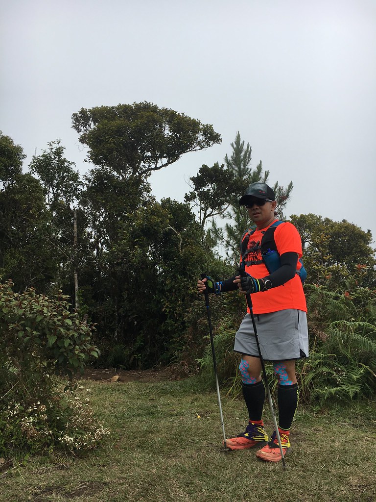
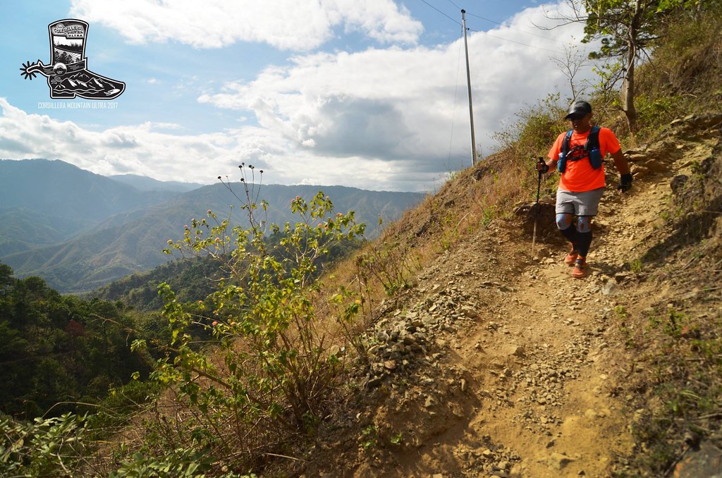
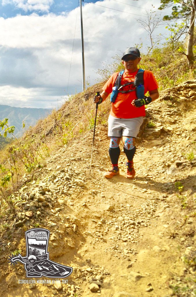
It’s one thing for a shoe to be comfortable but it’s another thing to be effective.  I took the shoe out on a run on the road. Surprisingly again, it felt smooth on the road.  It’s really rare for trail shoes to be smooth on the road. For trail shoes, you’ll need more traction and grip, which can slow you down on the road.  I was posting regular road pace with the speed instinct.  I’ll test it out more on the trail on do a more comprehensive review.  Based on the size of the lugs, it’s not an aggressive trail shoes but I guess this is good to go on regular trail conditions.  If you’re looking for a more aggressive shoes on technical trail, the Speed Goat and Challenge ATR is also now available.

Grab Your Hoka One One now

It’s time for you to experience Hoka One One and it’s time to fly Manila.  HOKA ONE ONE® shoes are available in Men’s and Women’s sizes (selected models) ranging from P6,295 to P7,295 at the following retail outlets:

  • RUNNR TRINOMA, LEVEL 2, SM TRINOMA EDSA cor. North Ave. Quezon City, 1105
  • RUNNR CEBU, LEVEL 2, SM CEBU Cebu Business Park Cebu City, 6000
  • RUNNR BHS, LEVEL 1, B3 Bonifacio High Street Fort Bonifacio,Taguig City, 1634
  • RUNNR ATC, LEVEL 2, Alabang Town Center The Garden, Muntinlupa City, 1799
Categories: My Thoughts | Tags: , , , | 32 Comments

Vitalis Weekend Escapade

Vitalis Villas

Vitalis Villas

Weekend travel getaway that doesn’t involve trails or mountains has been as rare as it gets for me.  Since I just finished 50K worth of Cordillera trails, I guess I earned this one.  Vitalis Villas boast of Santorini like architecture and makes it really worth your time and money’s worth.

Read About:

Vitalis Villas

Vitalis White Sands

Vitalis White Sands

Last month, our cousin started organizing the tour to Vitalis. We got a two bedroom room and another one bedroom room to accommodate the 10 of us.  We stayed in the one bedroom room and the rate is surprisingly affordable, which is Php 11,450, which includes the room complete with kitchen, masters bedroom, enormous living room area and a porch overlooking the sea.  That’s also inclusive of 3 buffet meals for the whole stay.    The two bedroom unit (Php 19,000) is perched on a hill and has two floors with one room on each floor.   The cost of the accommodation is between Php 3,000-P3,500 per person inclusive of all buffet meals, rooms and the services.  You can have a golf cart bring you to your room to the other facilities. It includes use of facilities in Vitalis Villas and Vitalis White Sands though water sports facilities is priced separately.

My sister and I came from Manila while the rest of the family came from our hometown in Baguio.  We had the longer travel time but we arrived earlier in Vitalis Villas in time for the buffet lunch.  The buffet meal was overwhelming as you get to have a lot of choices plus Petra sits atop of the property so you have spots overlooking the sea and the whole property.

Touchdown Vitalis

Touchdown Vitalis

Check in time is between 2-3 pm so we had a few hours at Petra for lunch. The rest of the family came at around 1 pm.  We had our one bedroom Villa at around 2 pm while the 2 bedroom Villa was available at 3 pm.  We were surprised at how enormous the room was. There was 2 king size bed, several sofas, kitchen, comfort rooms and bath rooms and our villa was on the lower part and nearby the lower pool and the view of the Ocean. You can easily fit 10 people comfortably in the room though the room is only for four people.

Vitalis

Vitalis

The room felt really comfortable so the first order of business was to catch some sleep. We woke up between 4-5 pm and then we checked on the rest who also fell in love with their beds at first sight.  It was then that we regrouped so we can try the water sports at the nearby Vitalis White Sands.

The View from Our Room

The View from Our Room

There are shuttle services from Vitalis Villas to Vitalis White Sands, which is on the lower end of the resort.  There are several pools in Vitalis Villas but the beach and water sports is located at Vitalis White Sands.  We arrived past 5 pm and we discovered that the water sports area is until 5 pm only.  They have kayaks, pedal boats, jet ski and an area for inflatables.  Since the water sports is not available we just took our time to swim in the beach.

Vitalis White Sands

Vitalis White Sands

It felt good to swim.  After swimming, we went back to Vitalis Villas at around 7 pm for dinner.  One of the pool area is just beside Petra, the dining area. Instead of going to dinner immediately, we took another dip in the pool before dinner.  This was followed by another buffet feast for dinner.  We’d regroup later into the night to take a deep on the lower pool in our room and had drinks at the mini bar after.

The Chapel

The Chapel

It was really nice to bond with my cousins once again, which is something we haven’t done in a while with shifting priorities and a lot of events happening the past few years.  After that it was time to rest for the next day.

Day 2

Happy Sunday

Happy Sunday

I woke up just in time to catch the sun rise view above at around 6:30 am and had breakfast at 7 am.  Of all the buffet meals, I have to say, breakfast was my favorites with longanisa, dried fish, pancakes, palitaw and a whole lot more.  We’d love to reload on this meal too as the next one is in Vigan already after we check out. Vitalis is located in Santiago, Ilocos Sur, which is around 45 minutes before Vigan. Up next was going back to Vitalis White Sand to try the water sports.  My niece tried out the zipline too.

Chillin' like a Villain!

Chillin’ like a Villain!

There was the early morning sea breeze to make it really relaxing to chill for the beach.  I could do this for hours but we also did try the pedal boat and the kayak.  It was fun to add some activity to this relaxing weekend. I must have gain x number of pounds just on the buffet dinners.

Vitalis White Sand is the perfect place to see the Santorini like infrastructure of Vitalis.  Just an interesting piece of trivia, Vitalis White Sand has been there for decades though it gained prominence when Vitalis Villas was completed last December 2016.

View from Vitalis White Sands

View from Vitalis White Sands

So we spent the rest of the morning at the beach.  I did drop by the hilltop adventure area where there was a mini zoo and a zipline area before going back to check out.

Vigan

Lunch at Uno Grille in Vigan

We then spent the next 45 minutes heading to Vigan to have lunch and a stroll along Calle Crisologo.  I haven’t been to Vigan for almost 2 decades so its nice to be back to appreciate the heritage city of Vigan.

Calle Crisologo

Calle Crisologo

We left Vigan at around 4-5 pm and that was our long trip back to Manila. On hindsight, we should have done a a minimum of 2 days and 3 nights type of vacation since it’s a bit tiring to spend one day on the resort and one day on the road.  I guess that now proves my point that I recover faster from races than family vacations. Looking forward to the next one.

Vigan!

Vigan!

Categories: My Travels | Tags: , , , , , | 30 Comments

Cordillera Mountain Ultra 2017

Survived 50K of CMU 2017

Survived 50K of CMU 2017

I’ve been keeping it wild since Cordillera Conservation Trust started showcasing the beauty of the Cordillera for the past 3 years.  It’s definitely the toughest and most scenic 50 kilometer distance with a whopping 3,000 freaking meters worth of elevation from Dalupirip to the peak of Mount Ugo. 

Read About:

Cordillera Mountain Ultra

3 Years of Keeping It Wild

3 Years of Keeping It Wild

3 years ago, when the first Cordillera Mountain Marathon was being organized I got attracted with the idea of mountain runs.  In an instant, I joined the 11K distance at Mount Pulag and was able to finish it.  I heard the stories of the mountain marathoners and felt they had a really an awesome experience being able to go to several provinces before finishing back at the ranger station in Mount Pulag.  That’s my light bulb moment that I should do a mountain marathon, which then had a cut-off time of 13 hours.  The next year, it was reformatted to be a 50 kilometer ultra event from Dalupirip at Mount Ugo, with a cut off of 14 hours. If you knew me, Ultras are part of my “Never” list and the cut-off is a bit stiff compared to the marathon distance a year ago. I went on to finish the 21K distance last year. When registration opened for this year’s edition, I took a leap of fate and just signed up for the 50K distance and as things were, the cutoff was even shorter at 13 hours. Good luck to me.

Pre Race Anxiety

When you lack training, try to do the math.

When you lack training, try to do the math.

For the first time since my first marathon in 2014, I was actually scared of the race.  My training plan didn’t turn out as expected with bouts of ankle sprain, shin splints, coughs, colds, busy work schedule and lack of training mileage.  My longest distance for the past 3 months was 17 kilometers on the trails and 21 kilometers on the road. I did insert some gym time walking on inclined treadmill for hours.  You don’t have to be an expert to say that it’s not enough for a 50 kilometer race with 3,000 meters elevation gain.  When it comes to training, the longer you train, the less you suffer on race day so I started conditioning my mind to get ready to suffer.  I plotted the elevation profile and tried to plot some target times each segment.  This is my first ultra event, the goal was to finish and meeting the cut-off would just be bonus. I did hope that I did finish before it became dark.  I guess flawed as it was, that was the plan.

Race Route and Elevation Profile

Race Route and Elevation Profile

Race Route and Elevation Profile powered by Suunto Spartan Sport

The first 9 kilometers was a rolling  terrain with a mix of paved road, dirt road and river trails until the foot of the climb to Tenidi Hill.  This was followed by a 3-kilometer climb to Tenidi Hill covering about 750 meters of elevation gain.  The trail descends for the next kilometer to Oling before the climb resumes to Ugo for the next 12 kilometers with total elevation gain of 1,100 meters (including about 300 meters steep climb to the summit).  The race descents back to Tinongdan for the next 14 kilometers and goes on another rolling loop at Tinongdan for the next 5 kilometers before hitting Dalupirip for the last climb and descent to the finish line.

The Race

Carboloading with Team Smart at home.

Carboloading with Team Smart at home.

Up until the claiming of the race kit, I was still thinking if it was possible to downgrade to 21K or just totally miss the race. Yes, that’s how anxious I was before the race.  So when I got my kit for the 50K distance and had my Raceyaya timing chip attached to me, I guess this is it.  I got some inspirational words from Carlo of Smart the day before the race and Jonel and Aldean before the race.  It’s time to put my heart and determination to test.

Here we go again.

Here we go again.

The race started at 4 am sharp and it was time to just execute the game plan or how much I could during the race.  I started of with a good pace and good thing that my shin splints didn’t bother me this time. I slowed down on the single track climb to the main road on the 2nd kilometer and I was just playing the elevation by speeding up on the descent and walking the ascents on the road stretch.  Upon crossing the hanging bridge, I started to slow down just to make sure that my heart rate would be low before I climb Tenidi Hill.

Tenidi Hill

Let's Go!

Let’s Go!

Tenidi hill was the toughest part of the course with 750 meters elevation gain in just 3 kilometers of distance.  If I get past this then the race is more manageable.  This is my 3rd time at Tenidi Hill and I could do this for 10 more times and it would never feel easy.  I took it one effort at a time disregarding the distance and just watching the elevation on my Suunto Spartan Sport. It does help mentally when you see you’re moving up the elevation even with the distance is just trickling in.  Before 3 hours in the race, I was up Tenidi Hill and it was a short descent to the town of Oling.

The Long Climb to Mount Ugo

Running around the ridges of Mount Ugo - Photo by Jefferson Chua

Running around the ridges of Mount Ugo – Photo by Jefferson Chua

The Town of Oling was a timing point and had a cutoff of 4 hours.  It’s also the last bail-out points of the race and once you continue here, you have to finish the whole loop since there are no other exit points (unless you’d like to exit at another province and end up there for days.  I thought for a second and said to myself, it was a go. This was a really long climb with the first 10 kilometers about 750 meter ascent and the next two kilometers having about 300 meters ascent.  It started with a technical climb from Oling and I was surprised that the first 2-3 kilometers, I was already able to cover about 300 meters of elevation.  That means that there would be some lower inclines above.

Resting Midway the Climb - Photo by Kat Faustino

Resting Midway the Climb – Photo by Kat Faustino

The first few kilometers of the climb were technical pine forested trails.  After the trails went higher, it shifted to long rolling run-able ridges that was just mesmerizing.  We were moving on single track ridge with some portion hot because of the time of day and some portion foggy and cold because of the altitude.  It was scenic yet it was tough. I just kept checking on the altitude and once we got up by 100 meters in altitude there was a stretch where we’d go down 50 meters.  It felt exhausting and frustrating but I realized the best way to deal with tough times is to look forward to good times.  During the toughest parts, I’d always remind myself how many kilometers it was to the summit and I need to finish the race so I can celebrate my birthday this week.

Nearing the summit.

Nearing the summit.

The last 2 kilometers to the summit was really difficult as it’s already a direct assault plus fatigue is coming into play.  I made it one push after another and things would get easy going down for the second half of the race.  I eventually reached the summit in less than 8 hours, which meant I have 5 hours to chase the cut-off for the second half of the race.  It was foggy at the top so here’s my id picture with white background at the summit.

Mount Ugo Summit

Mount Ugo Summit

The Long Descent

After I had my time recorded at the summit, I went on the descent. The first part of the descent was a bit technical so I wasn’t able to speed up yet.  I’m such a klutz when it comes to technical trails and almost slipped several times.  It wasn’t fast but it helped me recover.  There were about 2 to 3 kilometer of technical descent before it shifted to run-able descending ridges.  The problem was I felt too banged up to run. I did the next best thing, I brisked walked for the next few kilometers going to the aid station in Domolpos at kilometer 33 in 10 hours.  I have about 3 hours to cover about 15 kilometers of distance.

Descents - Photo by Harry Tanoja for Cordillera Conservation Trust

Descents – Photo by Harry Tanoja for Cordillera Conservation Trust

There was a short ascent after kilometer 33 but since I was up against time I just maintained the same pace for both uphill and downhill with faster brisk walks.  I managed to move past the next 2 kilometers at a good pace.  The next 2 kilometers were on a bit slippery and loose sand and rock surface so I slowed down.  It’s about 10-11 kilometers before the finish line and I have 2 hours to go.  The cut-off is still within reached though the window is closing a bit.

Chasing cutoffs

Chasing cutoffs

Entering Tinongdan Town at about kilometer 39, I felt my right quad cramping so I had to rest it a bit in one of the store while I took a soft drinks break.  I could barely move my right quad without pain so I slowed down again.  I tried to cushion each of my step with the pole so there would be less impact on my quads  It felt a bit better after walking though I would take occasional rest to massage the muscle a bit. Eventually, I went back to using to poles to reduce the impact on my legs.  With my window of chasing the cut-off becoming least probable, I started aiming just to finish before dark.  I just kept moving as the trails shifted to the rolling terrain in Tinongdan to the road back to Dalupirip and eventually the finish line.

With JP and Koi at the finish line.

With JP and Koi at the finish line.

It was beyond cut-off at about 14 hours but I’m glad I did finish the race before it went dark.  When I was in doubt whether to run or downgrade before the race, I always had this in mind.  It wasn’t about the time, it was always about the experience. It was just a few less muscle pains away from meeting the stiff cut-off but I’ll take that. I didn’t give up.   I have no regrets and no more looking back that I should have done the distance. There’s so many reasons to be proud of and to celebrate.  Of course, I’ll be back next year maybe to try the Vertical Kilometer or maybe another round to enjoy the tough Mount Ugo Terrain and just keep it wild.

Categories: My Runs | Tags: , , , , , , , , , | 26 Comments

#TaleOfTheTrail Southern Ridges (Singapore)

Southern Ridges is a cluster of parks in a 10 kilometer distance that gives high vantage point of the city and forest view along elevated planks along the course.

Read About:

Tale Of The Trail

There's a lot of places to visit in Singapore but let me take this chance to explore the Southern Ridges.

There’s a lot of places to visit in Singapore but let me take this chance to explore the Southern Ridges.

Southern Ridges is more of a city trail than the usual rough road and muddy forest trails I take. It does make up for it for the different vantage point you get to see in the area and the volume of climbing involved.  There’s the city view at Mount Faber Park then it shifts to forest views entering Henderson Waves, Forest Walk, Hort Park, Canopy Walk and eventually Kent Ridge Park.  This time I had a different tour of Singapore and it had me running from one park to another as I get to appreciate the view of Singapore from it’s Southern Ridges.

The starting point is an easy access as it falls just at Exit D of the Harbourfront MRT Station. The end point leads your to either Kent Ridge Park Station or the Pasir Panjang Station depending on which side of Kent Ridge Park you want to exit.  The reason I chose this route was because of the distance.  I needed to log in some mileage for an upcoming race yet I also need to come back early to catch my hotel check out.

Map and Elevation

Map and Elevation Profile Powered by Suunto Spartan Sports.

Map and Elevation Profile Powered by Suunto Spartan Sports.

The route starts at Harborfront MRT Exit D going to the Marang Trail.  The trail heads to McFaber Park – Telok Blangah Hill Park – Hort Park and Kent Ridge Park.

Trekking The Southern Ridges

Stairs and a lot of them

Stairs and a lot of them

It was easy finding the starting point of the Southern Ridges since it’s at Exit D of Harbourfront MRT station.  That’s the same station you take for the cable car ride to Sentosa.  You just have to look for Marang Road within the station and you’re all set.  It’s all uphill at this point with the trails shifting from uphill roads to stairs for the next kilometer.  It was a struggle at this point as the legs are still not warmed up.

Unli- Stairs

I always have a hard time with stairs compared to uphill paths since you can take the latter with tinier and less energy consuming steps.  I needed the struggle of the climb anyway so it’s time to hustle and just climb.

Upon reaching the top of the climb at Marang Trail, I got a peek of the city.  There was the  cable cars crossing over to the other side of Sentosa.

Cable Cars

Cable Cars

The next area to visit was the Faber Point, which would be the highest peak of the trek.  It was another 500 meters of climbing though it was not as steep as the Marang Trail.  It also helped that the area is frequented by tourists.

Merlion at Faber Point.

Merlion at Faber Point.

There was a Merlion at Faber Point and also a panoramic view of the city.

Appreciating the view.

Appreciating the view.

After Haber Point, I was supposed to go to Henderson Waves.  I took the road to the left since it would be intersecting to the same road that leads to Henderson Waves.  Well, this was the longer part since if I took the road on the other side, it’s just about 300 meters away.  It was a rush running downhill even if it was the longer route.  After reaching the intersection I had to climb up again to Henderson Waves.

Henderson Waves

Henderson Waves

Henderson Waves were a series of elevated wooden path, with waves on one side and the forest view on the other side.  It was fun running this part especially with the greenery surrounding the area. There were also a lot of students enjoying this part of the trail.

Running at Henderson Waves

Running at Henderson Waves

After the Henderson Waves, I was already at the Telok Blangah Hill Park.  There were painted signs on the road and I just followed the markings heading to the forest walk. There were side attractions like Sembcorp Forest of Giants  and Alkaff Mansion.

The highlight of this stretch though was the forest walk. That’s about 1.3 kilometers of descending zigzag trails on elevated steel planks.  There were also several runners / trekkers doing this part.  I enjoyed this part because of the green backdrop.  While I was struggling a bit on the metal planks since the lugs of the shoes tend to collide with the gaps on the steel ramp, the view was a lush green forest.

Elevated Zigzag Planks.

Elevated Zigzag Planks.

Once I got the hang of moving around the steel planks, I started to speed up since I need to finish early to catch my hotel check out time.  By the end of the forest walk, I was already in front of the group.

Forest Walk

Forest Walk

There were several exit points at the forest walk but I took the one leading to Hort Park. Hort Park was another beautiful park with themed gardens and wide greenery. I even saw one group having wedding pictorials at the center of the gardens.

Hort Park

Hort Park

If you love nature, Hort Park is a good place to visit.  Before reaching the Canopy Walk, I was able to see several themed gardens one after another as they are in the way of the Canopy Walk.  The Canopy walk starts at the end of the park.

The Canopy is a zigzag uphill path heading to Kent Ridge Park.  It’s quite challenging at this park since it was a climb but since it was on zigzag paths it was not too steep.  It was also good that the area is shaded by trees, which helped reduce the heat on the warm morning.

Canopy Walk

Canopy Walk

On the higher end of the Canopy Walk, there was a road heading to Peppy’s Road and the other road leading to the Pond.  Peppy’s Road is an exit point and I ended up taking the route to Peppy’s Road.

Kent Ridge park

Since I was just at 7 kilometers in my watch, I figured that I should have taken the road to the pond.  I retraced my steps and headed to the pond. There was an overlooking view on the elevated walkway and there were a lot of refreshing areas in the park to just chill.  Once I discovered the route to the pond, I checked my map and had to options to exit. There’s an MRT at Kent Ridge Park after passing the pond or take the MRT at Pasir Panjang.  I opted for the latter since I’ve already covered my 10K for the day in a little over 2 hours of running, walking and trekking.

Got lost but found my way to the MRT.

Got lost but found my way to the MRT.

I followed Peppy’s Road, which led to Pasir Panjang and just a few hundred meters away from the MRT Station.  I love this lost in the city moments.  It was fun exploring 10K worth of city trails, which was a great workout and a tour as well.

Categories: My Travels | Tags: , , , , | 30 Comments

Powering My Workouts with Javita

I guess there’s more to Javita than just their Teas and Coffees.  I added Javita Rush and Flex into my workout and it gave me an energy boost and at the same time, it faster muscle recovery.

Read About:

Javita

While I started drinking Javita because of their coffee, I am starting to appreciate their other products as well.  When it comes to coffee, it’s just 11 calories and has 0g fats component. It can really help you on managing your weight and still get an easy to prepare gourmet coffee.  It’s easy to prepare since it dissolves easily in both hot and cold water.  It’s just the right mix to give you that jolt to wake up your system for the day.  It’s a healthier source of caffeine and can really work wonders to your system.

Javita Rush

The first quarter of the year is always a busy one for me.  For one, all the interesting races are booked at this time because of the cooler weather and it’s also my busy season at work.  It’s a revolving cycle of sleep, work, train and repeat. That takes a lot of energy and needs a lot of consistency.  Little did I know that I had an energy source with me in the Javita Rush. With a tangerine pineapple blend, it’s invigorating to the taste buds and is a good energy base.  Of course, it’s one thing to read that on the label and it’s another thing to try it out.

Morning Run

Morning Run

At first, I just wanted Javita Rush because of the taste until one morning when it was the only cold drink available in my ref.  With no other choice, I used it as my hydration for my run and I was surprised by the outcome.  I started running from our home and would just run a few kilometers to the gym where I will resume my workout.  I felt energized so instead of going a short course, I diverted my route to Rockwell, where I had a few rounds at Powerplant Mall and went all the way to J.P. Rizal and went to Salcedo Village before going back to the Gym. The house to the gym is just about a kilometer and I ended up doing 11 kilometers.

Short Run Gone Long.

Short Run Gone Long.

After hitting the gym, I ended up spending more than an hour with a mix core and cardio exercise.  I still had the energy for the rest of my day. Talk about having a RUSH.  Since that day, I started adding Javita Rush as my pre-workout drink.

Plus more than an hour in the gym.

Plus more than an hour in the gym.

Javita Flex

River Crossing at RIzal Mountain Run

River Crossing at RIzal Mountain Run – Photo by Jose Ramizarez

With the energy reserves in place, there was something I needed to add to my training and runs. It was consistency.  When it comes to consistency, you have to work hard and also recover fast.  It’s a cycle of workouts and recovery.  The faster you recover, the more consistent you get.   That’s where Javita Flex comes in.  I like the sweet and fruity – strawberry and lemonade flavor of Flex.  While Javita Rush gives you energy, Javita Flex strengthen your joints to speed up muscle recovery and improve mobility.

21K The week after

21K The week after

Coming from a long lay-off last year, my muscles were still a bit rusty and stiff.  Javita Flex has helped reduce the stiffness and helped improved my mobility.  The first week I had a grueling 15-Kilometer race that had long and endless climb.  I had a 21-Kilometer road race the next week and then followed by an 11 kilometer mountain run over the weekend.  The good part about it was I was recovering fasted than I used to.  It’s just getting started since I ‘m set to do even longer races the next month.

At the peak of Mount Susong Dalaga after 3.5 kilometers of climbing.

At the peak of Mount Susong Dalaga after 3.5 kilometers of climbing.

It really helps a lot that I added Javita Flex as my post work-out drink as I’m ready to train the next day preparing for the next race.  It was a good thing I added Javita Rush and Flex in my routine.  It helps keep me energized and mobile in pursuing the finish line of each races.

How to Order Javita


You can order Javita online.  I ordered mine online and after filling out the form, I had my order delivered to me after two days.  I actually took it one step further by getting the STAR Gold Pack, which also comes with a dedicated website for me.

People can order and also join Javita through my site: http://myjavita.com/franxcafe .

Categories: My Thoughts | Tags: , , , | 32 Comments

Bravehearts 2017

Bravehearts is a “newbie-friendly” race… as long as you can endure the first 3.5 kilometers climb worth 400 meters of elevation.  The view does make up for the arduous task of hitting the peak of Mount Susong Dalaga as it gives you a summit view and a long ridge view of the Sierra Madre Mountain Range.

Bravehearts 2017

I’ve checked online on what to expect at Bravehearts and I found the tiny image at MGM Production website.  The thing is even with a newbie-friendly tag, you don’t expect an easy race that’s called “Bravehearts” and of course, MGM Production Races always have a trap in their races.  It’s a 3.5 kilometer climb to start the race with about 400 meters of elevation.  That’s the catch so be brave little one and hustle for that really long climb.  Honestly, I’m really looking forward to the climb as I am trying to increase my climbing threshold. The plan is to go steady and consistent on the climbs and then attack the descents.

Race Map and Elevation Profile

Map and Elevation Profile powered by Suunto Spartan Sports

Map and Elevation Profile powered by Suunto Spartan Sports

Race starts at Palo Alto Clubhouse and proceeds to a grueling 3.5 kilometer climb to the peak of Mount Susong Dalaga worth about 400 meters of elevation.  The route then descends for the next 1.5 kilometers and goes rolling for the next 2 kilometers.  The race shifts to a descending single track trails for the next 2 kilometers before being back to the main road heading to the finish line.

The Race

Wearing the black pussy cap.

We arrived early enough to get our kits and listen to the briefing.  It’s a whole new trail and I’m still thinking if there will be surprises in the trail aside from that really long climb.  I positioned myself at the back since I wanted to start slow and easy as the first 3.5 kilometers would be a climbfest. The plan was to maintain a consistent pace and keep moving.

Climbfest

Get Dirty - Photo by Jose Ramizares

Get Dirty – Photo by Jose Ramizares

At the start, I just kept a good brisk walking pace on the first kilometer, which were still on paved roads. While the energy level was there, I could feel that my legs were aching from the effort of the climb.  That’s one of the challenge for this trail since you’re immediately on the climb and won’t have enough time for the legs to warm up.  I braved the pain and just resumed the consistent pace.  I used my trekking pole on the climb though I’d be setting it aside on the descents.   The climbs were endless as one climb led to another.  I would checked the altitude using the Suunto Spartan Sports and would count down the remaining meters of climbing and kilometers of distance.  The second kilometer was probably the steepest stretch with about 150 meters of elevation.

One Side of the Mount Susong Dalaga Summit

One Side of the Mount Susong Dalaga Summit

I’ve hit the Aid Station at kilometer 2.5 and ate one hopia before proceeding with the climb.  From this point, it’s just about 100 meters of elevation left before hitting the summit.  I resumed my pace and just was consistent. No stopping except when I have to give way to descending runners.  At about 3 kilometers, you’d see the view of Mount Susong Daga and it was beautiful.  The next 500 meters was a short descent followed by a really steep climb, which had me on all fours just to reach the summit.

View of the mountains and the ridge from Mount Susong Dalaga.

View of the mountains and the ridge from Mount Susong Dalaga.

After crawling my way over a 200 meter steep stretch to the summit, I was amazed by the view.  The summit had the Sierra Mountain Range as part of its backdrop and you can see a lot of ridges.  It was really cold and windy in the summit so after a few snapshots, I went on with the race. Up next was running around ridges surrounding the mountain before going back to the main route.  When I hit km 4 mark, I packed my trekking poles and went on to speed up on the descent.  I reached the aid station after 1 kilometer of running and headed to the next part of the Race.

Making the most of the descents.

Making the most of the descents. – Photo from Diwata ng Bicolandia

Rolling Terrain

Met Master Del of Active Pinas who placed 3rd in the female category.

Met Master Del of Active Pinas who placed 3rd in the female category.

I didn’t stop anymore in the aid station as my Amihan vest was still loaded in hydration.  The next two kilometers were rolling terrains. There were some flat surfaces. There were some descents. There were some climbs.  I went fast on the flats and descent and brisked walk the climbs.  It felt nice to finally have gravity in my side this time.  There were also some scenic pockets on this stretch as we were going around the mountain.  There was another aid station before the long descents starts.

Renson also joined the race and he was fast. You can check the feature about him at PinoTrails.com

Descents

Met Mafie and Clang

Met Mafie and Clang

There was about 500 meters flat stretch before the the trails went downwards.  This was the time to attack the descent.  The attack was short though as it turned out the single track were congested and there was a long line of runners going at the same pace.  I joined the large group of runners all going at the same pace. The line became even longer as some runners were able to catch up with our group.  I’ll take the slower pace and try to speed up when the trails widen.  We went at this pace for the next two kilometers.

Met tone of Ayala Triads Speedster, Hanna.

Met tone of Ayala Triads Speedster, Hanna.

The trails started to widen at approaching the 10th kilometer. Everybody went to speed up on this stretch as everybody felt fresh after the congested part of the trail.  I went on to push this effort on the trails and hitting the paved grounds with 1 kilometer to go.  I always feel the drastic hardening of the surface when the trails shift to paved grounds.  So I walked it off a bit just to have my legs adjusted to the harder surface and then went on to push the pace until the finish line.  I did enjoy the challenge, the views and the fast trails. Great Job DBB and MGM Production.

Finish Line!!!

Finish Line!!!

Categories: My Runs | Tags: , , , , , , , | 35 Comments

Soleus Running Dance Festival

21K Done!

21K Done!

Soleus takes a bold new step with Soleus Running Dance Festival last February 4, 2017.  With the addition of world-renowned Zumba Fitness Presenter William Flores, Soleus is set to launch a series of fitness device that will count steps, lift counts and heart rate to make the most of your workout.

Read About:

Soleus Running Dance Festival

With Sabor Latino Himself William Flores

With Sabor Latino Himself William Flores

Me and dancing don’t get along well. I am too stiff and uncoordinated but there’s something about dancing that’s liberating and fun.  With William Flores in town, let’s just let’s forget that I have two left foot when it comes to dancing and just enjoy the activity.  It’s not everyday that you get to dance with a world-renowned Zumba Instructor.  Surprisingly, I did enjoy the zumba workout and it can be as challenging as a long run. 90 minutes with the energy level of William Flores is really intense, sweat-filled and really fun. It’s 100% total workout.

Soleus has been known for its presence in the running community with their really affordable GPS running watches that can really get you started in monitoring your progress. Soleus is expanding their line of watches to include cycling and fitness channels. SOLEUS, the brand that brought you “everything you need and nothing you don’t” to Running watches will now bring you everything you need for your gym fitness exercise as well.  Soleus is tapping William Flores for their series of fitness device that will count steps and lift counts, along with monitoring your heart rate to allow you to make the maximum use of your overall training and this will be launched over the course of 2017.  So it’s time to measure it all from running, dancing and to everything you do at the gym.

Soelus creates a world where people activate their passion and build community through their sports by making stylish, easy to sue timing and fitness devices so people can enjoy each moment of their work outs.  It was a loaded weekend for William Flores as there were sessions over the weekend and of course the Soleus Running Dance Festival.

The Soleus Sprint is such a cute workout accessory.

The Soleus Sprint is such a cute workout accessory.

Race Map

Map via Strave

The race starts at Seaside Boulevard and heads to Roxas Boulevard at Kilometer 5. The race then heads to the length of Roxas Boulevard from Edsa until Luneta and back for the next 10 kilometers of the race.  The race then heads back to Seaside Boulevard with an out and back at Sunrise Drive and Diokno Boulevard before hitting the finish line.

The Race

Before the Race - Photo by RJ of Running Photographers

Before the Race – Photo by RJ of Running Photographers

Being in race preparation mode, I’m just taking each race as more of training or testing some aspect of my run.  For this one, it was more of mileage and experimenting on different strides.  No time pressure for me for this one but just letting the legs get used to beating of running.

Sabor Latino

Sabor Latino

At gun start, I started strong just to let the legs warm up a bit for the first kilometer.  I then proceeded with my run-walk set for the next two kilometers of the race.  I was trying to shake off my rustiness from missing so many runs during the week.  The 4th kilometer had me feeling some stiffness on the shins and calves so I had to slow down a bit. I limited my walking breaks to just 20-30 seconds just so I won’t get lazy on the race. That’s the game plan for the next two kilometers.

It was nice seeing Inja and Cindy after the race

It was nice seeing Inja and Cindy after the race

Upon reaching Roxas Boulevard, the legs was feeling much better. I increased the duration of my runs longer and kept the walking breaks shorter. It was not fast but I was moving.  I held that pace for the next 5-6 kilometers from the Buendia Flyover to Edsa and back to Buendia Flyover.

Photo by Bicolano Runner

Photo by Bicolano Runner

I was now on my way to Luneta and I tried experimenting on different strides.  The plan was to endure the out and back and try to power walk the last 5-6 kilometers.  With the distance, I felt that the tightness was creeping in from my shins to my itbs. I kept the run-walk sets albeit the walk stretch was a bit longer to allow my legs to relax a bit.  I kept that pace until the 16th kilometer.  I still felt I can push it a little so I continued the run-walk set until I entered the Seaside Boulevard and Sunrise Drive midway the 19th kilometer.

Struggling but not quitting - Photo by Bicolano Runner.

Struggling but not quitting – Photo by Bicolano Runner.

The legs felt heavy already at Sunrise Drive. Even if I tried running, it was at a really slow pace. I shifted to power walk for the last 2.5 kilometers but kept the cadence high on the walk.  I kept that pace heading to the finish line.  That was a good training run.  My legs and game plan was able to adopt to different situations.  I’m done with my 21K and I still had enough energy for the post-race festivities.

Of course, you can see people enjoying the zumba with William Flores and hats of really to Soleus team for pulling one of a kind event. Hope to see more of William Flores and Soleus new line of fitness watches.

Categories: My Runs | Tags: , , , , , , | 33 Comments

Rizal Mountain Run 2017

15K Mission Accomplished

15K Mission Accomplished – Photo by Aquiz Minlay

Rizal Mountain Run 2017 is a really challenging course.  It gives you a variety of terrains and elevations to play with from suicide drops, long climbs and rolling terrains.  It’s not the easiest of runs but it’s really scenic exploring it and even more satisfying finishing it.

Read About:

Rizal Mountain Run 2017

Thanks to Suunto for providing the kits and letting me use the Suunto Spartan Sport.

Thanks to Suunto for providing the kits and letting me use the Suunto Spartan Sport. – Photo by Aquiz Minlay

I got a chance to join the Rizal Mountain Run 2017 thanks to Suunto, who also had me try out the Suunto Spartan Sport for the race. My mind kept flip-flopping on whether I should do 1 15K or a 30K distance but ended up with 15K since I like to experiment on several aspects of my run (including new shoes).  I did a recon and also joined several races along the route last year so this would be a familiar territory for me.  Of course, since this is my first trail run for the year, I’m definitely going to enjoy it.

Race Route and Elevation

Maps and Elevation is powered by Suunto Spartan Sport

Maps and Elevation is powered by Suunto Spartan Sport

Race starts at Base Kamp at Pintong Bukawe and it has a 2 kilometer road stretch heading to the trail head. It then goes on a two kilometer steep descent of 330 meters heading to Bajo River and another 1.5 kilometer short climb heading to Casile.  Casile is a lung-busting 3 kilometer climb with an elevation gain of about 300 meters.  It then goes on rolling terrain on the next 6.5 kilometers before going back to the road on the final 1.5 kilometers to the finish.

The Race

Ready to Race

Ready to Race – Photo by Aquiz Minlay

I left Makati at 3:30 am to fetch Aquiz, who would be covering the event for Pinoy Trails at Quezon City.  It was weird that waze had us go through to San Mateo but eventually sent us back to Marcos Highway for the longer route. Anyway, we’ve reached the race venue at around 5:20 am, enough time to get my kit and warm up for the gun start at 6:30 am. It was nice seeing a lot of familiar faces on the trails and if there’s one thing I appreciate in the trails, it has a more laid-back pre and post race environment.

Check out that sandbagger on the left side wearing neon yellow.

There’s a sandbagger on the left side wearing neon yellow.

The plan was to start slow since I’m having problem breaking in my legs because of shin splints. I headed to the back of the starting line so I won’t be pushed by the usual fast start of most people. I’ll make my move when my legs warm up. At gun start, everybody was off to a fast running start well for me, I had to run walk my way on the first 2 kilometers and I could count the persons on my back.

Photo by Jose Ramizarez

Photo by Jose Ramizarez

After 2 kilometers, we entered the trail head.  It was a steep descent which can both be fast and scary. I started to make my move when my legs warmed up.  I started to speed up with the gravity and trusting the traction of my shoes.  There were some bottlenecks on the descent but I was slowly passing through the runners. There were some technical part where I slowed down. The game plan was simple, keep moving.  I was trying to make up for lost times. After 2 kilometers, we hit the river.

River Crossing 101

River Crossing 101

There were several river crossing at Bajo River.  The first one, I used the advise of the locals who were pointing to a shallower stretch in the river. I made my way there and I overtook several runners who were in the more technical stretch of the river.  There was a short land before another stream of water. I slipped as I was too fast on that stretch but quickly stood up to resume the race.  Up next, was another river crossing with bigger stones and deeper river.

River Crossing - Photo by Jose Ramizarez

River Crossing – Photo by Jose Ramizarez

I tried balancing in the stones and walked in the river on some stretches.  I’ve been in this river before so it helps that I’m familiar with the river.  I slowly made my way over the river and I was ready to go.

Running on waters. - Photo by Jose Ramizares

Running on waters. – Photo by Jose Ramizares

As I crossed the river, I knew that I was heading to the next part of the race which is the climb part, I saw Aldean, who’s part of the organization team of the race and told him that the race was great.

Great Job Aldean! - Photo by Jose Ramizares

Great Job Aldean! – Photo by Jose Ramizares

I took out my trekking poles as it’s now on climbing mode.  There was a short climb before heading to Casile Road towards the 6th kilometer.  I took a drink at the aid station as well as refilled my simple hydration bottle.  The plan was not to stop during the climb.  It’s a 3 kilometers climb and I was training my mind not to quit, my legs to be strong, my lungs to endure and my whole system to learn to recover.  No whining just pure climbing.

With Majo of RMR Team

With Majo of RMR Team – Photo by Aquiz Minlay

Knowing the Casile climb, the steepest part was the first kilometer so I went on to brisk walk the first kilometer watching my heart rate and the altitude with my Suunto Watch.  If my heart rate was high, I would slow down to allow myself to recover.  If it went low, it was attack mode once again.  One kilometer after another until we reached the top of the climb. It helps that I’m familiar with the route and was determined not to stop.   I also slowly passed some runners who stopped along the climb.

Great to See you back in the trail Maui

Great to See you back in the trail Maui

We took a right turn towards the 9th kilometer and this was a new territory for me.  It was a rolling course with sharp climbs and some descent. I’d run some of the descent but whenever I see a climb approaching, I would slow down 200-300 meters before the climb to keep my heart rate low during the start of the climb.  Honestly, the rolling terrain felt more exhausting than the climb since it’s also a lot hotter already.  It was more than 6 kilometers with these terrain but I enjoyed the shifts in surface from fire tracks to single tracks and also enjoyed the view.  I also loved that I am able to pace myself well.

Back in the road - Photo by Aquiz Minlay

Back in the road – Photo by Aquiz Minlay

We’ve finally hit the road at the 15th kilometer mark. Obviously, the race is longer than the race distance but who cares. Cheers to bonus kilometers!!! Whenever I shift from trail to road, I always feel the change in surface. I can feel the much harder surface as compared to the trail but it’s also less drag.  I tried to run-walk my way to the finish line even on a slightly elevated roads.  As I made my final turn to the road, there it was the Finish Line and an end to an Epic Race. Great Job Baboy Ramo Gang and Race Yaya!

Shut up Legs!!! - Photo by Aquiz Minlay.

Shut up Legs!!! – Photo by Aquiz Minlay

I really enjoyed the race. I was nowhere near fast but I’m glad that I was consistent.  I was able to use the race to train myself to be stronger.  I was able to enjoy the company of trail running friends after the race. That’s one of the things I like about trail races is that people stay just to tell about the epic race experience and chat about future races. All’s well that ends well… or wait, I did have a flat tire on my way out of the area. I’m just glad there were some locals who helped me replace my flat tire.

Categories: My Runs | Tags: , , , , , | 25 Comments

Specialized Concept Store Opens in Quezon City

Specialized Philippines is among the pioneers of changing the face of bike shops in the country with the opening of their first concept store in 2013.  With the growth in the cycling industry, they are reaching more territories with the opening of  their concept store in Quezon City located at 11 Congressional Avenue Extension, Barangay Pasong Tamo, Quezon City.

Read About:

Specialized Quezon City

If you love bikes, Specialized is always an easy recall with their fast and efficient bike designed to make the most out of your pedal. It’s a brand founded by riders for riders in 1974.  It has introduced new bike technology and the top-of-the-line bike accessories.  Specialized Philippines had their first concept store located at La Fuerza Compund, Pasong Tamo, Makati.  Cycling is a much bigger sport now with Triathlons being the ‘golf’ of the new generation, Duathlons having its own niche market and of course, both road and off-road cycling enjoying its own set of patronizers.

The Specialized Philippine family just got bigger with the formal opening of their second concept store last January 21, 2017. Specialized Concept Store – Quezon City is located at 11 Congressional Avenue Extension, Barangay Pasong Tamo, Quezon City. While the first concept store was a breath of fresh air because of its design and look, the second concept store features an updated global design direction.  The new store has been conceptualized to give the best and most inspiring experience to riders.  Whether you ride road or mountain bikes, or need something for your body or bike, you will certainly find the leading edge and innovative products in the store.

2 Wheel Nation

Specialized is pleased to work closely with 2Wheel Nation to bring a global standard of retail to the Quezon City market.

With the new store, we are excited to bring a new experience and focus on value added services for the customer, says Mark Rivera, Managing Director of 2Wheel Nation.

Dedicated Space for Women’s Cycling

There’s no doubt that there’s a lot more women joining the cycling craze.  In fact, getting chicked is getting a lot more common these days.  Specialized is among the pioneers in the industry to connect to women.  They have dedicated a space for women-specific bikes, equipment and apparel.

S-Works and Performance Products

The Specialized Concept Store will showcase some of the Limited Edition products that bear the S-Works name. Here, the most discerning riders can customize and build their bikes with their own unique tastes.

With this showcase designed “For Riders, By Riders,” The new Specialized Concept Store will Continue to be a place where riders will be inspired to ride longer and faster than ever.

Latest Specialized Bikes

While we’re at it, let’s meet some of the latest two-wheeled friends coming from the Specialized Family.

Epic Hardtail

  • Epic Hardtail takes hardtail allow XC bikes into the modern age with the most capable geometry out there and a build kit that’s all business.
  • Given its lightweight and ultra-stiff characteristics, M5 aluminun was the natural choice for the frame construction and when complemented with speed-focused XC 29 Geometry and internal cable routing, you get a bike that compromises nothing in delivering explosive speed, confident handling and hassle-free maintenance.
  • A custom RockShox Reba RL 29 fork offers up to 80/95 mm of smooth travel, while an easily accessible compression and rebound adjusts permits you to customize the feel according to the terrain at hand.
  • Shimano controls the 11-speed shifting with SLX shifters and ultra-crisp and reliable Deore XT M8000 near derailleur.

Epic Hardtrail Comp Carbon

  • With lighter, faster and better handling, the Epic HardtailComp Carbon is changing XC hardtails in a big way.
  • By Pairing FACT 10 m carbon fiber frame with our XC 29 Geometry, this Epic places a focus on tight tube angles and extremely light overall weight for explosive speed and nimble handling on the race circuit.  For good measure, they also gave it a 148mm rear spacing and all-new triangular post-mount brake mounts.
  • A custom RockShox Reba RL 29 fork offers up to 90/100 mm of smooth travel, while an easily accessible compression and rebound adjusts permits you to customize the feel according to the terrain at hand.
  • Shimano Deare XT 11-Speed rear derailleur is tough, reliable and incredible precise.

S-Works Roubaix eTap

  • We’ve been saying it for years—smoother is faster. But with the all-new S-Works Roubaix with SRAM eTap, this philosophy is taken to new, remarkable heights.
  • Featuring the Rider-First Engineered™ design that ensures every frame size has the same legendary responsiveness and smooth ride quality that you’d expect from a Roubaix. The S-Works FACT 11r frameset is their highest quality carbon frame, offering the ideal blend of light overall weight and targeted stiffness, while the all-new Future Shock “suspension” system at the cockpit delivers a revolutionary degree of comfort and control.
  • An S-Works Roubaix Disc fork is built from our top-end FACT 11r carbon fiber for supreme stiffness, strength, and reactivity, while a thru-axle design only stands to bolster all of the above.
  • SRAM Red® eTap 11-speed shifters provide a glimpse into the future of shifting, and double as brake levers for the SRAM Red hydraulic disc brakes. They communicate wirelessly with the front and rear derailleurs for a ground-breaking level of performance, while offering new, intuitive shift capabilities.

Roubaix Comp

  • When you’re rolling smoother, you’re rolling faster. And regardless of if you’re on the cobbles of Northern France or the chip and seal of your hometown, you’ll benefit immensely from the all-new Roubaix Comp.
  • Featuring their Rider-First Engineered™ design that ensures every frame size has the same legendary responsiveness and smooth ride quality that you’d expect from a Roubaix. The FACT 10r frameset is exceptional in every way, offering the ideal blend of light overall weight and targeted stiffness. Meanwhile, the all-new Future Shock “suspension” system at the cockpit delivers a revolutionary degree of comfort and control.
  • A Roubaix Disc fork is built from their top-end FACT 11r carbon fiber for supreme stiffness, strength, and reactivity, while a thru-axle design only stands to bolster all of the above.
  • This Praxis Zayante 50/34T crankset is perfect for tackling steep grades and rough roads.

Roubaix Elite

  • The idea of a perfect road is a myth, as there’s always a chip, a crack, a rough patch—you name it. But with our all-new Roubaix Elite, you’ll be taming wild asphalt without any extra effort. This is how road bikes were always meant to be.
  • Featuring their Rider-First Engineered™ design that ensures every frame size has the same legendary responsiveness and smooth ride quality that you’d expect from a Roubaix. The FACT 10r frameset is exceptional in every way, offering the ideal blend of light overall weight and targeted stiffness. Meanwhile, the all-new Future Shock “suspension” system at the cockpit delivers a revolutionary degree of comfort and control.
  • A Roubaix Disc fork is built from their top-end FACT 11r carbon fiber for supreme stiffness, strength, and reactivity, while a thru-axle design only stands to bolster all of the above.
  • This Praxis Alba 2D crankset is perfect for tackling steep grades and rough roads, and it also features supreme ramping for precise shifts between rings.

Ruby Elite

  • Who said that performance and comfort don’t mix? It sure wasn’t Specialized, because our all-new Ruby Elite combines the two in one seamless, unprecedented package.
  • The FACT 10r frameset is exceptional in every way, offering the ideal blend of light overall weight and targeted stiffness. Meanwhile, the all-new Future Shock “suspension” system at the cockpit delivers a revolutionary degree of comfort and control.
  • A Ruby Disc fork is built from their extraordinary FACT carbon fiber for supreme stiffness, strength, and reactivity, while a thru-axle design only stands to bolster all of the above.
  • Power to the pedals is provided by the exceptional Praxis Alba alloy crankset. It’s stiff and efficient, and the ramping of the chainrings ensures beautiful shifts between rings.


Categories: My Thoughts | Tags: , , , , , , , , , | 5 Comments

A Weekend of Eat and Run in Bacolod

Eat and Run Bacolod was a weekend filled with good food, wonderful people, scenic runs and a lot of wonderful memories.  Adventouristas Inc. gave us a one-of-a-kind tour to better appreciate the trails, nature and the variety of delicacies.

Eat and Run Bacolod

Matalan-og Falls

Matalan-og Falls

“We travel not to escape life, but for life not to escape us.”

That’s one of the quotes posted in our homestay at Don Salvador Benedicto for the very first Eat and Run Bacolod.  I booked this trip organized by Adventouristas, Inc. upon the invitation of Maui Lopez last November.  Between then and now was a lot of overflow of stress from mounting a trail race, a fund-raising activity at work and some emergency situations before the year-end.  It was an escape I really needed to de-stress and refocus.  We get lost in the clutter of a busy life and it’s this escape that we re-discover that the best things in life are the simple ones.  Travel is the best ways to appreciate life.  It’s a big bonus when it comes with a fitness element and a lot of food.  It’s an adventure designed for people just like me who wants to make the most out of life and still enjoy it to the fullest.

Hello Ruins!!!

The Ruins

The Ruins

I’ve seen so many post about the Ruins and how beautiful it was.  Well, I can finally say that I’ve seen it up close and was able to explore it.  It was majestically built that even a fire couldn’t pull down its beauty.  The Ruins was our first stop coming from the airport.  While a version of me was looking forward to the dirt school part of the tour, there is always that traveler in me that gets awed by wonders like this.

Calea Cakes

Calea Cakes

After the ruins, we’re on our first stop on the eating part of the tour at Calea Pastries & Cake in Bacolod City.  Calea has the best cakes. I opted for the Blueberry Cheesecake since it’s been among my favorite cakes and their version was really such a delight to the sweet tooth in me.  Carla also shared her White Chocolate Cheesecake, which is among their specialties and I also liked it.  We also had coffee at Calea before heading to Salvador Benedicto.

Don Salvador Benedicto

Our assigned house.

Don Salvador Benedicto (DSB) is around 1 to 1 1/2 hours away from Bacolod.  It’s also a popular tourism hub especially with the Baguio-like climate, the higher elevation and the view of Mount Kanlaon.  DSB would be our home for the next 3-days.  We were welcomed with another round of food and of course the warm hospitality of the Ramirez Family.  It was cold, foggy and a really great weather just to chill and relax.  We got assigned to the red house and I had my bed at upper part of the A-shaped house.

Foggy Times at Don Salvador Benedicto

Foggy Times at Don Salvador Benedicto

It’s Time to Run

Ready to Run!

Ready to Run!

After a sumptuous breakfast, we are now starting the dirt school part of the event.  Coach Ige Lopez is the one handling the dirt school.  When it comes to trails, I really learned a lot from Coach Ige.  I still use some of his pointers when I attended his dirt school at Mount Makiling last year.  There were so many insights about trails on the lecture.  You get to learn on how to prepare for a race and the other essentials of trail running and mountaineering. We also got to do some drills to properly warm up and prepare for a run.

Let's Run!

Let’s Run!

We were enveloped by a foggy backdrop with slight rains.  It was a really good weather for a chill run. Of course, we’d also want the skies to clear up for us to better appreciate the view of Don Salvador Benedicto.  We still had some time in the morning so we did a 5 kilometer out and back run.  It’s always a unique experience when you are in the trails.  Since it was raining, we got to do slippery dirt roads and mud tracks.  We also had to deal with a rolling course. In short it was not easy but the trails were run-able.  I went at an easier pace on the first run since we still would have another run in the afternoon.

Thanks to Navigation features of Suunto. W found our way back.

Thanks to Navigation features of Suunto. We found our way back.

It was fun to run in the wet weather with slippery grounds to play around.  I was with the tail-end of the pack and ended in a fork with three separate directions. In short, we’re lost.  Thanks to the navigation features of GPS watches now, we found our way back.

Lunch Time!!!

Lunch Time!!!

In between runs, we had lunch. There’s the Chicken Inasal, there’s KBL (Kadyos, Baboy at Langka), Seaweeds and Buco Pandan.  After a good run, it was perfect to eat again. We would have a few hours before the next and longer run for the day.

Run # 2

Run # 2

It was a bit colder and rainy in the afternoon but we’re good to go.  Trail running is an all-weather sports and it’s a different experience on dry and wet trails.  The roads were muddy and getting dirty at this point is normal for us now.  We made a short turn on single tracks heading back to the main road.

While waiting for the rest.

While waiting for the rest.

After hitting the main road, we stopped after a kilometer on the road to do some tree planting.  We planted one tree per participant.  That’s another highlight of the event. While we were here to run, it was a good thing that they incorporated some tree planting.

Tree Planting!

Tree Planting!

After the tree planting part, we headed to long and winding descent along dirt roads.  While the trails were slippery, there were some solid spots in the trails that would be run-able.  It was a continues run for a few kilometers but you’ll have to adopt fast on the changing surfaces.  When we hit the lower part of the trails, we hit some sugar cane plantations and also some rice fields.

Slippery Trails.

Slippery Trails.

The trails also shifted slowly from fire roads to single track roads.  The roads got muddier as the rains kept falling.  It’s all part of the experience though.  It was also time to slow down and be more strategic on your strides.  It’s like a chess match that you have to plan two to three steps ahead.  Each stride was heavier with the mud adding to the drag.  As we made our way back in the upper part of the trails, we made a turn to single track descending trails and it was really slippery. We took it slowly at this stretch.  After the long technical stretch, we saw another fork so we opted to use the navigation system of GPS watches and found our way back yet again. Even on a foggy weather, I can see that there are a lot of scenic spots in the trails.

It was boodle fight after the runs.

It was boodle fight after the runs.

We had a good boodle fight after the runs.  We’re just so glad that we’ve been burning calories all day so we can enjoy the meal guilt-free.  It was a good mix and a good meal.  After the meal, we had bonfire before calling it a day.

Bonfire

Bonfire

Matalan-og Falls

Hello Mount Kanlaon

Hello Mount Kanlaon!

While we loved the cold foggy weather, we were hoping that the weather would finally clear up so we can appreciate the views.  We got our wish on our last day and we finally saw Mount Kanlaon.  It was great to be up early to just appreciate the view of the area.

Yana was such a trooper

Yana was such a trooper

We are also scheduled to trek Matalan-og falls, which was about 4 kilometers away from our area.  We started from our area to run / walk until the jump off point heading to Matalan-og Falls.  I took it slow as this was my time to appreciate DSB without the foggy effects. I was also making mental notes on the direction back.  From the jump-off point, there was about 1.3 kilometers of technical trails heading to the falls.  It was another lesson of navigating technical trails for all of us.  Charlle and I stayed in pace with Coach Ige and her daughter Yana, who was such a trooper for her age.  It was a nice pace as we had to deal with slippery and steep descents. It also gave us the time to appreciate the view.

It's a challenging route.

It’s a challenging route.

As we reached the lower part of the trail.  We had to navigate through several river crossings as well as going over some rocky terrain.  The destination is worth all the effort though as the falls was really a visual delight and the cold waters falling off was really refreshing.

Matalon-og Falls.

Matalon-og Falls.

We stayed for some time in the falls to enjoy the area while waiting for the rest of the pack.  It’s among the more beautiful falls I’ve seen.  After a while we headed back to the top and was again challenged with the climb and the technical terrain.  We had suman before running our way back to our homestay for lunch.

Craft Beer to Send us Off.

Craft Beer to Send us Off.

We had lunch and really cold and delicious craft beer after.  It was a chase to the airport after as I barely made the boarding call and was the last one entering the plane before it took off.  That was an epic weekend, thanks to Adventouristas, Inc.

Categories: My Travels | Tags: , , , , , , | 37 Comments