


After about 10 kilometers of climbing.
Mount Makiling definitely is an enchanting place. Its rich forest reserve can really make up for the arduous task of navigating its peak. It will get you mesmerized by its raw beauty even as the technical nature of the trail challenges your endurance, mental toughness and overall body strength. #NuunDirtSchoolPH
Read About:
- Climbing the 12 Peaks of Mt. Batulao
- Cordillera Mountain Run
- #TaleOfTheTrail Dragons Back (Hong Kong)
- #TaleOfTheTrail Camp John Hay Trails (Baguio City)
- #TaleOfTheTrail Mount Talamitam (Nasugbu, Batangas)
- #TaleOfTheTrail Mount Cabuyao (Tuba, Benguet)
- #TaleOfTheTrail Maysawa Trail (Tanay, Rizal)
- #TaleOfTheTrail Mount Kinabalu (Kota Kinabalu, Sabah, Malaysia)
- #TaleOfTheTail Mount Marami (Maragondon, Cavite)
- #TaleOfTheTrail Lantau Peak (Lantau Island, Hong Kong)
- #TaleOfTheTrail Lion Rock (New Territories, Hong Kong)
- #TaleOfTheTrail Ampucao – Sta Fe Trails (Ampucao, Itogon, Benguet)
- #TaleOfThe Trail Casile/ Bajo River / PG / Pintong Bukawe (San Mateo, Rizal)
Nuun Dirt School

When it comes to my electrolytes need, I have been using Nuun for about 2 years now. I like the flavors they offer. It’s more convenient bringing the Nuun tablets, which you can just add to water especially when you are on remote areas compared to bringing bottles of electrolytes. In a nutshell, electrolytes are important to improved your water retention especially when your work out. They came up with the dirt school initiative lately and I’ve been wanting to join especially since it’s handled by Coach Ige Lopez, who’s not only a seasoned triathlete but a mountaineer by heart. I wanted to join the Mount Makiling leg but it took me the last minute to sign up because I’ve been busy with setting up my first business venture. It was a good thing that I was still welcome to join even with the last minute advice.
The Map and Elevation

Map Powered by Suunto Ambit 3 Sport

Elevation Profile is powered by Suunto Ambit 3 Sport
The trek started at the Botanical Garden which is about 800 meters away from the starting area. The trail follows the Makiling Trail which is about 5.4 kilometers from our first pitstop at Agila Base with a total climb of 400 meters. The Makiling trail, with a moderate climb over the next 2.5 kilometers covering about 240 meters of elevation. The trail shifts to a more technical and steep trail with about 320 meters worth of climbing over the last 1.3 kilometers to the summit at kilometer 10. The trail then heads back to the starting area covering a descent of 930 meters over the next 10 kilometers.
Trekking Mount Makiling

We had an early start for this one as I joined Dans (Nuun) Team for this one. Thanks for squeezing me in your van for the drive from Manila to UP Los Banos in Laguna and back. We left Manila a little past 4 am and arrived at Los Banos around 6 pm for the registration and the initial briefing. Coach Ige gave us a few pointers on the trails and gave us a summary of the topics to be discussed. We started with an easy jog from the Botanical Garden to the Mariang Makiling Trail which is about 800 meters away.

Ready, Get Set, Go
After registering, we were segregated into the fast, moderate and slow group. I joined the moderate group since it’s always difficult to be at the tail end since you’ll always have the shortest break when it comes to pit stops. We started with an easy jog to warm ourselves up but after a kilometer I shifted to a fast pace walk.

We started on a mix of paved and dirt roads.
It was a combination of paved and dirt roads which is shaded by the forest that surrounds it. Some areas are already being paved for the communities that surrounds the area. The first goal was to reach the Agila Base where the lecture would be held. The roads were mostly uphill but the climbs were moderate. Something that you can really run if you wanted to.

Slow Down!!!
Slow down!!! Actually, I didn’t want to speed up since I know it was a pure climb for several kilometers. What I did was to go on a brisk walk pace without stopping and have a few sips of Nuun from my hydration bag. There were stretches that I would run especially when I thought we were already nearby the Agila Base. It turns out that the Agila base was about 6 kilometers from the Botanical Garden.
In search for the Agila Base.
The paved roads at kilometer 4 transformed into a leaner trail which is a bit stoney. I just noticed that when trails starts to get leaner, it becomes more difficult. I shifted to a run walk set to reach the Agila Base faster and after two more kilometers, we’re finally there.

Finally, Agila Base.
The Agila Base was overflowing with Nuun hydration. After an hour of climbing, a cold cup of Nuun was priceless. We also had Lightwater, Bonk Breakers, banana and Regent Snacks. The more important part was the lecture where we got to learn a lot about the trails. We had drills on climbing and descending. For climbs, you can go with faster but shorter strides or you can go with longer strides with support from a pole or using your arms to push your quads to aid on the stride. For descents, it’s better to go on a S path to be able to have more balance.

Pitstop!!!
Another important lesson was on hydration. Anytime, you’re working out for over an hour you need to replenish your electrolytes. That’s where Nuun comes into play. Then comes the part on nutrition, wherein you better set alarms on when to eat, take gels or sip water because sometimes you lose track of time on the trail. Nutrition on trails is by feel. The goal is never to feel hungry but not to be bloated so you’ll have to play around with a comfortable mix with this one.

The mystical trails of Makiling.
We also got to discuss the proper use of trekking poles, which is supposed to be used to propel yourself forward. We also got to the part on training for trail races where it’s important to be aware of the elevation profile. Unlike road races where you build on the distance, trail and mountain races would entail you to build on elevation too.

Single track trails to the top.
It was then time to resume the trail. It’s now the harder part of the climb. The wide trails shifts to single track trail with a combination of muddy, rocky, and dirt surfaces. The next 2.5 kilometers were tolerable though it was a straight and moderate climb. This was the part which can be run or jogged. I went at this stretch on a combination of run, jog and power walk. I was reserving my energy for the steeper part of the trail. I was also on the look out for leeches as they are common in this area but thankfully, I didn’t encounter them here.

Then comes the technical part.
After the climb for the last 2.5 kilometers, the trail shifts to the more technical part. The trails gets muddy. The elevation becomes a lot steeper. The steps are not defined and need you be on all fours at times. It was managing the trail a few steps at a time. I think this was about station 20 or 22 and the peak was in station 30. Every time I see a new station, I get the feeling I’m getting closer. It was a really total body work out from here on. I had to rely on even the tiniest twig just to get balance on some areas. I had use my upper body to push my legs on the area that require longer strides. I took a few breathing breaks to rest and also check on my stinging legs. It was the tough part of the climb.

There were some views in between.
It was the mental and strategic part of the climb. It was the time where your patience would be tested. It’s also a mental game on how to plot your steps maintaining balance and going on forward. I think I’m now more patient on stretches like this compared to a few years ago. Each step was a lesson learned on how to adopt on different trail surfaces and conditions. The steep part also had slippery stretches so I also had to rely on the traction of my shoes and my upper body for balance.

When too tired, have a selfie.
It was nice that Coach Ige was going around during this stretch so I was able to get some pointers as well as some added motivation on the climbs. It was a slow and dragging pace but eventually there’s no such thing as forever as I’ve finally reached station 30, which is the summit.

Station 30!!!
Unlike the other mountains, the summit didn’t have an overlooking view. The charm of Mount Makiling is the journey and the rich forest reserve that keep the eyes refreshed as you navigate about 960 meters of elevation. It felt satisfying conquering your own limitations and being able to push yourself to be about 1,100 meters above sea level. I took my energy gel and went on to proceed downhill.

Going Downhill
Going downhill is equally difficult on technical trails. I got this lesson from Coach Ige on treating technical trail like a chess game wherein you plan your next few steps at a time. It’s also important to use the three point system so either there are two feet on the ground with one hand used for balance or two hands for balance and one foot moving forward. Using that concept, I had an easier time on the descent and also was more comfortable on the tough part. Luckily, I didn’t slide or fall on the descent.

The road downwards.
I went on to speed up after the area after the technical trails since I wanted to go for another round of hydration. I was able to see a store about 1 kilometer after the Agila base and went on to buy softdrinks, which felt really refreshing since the cold drink plus the sugar was a fresh boost of energy. Since I was past the tough part and I’ve learned a lot of lessons, I decided to just go at a very chill pace heading downwards just to enjoy the experience. I then reached the ending point of the trail and it was mission accomplished!
About 20 kilometers Done.
I really enjoyed my first Nuun Dirt School experience. It’s really great learning from Coach Ige and from the people at Nuun Dirt School. I’ve been spending a lot of time in the trails but I’m still learning a lot. I really recommend for people who wants to get familiar to trail running to join the next Nuun Dirt School. They had the first leg at Nuvali and the 2nd leg at Mount Batuloa. You can follow Nuun Dirt School at their Facebook Page (Nuun Dirt School).
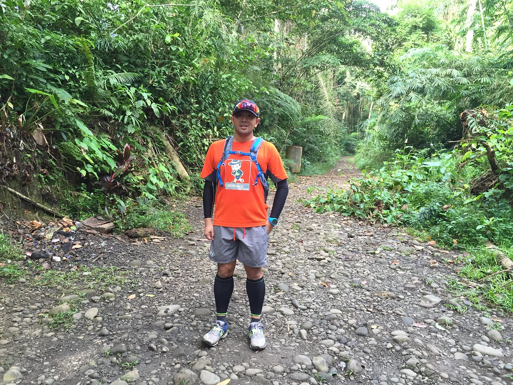
Outfit of The Trail

- Top: Berghaus with #TaleOfTheTrail Design by Breakout Design
- Shorts, Calf Sleeves, Arms Sleeves, Hydration Bag and Trucker Cap: Under Armour
- Shoes: Brooks Pure Grit 4
- Eyewear: Oakley Radarlock Path
- GPS Watch: Suunto Ambit 3 Sports
- Socks: Ahon Trail Socks
45 Responses to #TaleOfTheTrail Mount Makiling (Los Banos, Laguna)