Decade of the Franc / Year of the Franc 14

Snow Mountain was my Highest Peak in 2019

“Saying goodbye to 2019 is a bit different now since, it’s not a year that we are leaving behind. It’s a whole new decade that’s coming in and safe to say, I’m a totally different person this decade compared to the last.“

Decade of the Franc / Year of the Franc X14

10 years and another lifetime ago

10 years ago, I’m such a corporate hotshot and modesty aside, I was ahead beyond my time. When you’ve reached the upper echelons of your finance job portfolio, somehow you get bored. You tend to get lost in the mix of your achievements and the drama that goes in the corporate world. Yet, you just have to get lost to find a better way.

Something New in 2019

My greatest strength was not that I was good in words or numbers. It was being creative and being able to think outside the box in whatever I do. Reaching you max doesn’t mean you have to stop learning and developing new skills. It was time to transform the corporate Franc to a more well-rounded (pun intended) individual.

A little bit of international hikes, races and trips

For this decade, I’ve learned in a lot of new things and make things matter. I’ve evolved from an employee to an influencer to a game changer. So just to mix things up with usual format of my Year of The Franc post, here’s 10 things I’ve done or learned in this decade.

Trails Unlimited
  1. Started Francramon.com and this blog has grown leaps and bounds. It has over a million hits and has won certain accolades including best personal blog and citations in travel blogs. It was also my key to opening a lot of channels in the fitness world.
  2. Started Running. I started running in 2010 as my way to move forward and I’m tens of thousands of kilometers ahead from my 2010 self. I’ve had 2 marathons, 1 trail ultra, several duathlons and over two hundred road and trail races. While my blog was my access pass to where I am, it was running that created me a niche.
  3. Started Francramon Enterprises Inc. Well, this is a work in progress and safe to say, I’m not good at managing my own business yet. I’ve counted my losses as my tuition fee in learning the ropes of business. In just 3 years, I’ve expanded my brand and product range and learned new things since the day I started.
  4. Started climbing peaks and running trails. There’s the non-competitive part of the mountains and trails that taught me to enjoy nature and getting dirty each weekend has been a norm now. With #TaleOfTheTrail preceding Pinoy Trails, I’m glad to be all over the country and the world climbing peaks and running trails. I even have my version of the Asian Trilogy.
  5. Started PinoyTrails.Com. Pinoy Trails was meant to be a community portal for trail running and a database for trails but it grew much bigger than that. We were able to expand the site and create a community and developed our own brand of races.
  6. Started organizing races via PT Events. This is probably a source of my greatest heartbreaks and greatest victory. We started really raw and inexperienced but I’m an open book when it comes to absorbing new skills. We started the STAR brand and had a trilogy of races including the biggest one in 2018. We also did the Hoka Trailogy and created a premium branded racing environment. It’s extremely satisfying organizing races but it’s also extremely exhausting.
  7. Started Trail Academy. Along the way, I’ve done talks to inspire people to try out running in the trails but Trail Academy is just a lot of steps further. Started a FREE trail talk and run segment by partnering with brands and developers.
  8. Started to incorporate brand strategy into my list of to dos. It just helps that I’ve been part of the consumer and also working closely with brands that I have a good read of the market. I’m just glad to utilize marketing and brand management skills in MBA as I’m sure it will come in handy as an added skill to my portfolio.
  9. The last decade too was my greatest struggle both financially and emotionally. It’s the decade where my mom was fighting the big C and that’s really draining in financial resources. I’m not complaining cause no amount of money would amount to be equivalent to good health.
  10. This decade is also probably the most exhausting of all due to all of the above. Sometimes, I just get too tired to appreciate how much I’ve gained through the years. That’s also the lesson I’m taking in to the next decade: “Just since you can do it all does not mean I should do it all.”
Races and Events

On to the Next

On to the next

Measuring a year or a decade has always been tough because everything comes at a cost. The cost of success is time, hard work and consistency. I’m such a different person 10 years ago and I’ll be a different one in the next 10 years. Here’s what I’m taking in for the next decade.

PT Dirt Squad
  1. Change is good. If the past few months is any indication, a lot has already changed and I’ve started redeveloping old habits and set absolutely new goals.
  2. Prioritize. I’m realigning my priorities and I don’t want the next decade to be as busy or as demanding as the last one. It was not an easy decision but I’m stepping away from some of the stresses I do. I’m not getting any younger.
  3. Appreciate the now. I’m in the age range of my dad when he passed away and if history does repeat itself, I would want to spend those times doing the things I love. Live in the moment and make each moment count.
  4. Value people who value me. Life is too short to be bothered with what people say or do. Take the hit, grab those lessons but the story-teller of your life is only you, and you alone.
  5. Be content. Life will never be perfect. Learn to adopt. If things are tough, learn to be thrift. If life gets generous learn to appreciate and enjoy it.

Categories: My Thoughts | Tags: | Leave a comment

Incoming: Corregidor Heritage 21

Corregidor Heritage 21 takes you back to the rich history of the island known for its strategic location and valor. Take a 10K and 21K running tour on February 9, 2020 as you navigate the old relics and be mesmerized by the scenic sites on an unforgiving up and down terrain of the island. Limited slots only.

Corregidor Heritage 21

https://www.facebook.com/bbgrunph/videos/981123392262488/

Corregidor is not called The Rock for nothing. It was the foothold of our defense during the war as it seats strategically at the bottom of Manila Bay. The Rock is one tough route to crack for a run. It’s always an epic adventure as its both a race-cation that’s fun and memorable, and it’s a must-do bucket list type of a race coming from the variety of surfaces, terrains and overflowing scenic and historical delight along the way.

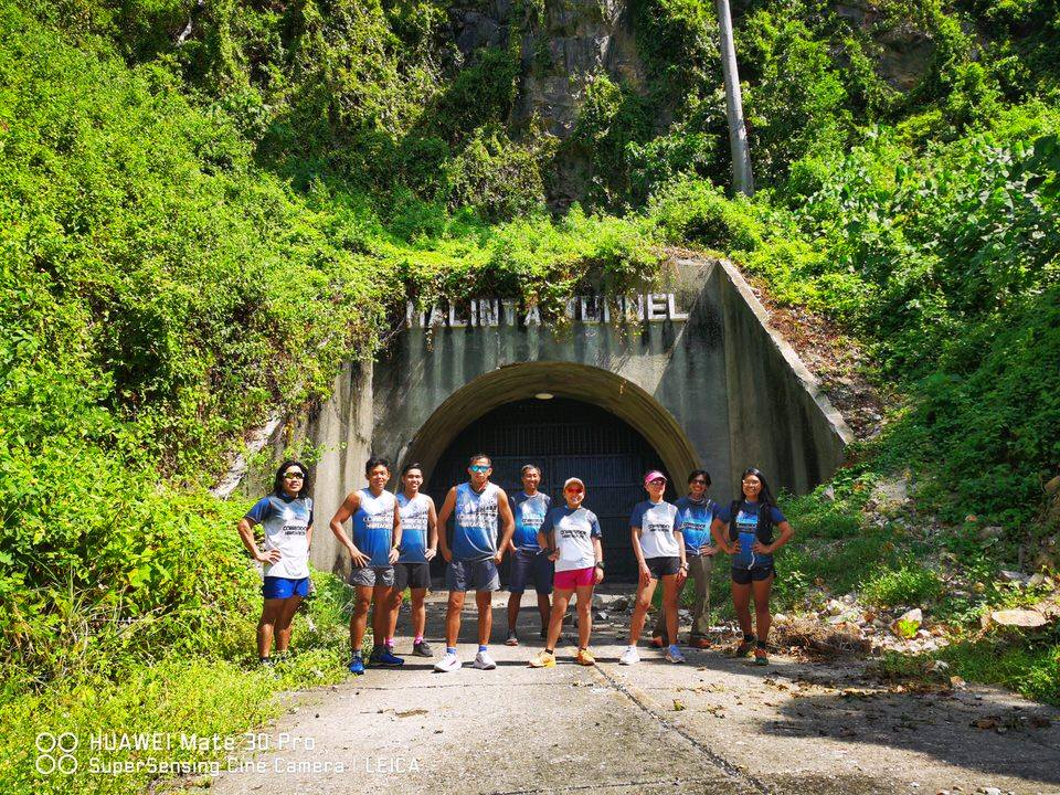
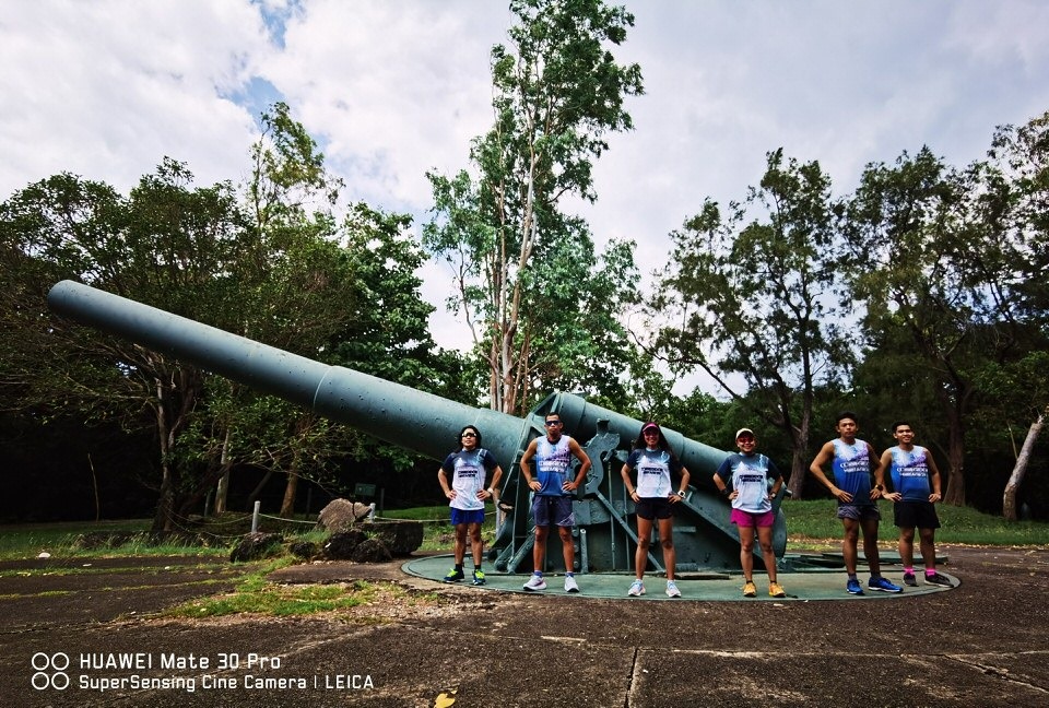
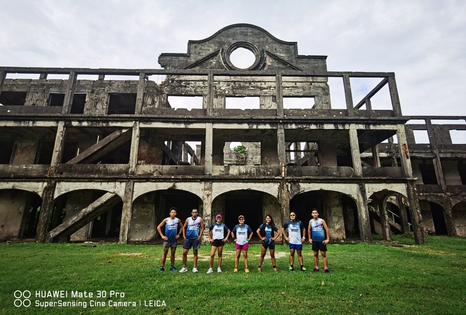
CH21 is a heritage tour on foot with the relics of the Malinta Tunnel, Mile Long Barracks, the batteries and a lot more. It’s also a little bit of everything as you get to run on ridges, on rocky beach paths, on trail surfaces, on airfields and navigate through steep uphill and suicide descents along the way.

Whether you take in the full 21K course or get to experience the 10K distance, it’s bound to be an epic adventure. Registration is until December 31, 2019 only. Slots are limited, register now!

Race Details

Date and Venue

  • Date: February 09, 2020
  • Venue: Corregidor Island

Fees and Inclusions:

  • Corregidor Heritage 21K: P1,800 inclusive of Event Singlet, Finisher Shirt, Finisher Medal, Race bib with Timing and fully-loaded race support on race day
  • Corregidor 10K Challenge: P1,300 inclusive of Event Singlet, Finisher Medal, Race bib with Timing and fully-loaded race support on race day
  • IMPORTANT NOTICE:
    • Your race registration is non-refundable. Please also be reminded that the registration fee you have paid does not include transportation to the island.

Registration Procedure

*REGISTER FIRST before booking your ferry to Corregidor.

I. Registration Procedures:

  • Proceed to https://myrunti.me/register#/corregidor-heritage-21k-2020 The registration fee does not include ferry transfers and accommodation to and from the island.
  • Wait for 24 hours to receive an email (through the email address you have provided in the payment transaction) indicating your RACE PAYMENT CONFIRMATION detailing the event you are registered in, instructions on race kit claiming and how to book for your ferry transfers to and from Corregidor Island.

II. Ferry and Accommodation

  • Our event partner, Sun Cruises Inc. provides ferry services from Manila to Corregidor as well as accommodations on the island. They will be giving special discounted rates exclusive to all Corregidor Heritage run participants.
  • Should you wish to avail of their ferry transfers and accommodation, please contact:
  • Sun Cruises (8AM to 5PM – Mon to Fri; 8AM to 12noon Sat) at Tel: (632) 8465-8840 Mobile: 0998-968-3256
  • E-mail: reservations@suncruises.com.ph *Note: Online booking through Sun Cruises’ website is not applicable.
  • Upon booking, kindly send an e-copy of your Payment Confirmation. Race participants may ONLY book with Sun Cruises after a successful registration. Race participants are given a special discounted rate.

Suncruises Rates and Packages

  • A. Runner (SAME DAY)
    • Rate: 1,900 Php / person
    • Inclusion:
    • * Roundtrip Ferry Transfer (Manila Corre Manila)
    • * Shrine and Island Entrance Fee
    • * Buffet Lunch with one round of drinks ( DAY 1)
  • B. Runner ( camping )
    • Rate: 2,200 Php / person
    • Inclusion:
    • * Roundtrip Ferry Transfer (Manila Corre Manila)
    • * Shrine and Island Entrance Fee
    • * Buffet Lunch with one round of drinks ( DAY 1)
    • * Camping fee
  • C. Accommodation: Corregidor INN
    • Single : 3,400 Php / person
    • Twin : 3,000 Php / person
    • Extra Mattress : 2,600 Php / person
    • Inclusion:
    • * Roundtrip Ferry Transfer (Manila Corre Manila)
    • * Shrine and Island Entrance Fee
    • * Buffet Lunch with one round of drinks ( DAY 1)
    • * Packed Breakfast with one round of drinks
  • D. Accommodation : Hostel
    • Rate : 2,850 Php / person
    • Inclusion:
    • * Roundtrip Ferry Transfer (Manila Corre Manila)
    • * Shrine and Island Entrance Fee
    • * Buffet Lunch with one round of drinks ( DAY 1 )
    • * Packed Breakfast with one round of drinks

Race Updates

Categories: My Thoughts | Leave a comment

The Tale of The Trailogy

Hoka GTX culminates a trilogy of events under PT Events and Hoka One One with each having a unique feature and challenges that’s bound to create a lot of memories on the trail.

Speedgoat Challenger

Speedgoat Challenger – Photo by Glairold Recella

Speedgoat Challenger was the birth of the partnership between PT Events and Hoka One One. Previously, Hoka was the main sponsor of the previous flagship Pinoy Trail event, STAR Trail Challenge. It had a fast and furious dry trail feel that highlighted the trails of Timberland and San Mateo relying on a faster and flatter route. We had several growing up pains and a few hiccups but at the end of the day, everybody had a lot of sense of fulfillment and a lot of new converts to trail running. It was the biggest event of the trailogy with a lot of athletes from different sports and discipline, trying out trail running.

Mafate Mudfest

Mafate Mudfest – Photo by Glairold Recella

We wanted a rainy day trail feel so from the fast dry trails, we had to search for a slip and slide route to usher in a wet and wild adventure on race day. It was probably the weakest of the 3 events with not so much participants. It was an exhausting journey to race day with some naysayers adding to burden of the race. We’re glad we didn’t give up on the idea as when race day, happened it was one hell of an experience. It was a character building race definitely for the participants. Looking back, it’s my favorite race in the trailogy. At the end of the event, everybody was asking on when is the next Mafate race. If that doesn’t tell you that you’ve done a good job staying true to your brand then I don’t know what will.

Hoka GTX

Hoka GTX – Photo by Calvin Nadua

Hoka GTX was a fitting culmination, inheriting the mantle of our previous flagship event, STAR Trail Challenge. It was a year-ender and is a feel-good course with shorter distances and a tamer elevation gain. We’re happy to end on a successful note. It was definitely a Grand Timberland Xperience as we’ve focused the routes inside Timberland Heights making use of both their road and trails and featuring both Panoramic Table Top and Pondopo Hill along adventure farm. The Table Top brings in the mountainside view while Pondopo Hill gives you a cityscape view from a higher vantage point.

Hoka GTX is brought to you by Hoka One One and PT Events with Timberland Heights as Venue Partner. Pinoy Trails is the Media and Marketing Partner. The race coverage is handled by Spektra Productions, A&J Visuals, Active Pinas, CN Creatives and Cignal TV. Hoka GTX is supported by Amihan Sports Gear, Runnr, Garmin, My Runtime and Ziv Eyewear. Pies Energy Bar, Vitargo, Lightwater, Vitamin Boost and Emco Musli is the Hydration and Nutrition Partner.

The Trailogy

It was really nice to find creative ways to create new routes in Timberland Heights. We wanted each experience to be different and that’s just the beauty of trail running, no two trails runs are the same as there are a lot of elements involved. Timberland Heights is such a flexible playground, you can create an easy, moderate or even hardcore route and believe me, there are still untapped trails in the area. We are really thankful to Timberland Heights and Filinvest Land Inc for allowing us to explore their trails.

It was not an easy journey as each leg, we’d encounter roadblocks and it was physically and emotionally exhausting mounting each one. Honestly, I need to take some time to recover. When it comes to events, there’s no low gear for us, it’s all-out effort from me and my team. It’s not just our time and effort that’s invested in our events but our heart and soul as well. It’s never gonna be routine for me and the team but the good part with time and experience, we just get better.

Hello to premium races. From the start, we’d wanted to create a premium racing environment and it didn’t come cheap creating a race like the trailogy. It’s not for everybody but the goal is to make each race experience worth it by leveling up on the inclusions and make sure to having the right facilities and support on race day.

We also intensified sponsor support to races taking the race as a branding opportunity. It was fun to work hand in hand with brands and drain our creative juices to make their sponsorship worth it. We were able to create a trail expo for their products. Hoka was also able to have instant ambassadors to promote the brand with the Hoka-inspired inclusions. We’d also ensure that every sponsor gets their time of day to be promoted during the duration of the trilogy.

While the kids race is a side event of the main distances, we’re happy to see kids as young as 2 years old join the race. Even if the allowed age is up to 10 years old, you’ll see that a bulk of the runners are the younger ones, the ones you had to carry to reach the podium. The kids race also creates a family friendly bonding experience as we’d encourage the parents to join their kids on the short run. We hope that the kids race grows even bigger. After all, our advocacy is to have people try the trails and the young ones are always welcome.

In the end, we just want to promote the trails, the outdoors and a lifestyle of fitness. We are grateful for everybody who joined our races from the runners, our race team and volunteers, Timberland Heights and our race sponsors. We’ll this is just the beginning for all of us and we hope that we get to see you in the trails moving forward.

Categories: My Runs | Tags: , , , , | Leave a comment

#TaleOfTheTrail Hoka GTX

For HOKA GTX, the focus of the route is to enjoy the whole Timberland Heights area with all routes inside their confines. It’s a different look compared to the fast dry trails at Speedgoat Challenger and the wet and wild Mafate Mudfest. This time, it’s gonna be about having fun and chilling at the road and trails of Timberland Heights.

#TaleOfTheTrail

It’s a few days before Hoka Challenger ATR Grand Timberland Xperience #HokaGTX and here’s a Tale of the Trail perspective of the different race routes. For the first time, all race routes would be inside Timberland Heights and we get to appreciate a new section of the adventure farm with a mix of trail and road this time around.

18K Race Route

It’s the full course in terms of a meal. You get to have an appetizer navigating the feel-good rolling terrain of the Green Zone for the first 2.5 kilometers. It’s followed by a moderately out and back heading to Base 2 and back to the Chapel entering the 5th kilometer.

The trail then descends to Timberland Falls and climbing up to the Scenic Panoramic Table Top for the next 3 kilometers and then descend back to AS 1 at Timberland Base 2 at Km 9. The route then heads to a long but moderate ascent along the Roxas Loop until Kilometer 12 before shifting to the descent and climb at Black Diamond Loop heading to the road area.

It’s another half a kilometer heading to the Adventure Farm area where we get a scenic backdrop of the cityscape along Pondopo Hill, which then leads to a steep descent before steep climbs heading back to the road at Km 15. The route the leads to a road climb and a short loop a The Glades for the next 3 kilometers to the finish line.

12K Race Route

12K is the complete loop of the course. It takes out the green zone and the basic trail area. The main difference is that from the start it proceeds to the Spine Road Heading to Timberland Falls and hits the Panoramic Table Top at around Kilometer 3 and Base 2 at Km 4.

It goes on a 4.5 K stretch from Base 2 to the Timberland Road passing to the Roxas Loop and Black Diamond. It’s another 1.5K stretch from Timberland Road until the loop in Adventure Farm before heading to the finish line on ascending roads.

8K Race Route

The 8K route heads directly to the Glades for a short route before entering the Black Diamond Trail head. It’s another 2 kilometer before hitting the Timberland Road heading to Adventure Farm with Pondopo Hills as key highlight for the short and sweet route.

The route then ascends Pondopo Hill before the steep descents and ascents heading back to the road before it’s an all out climbfest on Timberland Road heading to the finish line.

Aid Stations

Pies Energy Bar will be at the aid station

Please take note of the Aid Station, which is on Timberland Base 2 and just outside the Black Diamond Stretch. Please take note of the Mandatory Gears and hydration stops would be apart. There will be food, water, Vitargo, Pies Energy Bar at the aid station. There will also be sub aid station in some areas for water refilling only.

It’s gonna be fun in the trails so get ready to have fun, enjoy and be amazed by the raw beauty of Timberland Heights.

Categories: My Travels | Tags: , , | Leave a comment

A Closer Look at Coros Apex

Coros Apex

The new kid on the block, Coros Apex, may just be the right watch for you with a full GPS life of 35 hours and a display that you can customize as a lifestyle watch or with metrics you need on your activity.

Coros Apex

I’ve probably gone through the most basic GPS watches up until the premium ones whether as my go-to watch or part of my regular watch reviews. The trends has been that the price of GPS watches continues to skyrocket as developers add more features to track your workouts and lifestyle. I have actually settled for a more basic watch with just the displays I needed for a run. After all, I haven’t been actually geeky and competitive as of late.

Scaling Snow Mountain with Coros Apex

Well, that’s until I found Coros Apex. Coros brings in the high-end features like full color display, activity tracking, watch face customization and a Full GPS life of 35 hours at the mid-tier price level. Coros Apex retails at Php18,995 while other high end watches can go as high as Php 30-40K price range. Somehow, it’s a game changer and here’s what I’ve learned for the past few months of using Coros Apex.

Full GPS Life of 35 Hours is Real

Ever since I got my Coros GTX, I knew the re-conning point would be my Snow Mountain Hike since it’s a multi day hike and we’ll surely take lots of hours climbing 3,886 meters of Snow Mountain. So here’s the drill.

  • Day 1 Hike: 7.91 K, 1,130M elevation gain, 7:03 hours
  • Day 2 – Hike 1: 7.58K, 799M elevation gain, 7:40 hours
  • Day 2 – Hike 2: 7.28K, 163M, elevation gain, 5:01 hours
  • Day 3 Hike: 5.5 Km, 624M elevation gain, 3:58 hours

That’s about 24 hours using full GPS in 3 days and I’m still at 37%. I had so much confidence in the watch that I didn’t even bring my charger the whole trip.

Navigation Features

Good news! You can save the map directly to your watch, you can either email or air drop the GPX files to your phone linked to the watched and once synced, you’re good to go. To test this feature, I uploaded the 8K route for Mafate Mudfest in one of our final recon while I did the 16K route. Once I stepped out of the regular 8K route, you can actually see a dot deviating from the route map and tell you how much distance you are from the correct route. So when I got back to the route, it was spot on as it showed me the distance to the proper route.

Customization

You can easily customize your views. For me, I usually want to see my heart rate and my altitude on trail runs and I’m more pace oriented on road runs. It’s easy to set your desired metrics at the Custom Interface portion of your Coros App on the phone, which you can sync to your watch. There is also an available watch face customization to suit your different moods even when you use it on your regular lifestyle modes.

Fitness Tracking

Aside from tracking your workout, Coros also tracks your activity from your average steps, heart rate, energy consumption and fitness level on a day to day basis. I’m geeky about this stats but here’s one of the drawbacks I see with Coros Apex. When it computes your VO2 max and threshold pace, it’s mostly using your pace and heart rate when you work out irregardless of the terrain. I’ve noticed this difference since I am mostly on trails and I used to have a low threshold pace because with the climbs, it’s much slower and faster to get that heart racing. So when I switched to road runs, I had a big jump in my metrics, which is due to the faster pace and less drag during road runs. Other than that, I’m good with the Tracking.

Sleep Tracking

If there was something I was trying to master, it’s my sleep. Most of the times, the stats are on point though there are few days that you’d surprised how poor your sleep quality is. So when I wake up, I check the quality of sleep and if I feel I lack a good sleep, I usually try an hour or two of extra sleep.

GPS Detection

GPS detection is a few seconds and you’ll get notification once it has detected the GPS and heart rate. So far, even in remote areas, I’ve never had a problem with the GPS reception. For the heart rate, it’s a wrist based heart rate, which according to many is not as accurate as a heart rate monitor. I get annoyed using the chest heart rate so I’d give the little difference in accuracy for comfort.

User Friendly

Funny, how I never read manuals when it comes to watches. Coros Apex is easy to operate. You just have to choose a workout on the dial button, detect GPS and heart rate and you’re good to go. One point of adjustment is the use of the dial button instead of just regular button so when you start or end the work out, you have to roll the dial until it unlocks before pressing the button. It’s more of an added protection so you just don’t accidentally pause or end workout.

Coros App

Uploading of files is fast and easy with bluetooth connectivity between watch and phone. You can easily access your data on your phone and upload a watermark photo, gpx data, or workout details on social media. I think the biggest drawback is that there is no dedicated desktop app for Coros where you can access your data. You can always pair it with Strava or a GPX viewer. Coros should really develop a dedicated desktop app like other GPS watches where you can see you workout or even create routes. For now, I’d be content with pairing it with Strava.

Everyday Watch

When you see how lifestyle watches are evolving to be GPS watches, the same holds true for GPS watches being lifestyle watches or an everyday kind of watch. Coros is a GPS watch with lifestyle look and features with customizable watch face and replaceable straps. Since it is top-of-the-line in terms of battery, it can go on for days without charging.

Categories: My Thoughts | Tags: , | Leave a comment

#TaleOfTheTrail Mount Qixing, Yangmingshan – 1120 MASL (Taipei, Taiwan)

Main Peak

While Mount Qixing at Yangmingshan has an impressive view of Taipei, what impresses me more was how they’ve managed to make the hike accessible.  It’s stairs unlimited up until the summit but the climb is doable for any age and fitness level.

Asian Trilogy

The Asian Trilogy is being able to summit the highest summits of Malaysia (Mount Kinabalu, 4095 MASL), Japan (Mount Fuji, 3,766 MASL and Taiwan (Jade Mountain 3,950 MASL). With the first two ticked off the bucket list, the next one was Jade Mountain but as fate would do, we’d miss the chance via lottery.  Snow Mountain was the next highest mountain at 3,866 MASL so that was our consolation. I hope that the additional 1,120 MASL of Mount Qixing would make up for the less than 100 meters difference between the top 2 mountains.

Mount Qixing

After a successful climb at Xueshan / Snow Mountain, our quads were aching for a little bit of suffering so we decided to do an easy hike the next day.  Yangmingshan National Park has a lot of mountain ranges and I was able to visit the park at least twice in my previous trips to Taipei.  It’s just a bus ride away from Shilin MRT.  Since we are a group, we just decided to take a cab heading to the jump off point at Yangmishan via the Miaopu Entrance at about 560 MASL.

Starting at around 11 am, we headed to the trail head and it’s a lot of stairs, in fact, it’s a stairs unlimited up until the summit.  That’s about 2.5 kilometers of distance climbing about 660 meters.  We went at an easy consistent climbing pace and since we had a high climbing threshold from the Xueshan Climb, climbing felt easy. I have to admit the quads were stinging. 

Stairs Unlimited

The first kilometers of climbing were on more defined steps and shifts to rocky steps towards the last kilometer to the summit.  There were also a lot of flora and fauna and even saw a majestic looking lizard along the route.  I have to admit because of the defined steps, climbing was easier. It still requires a lot of effort though because of the 660 meters of climbing you have to cover. 

When we were about to reach the upper part, it started to go cold and foggy.  That’s what you get with high mountains, they have their own micro weather.  The higher part was more of an effort with some of the rocky steps being a bit slippery.  I just continued the climb counting down the remaining meters until we reached the summit.

The summit was really foggy with no clearing.  Too bad for us as it would have been a wonderful view of the city at such a vantage point.  The climb was still impressive as you can see that people of all ages and fitness level were able to summit.  I hope we have peaks like this where people can have better accessibility at some peaks.

East Peak

After a while at the main peak, we took the east peak where we headed down to the park.  It was a steep descent on steps but it was tolerable.  It was totally foggy and felt like a walk in the clouds. It would have been a lot more awesome seeing the cityscape and mountain ranges from this vantage point.  We exited to the park and tried to find our way back to the main trail.  We eventually went back to the main trail and went down to Miaopu entrance to wrap up the hike.

It was a painful hike from the overused quads the previous days but it was a good work out. We had street foods at the bus stop before heading back to Xilin MRT to catch our dinner at Din Tai Fung at Taipei 101.  I would definitely do this hike again, hopefully on a clear day so I can appreciate the summit.

Categories: My Travels | Tags: , , | Leave a comment

#TaleOfTheTrail Syue Mountain (3886 MASL), Taichung, Taiwan

Syue Mountain is the 2nd Highest Mountain in Taiwan at 3886 MASL. It’s a tough climb with mix of stony and scree surface heading to the summit but we were rewarded by clear skies to be amazed by the scenic landscape.

#TaleOfTheTrail

Looking Back

Looking back, I’ve never seen myself as a Mountaineer or probably nowhere near to any fitness activity. My first international climb at Mount Kinabalu, I was wearing an ordinary backpack and just wearing compressions up high at 4,095 MASL at the summit. The second time, I had an uber heavy hiking bag approaching the switchbacks of Mount Fuji and getting amazed at the land of the rising sun view at 3,766 MASL summit. My third climb was both a struggle with the scree (broken rocks) surface heading to 3,677 MASL of Mount Semeru and a total adventure with the off roads heading to Mount Bromo. The Fourth Climb should have been Yushan, which is my last leg of the Asian Trilogy at 3,952 MASL but as fate would have it, we didn’t get the slot on the raffle and had to settle for 3,866 MASL Syue Mountain.

Syue Mountain

Syue Mountain / Snow Mountain / Xueshan is called by locals as the most beautiful mountain in Taiwan and it didn’t disappoint. As painful and hard the climb was, we had a scenic feast of the mountain ranges, the mystical Black Forest and the sea of clouds at this altitude. Makes you appreciate that the best things in life are the ones we worked hard for.

Arriving Taipei Early Morning of October 30, 2019, we had the day in Taipei just visiting shops in case we miss out on some outdoor gear. We headed to our home stay in Taichung in the evening (around 1700-1800 MASL) to get a acclimatize with the altitude. We headed the next day at our Jump Off point which is Wu Ling Farm / Shei-pa National Park (2,140 MASL) at around 9 am, which is the start of our hike. We had a short briefing, stretching, getting to know each other. While I’m on my own, Trail Adventours has been a comforting partner in this hikes since I’ve been with them for all my international hikes.

Wuling Farm (2,140 MASL) to Hut 369 (3,150 MASL)

I’ve plotted the elevations and terrains for the climb reading different post on Xueshan. The first task is hitting 2 kilometers from starting point to Qika Hut. That’s about 320 meters of climbing. The trail were switchback trails to reduce the impact of the climb on dirt surface with stairs. We took the trail track beside the stairs to lessen the effort each step. I joined the first group and it was switchback trail after another. Surprisingly, we’ve finished this part really quick.

While the Qika Hut was an easy switchback hike with dirt surface that’s easy to trek. The surface goes a little technical after that with loose rocky surface and the dreaded crying slope along the way. Still was part of the first group and made our way one switchback climb at a time. The surface was an added drag but we needed a little bit of slow as we are approaching above 3000 MASL at this stretch. We had lunch at around the 3rd kilometer before proceeding to the tougher part of the climb.

Approaching 3,000 MASL

The climbs were tougher but the views were getting better. As we approached 3,000 MASL, we were entering the dreaded crying slope. It’s between the Km 4-5 as the trails become technical and the becomes a lot steeper as some parts are about 40-45% inclines. It’s not called Crying Slope for nothing. It also started to rain so we started to slow down and added a few rest stops in between until we’ve reached the end of the climb and it was gorgeous.

This was the toughest part of the climb but the ridge view made the effort worth it. It gets even better as we go up. We then proceeded to the East peak of Syue Mountain at 3,200 MASL at around kilometer 5 of the trek. It was the highlight of the day. After this, we’d be descending to hut 369 at 3,150 MASL for our homestay for the night.

East Peak of Syue Mountain

It was a smooth descent and we were at our spot before 4 pm, which was a few hours earlier than expected. We had dinner and was supposed to rest until 1 am. Unfortunately, sleep didn’t come to me as I had a bad tummy.

Hut 369

Hut 369 (3140 MASL) to Summit (3886 MASL) and Back

We were up by 1 am the next day. I barely had sleep. I missed breakfast since I’m worried about my tummy. The plan was to stay mid-pack and just take it slow. We started the hike at 2 am and it was extremely cold, probably less than 5 degrees. I had several layers of clothing. It’s about 3.8 kilometers to summit with about 800 meters of elevation gain.

Even as I promised to be at the mid-pack, I was right there in the front pack. The surface were broken rocks, which was tolerable but had some drag. I think they intentionally made the surface this way so people will slow down to avoid altitude sickness. It was an all-out assault at the start.

After a kilometer of walking, we entered the Black Forrest. The place was enchanting which was shaded in trees and had a mix of rocky to bouldery surface. I started to question if they should have named this as Stony Mountain rather than snow mountain. We’d take it slow and take a few rest in between. The goal was to reach the summit by 6 -6:30 am. There were several descents and mostly ascents. The Black Forest was a 2 kilometer stretch.

It was down to the last kilometer of the climb and we were on the basin with about 300 meters of climbing left on the last kilometer. It started on switchback trail and the surface was scree or broken rocks. I always struggle on scree surface but the rocks were stable enough to move on forward. We were spaced apart to avoid falling rocks, if any. The last 500 meters was the toughest part with slopes up to 45% but counting down the last few climbs can really be empowering. It was technical on the last stretch but we’ve finally reached the summit at 3886 MASL.

3886 Meters Above Sea Level

We were lucky enough to have clear skies at the summit. The group before and after us had no clearing. So this is my own version of Asian Trilogy with Syue Mountain as my last leg (I also did another 700 meters of elevation the next day just to cover the less than 100 meter gap between Syue Mountain (Xueshan) and Jade Mountain Yushan).

While I didn’t have breakfast, I was quite confident since I had Pies Energy Bar with me.

It’s always a milestone when I’m at the summit but I love how climbs can humble you and be appreciative the beauty that surrounds you. After a while, it was our time to head back.

Heading down was as difficult as climbing it because of the technical rocky terrain. It was just less exhausting with gravity by our side this time. We slowly descended the open trails before heading back to the Black Forest. The Black Forest was mystical with the rich flora and fauna that surrounds it. We got to appreciate the place more as it was still dark when we ascended. The mix of various sized rocky paths made it extra challenging before we got to exit the Black Forest after 2 kilometers and another kilometer before exiting the trail to Hut 369.

We we’re back to Hut 369 past 9 am and we can rest a bit before heading to the last stretch of the hike.

Hut 369 (3,150 MASL) to Wuling Farm (2,140 MASL)

It was the easy part of the hike as we were mostly heading down. First, it was a 2 kilometer slow ascent to the East Peak before the mostly descending next 5 kilometers. Upon reaching the East peak, it started to rain. I had my rain coat and proceeded with the descent. I was motivated by hitting the bus early so I can have more rest.

As it rained, I started to trust my Hoka Challenger ATR with GTX on the wet rocky surface and surprisingly, it didn’t disappoint. It had a good grip on the surface even as I was descending rapidly on the steep slopes. Though this was the easy part, the switchback stretch felt long and dragging. It felt like forever but I just kept moving on until I hit Qika Hut, where we regrouped and eventually finished the hike after 2 more kilometers.

It was another surreal adventure and a welcome breather after all the busy days. Somehow, I earned the trip, the rest and the milestone. Now, back to regular programming.

Categories: My Travels | Tags: , , , , | 1 Comment

Perform at Your Best with U.S. Potatoes

Snow Mountain Peak at 3886 MASL

Fitness is more of a journey rather than a destination.  It’s a process that involves building your bases, training and figuring out your diet and nutrition.  Diet and nutrition get you past the rigors of training heading to your athletic goals.

Athletic Goals

Everything starts with a goal.  It may not be as big as being an elite runner or winning it all.  It can be as simple as being fit, starting a new lifestyle and enjoying the process.  Once you get started, it becomes a lifestyle.  I’ve chased so many athletic goals in the past.  I’ve hit my first sub 1 10 kilometers.  I’ve had a good time at my first half marathon.  I became a duathlete.  I’ve gained enough mental fortitude to finish two marathons and a 50K trail marathon.  Just recently, I’ve summitted Snow Mountain (3886 MASL), which completes my own version of the Asian Trilogy after doing Mount Kinabalu (4095 MASL) and Mount Fuji (3766 MASL).  These were a lot of stories but the more meaningful part of each goal was the journey that came with it.

The Journey

Each journey begins by making a choice.  We choose to live by the fitter side of life and that is a victory on its own.  We build our bases by slowly building our body up for the long haul.  If there’s one constant in the journey is that diet and nutrition matters.  Diet is another one of my struggles as in time, our body’s metabolism slows down but that doesn’t mean I won’t give it a good fight.  Learning what’s good for your body is a start of winning the battle of the bulge.

Let’s start with 3 nutrients our system needs – Carbohydrates, Potassium and Energy. These are all found in Potatoes, which are an excellent fuel for our body and our brain whether we’re chasing to be the best or just keeping fit and active. 

Potatoes have 26 grams of complex carbohydrates. Carbohydrates are primary fuel for your brain and your muscles.  With a limited store of Carbohydrates in our system, we need to constantly replenish them as we exercise.

Potassium is an important electrolyte that aid in muscle and cardiovascular and nervous system function.  A medium size skin on Potato (5.3 oz) has 620 mg of Potassium, that’s even more than a medium size banana that only has 422 mg.

Potatoes are also excellent source of Vitamin C; a 5.3 oz of Potato with skin on has 30% of Daily Value of Vitamin C and contains 3 grams of Protein and 2 grams of Fiber.

Diet and Nutrition

White Potatoes are packed with more nutrients than sweet potatoes

With an ideal weight, you can perform better in your athletic and sports activities.  It can give you added endurance on long-haul activities like runs, climbs and rides.  I’ve included potatoes in my diet, and I’ve noticed the extra energy they give me during my activities. It doesn’t hurt that they are affordable! Talk about good value for your money.

Potatoes are recommended by sports nutritionists for weight management.  I’ve heard time and again that in proper weight management, it’s calorie-counting that’s important. When we work out to get to our ideal weight, we still need to consume calories for energy and to stave off hunger. A medium size skin on Potato only has 110 calories, with no fat, no sodium, and no cholesterol. Potatoes have “calories that count” so replacing other meals with Potatoes can do wonders to help you achieve your weight goal. 

Destination

The destination is really a satisfying feeling whether you’ve hit a new personal best, summitted a new mountain or was able to move up a new distance.  It takes hard work, perseverance, determination, patience and having Potatoes on your plate can help you become the best version of yourself.

For more information on U.S. potatoes, and how it can power up physical and mental performance, visit the Potato Goodness website or like and follow Potatoes USA-Philippines on Facebook.

Categories: My Thoughts | Tags: , | Leave a comment

WOMEN EMPOWERMENT WITH INEX ACTIVE

INEX Active Founder Maxine Sebastian and her mother Sen Pia Cayetano

INEX Active Wear brings out women empowerment in their workout gear with soft, silky and seamless structure that brings comfort and performance on your activities.

INEX Active Wear

A new line of workout gear, INEX ACTIVE, was launched last October 23, 2019 at the Mindful Movement Asia Pilates Studio in Bonifacio Global City, Taguig through an invigorating Pilates session headed by Mindful Movement Asia Pilates Studio General Manager Ken Colubio and Pilates coach Regina Del Rosario with INEX ACTIVE Founder and daughter of Senator Pia Cayetano, Maxine Sebastian and Managing Partner Juancho Palacios.

INEX ACTIVE Managing Partner Juancho Palacios, Founder Maxine Sebastian, Mindful Movement Asia Pilates Studio Pilates coach Regina Del Rosario and General Manager Ken Colubio

“INEX is short for inexorable which means unstoppable and relentless as we want the name itself to be empowering.  We wanted the logo to mean something, so we chose the wolf and the moon.  The wolf symbolizes personal power and all that is INEXorable in every one of us; the moon is a symbol of female strength.  They say when the moon is full, women are in their highest point energetically.  So, we’re hoping that by wearing INEX, women will be able to bring that feeling with them,” – according to Maxine Sebastian.

Kelly Misa

The event was also graced by notable personalities like Sen. Pia Cayetano, beauty queen-turned image consultant Abbygale Arenas-De Leon, Ms. Earth 2015 Angela Ong, model TV-host Kelly Misa to name a few; and they had the privilege to try and enjoy the newest INEX activewear styles.

Ms Earth Angelia Ong

The seamless structure of INEX ACTIVE sportswear is mainly made up of nylon which is soft as silk.  It is also breathable, durable and odor-inhibiting in which it wicks sweat from your skin to fabric’s surface where it can evaporate.  They are available in the sweetest pastels to the most energizing neons.

INEX ACTIVE is passionate about finding fresh ways for women to express themselves through their activewear and ultimately sharing the joy of an active lifestyle.  They are big believers in self-acceptance and self-expression.  This is why they aim to provide a variety of styles that complement every body type and to encourage women expressing themselves and embrace what makes them unique.

Another core values INEX ACTIVE want to share to their customers is “It’s Cool 2 Care”.   They are committed to slowly but surely shifting to a more sustainable business model starting with their packaging options in which their customer can choose between their reusable pouches and their 100% compostable packaging.

Follow INEX Activewear

INEX activewear is available online at inexactive.com. You can also follow them on their Instagram and facebook account at @inexactive to keep up to date!

Categories: My Thoughts | Tags: , | Leave a comment

Volvic Force of Nature Marathon

My calf muscles was about to cramp at km 10 and 13 but thanks to kind strangers who had muscle spray, I was able to continue. Then I was back to the usual dilemma on how to last the next 10K on cramping legs. Somehow, I did! That’s a reminder of how it is to suffer and yet find the inner strength to gut-it-out and finish.

Volvic Force of Nature Marathon

Calm before the heat – Photo by Bert’s Eyeview

I forgot how it felt like to suffer in a race. While the course was moderately rolling, the challenge was the scorching heat of the sun. That’s trail running, it can give you a different experience every time you’re on the trail. 13K into the race along the open Rifle Range Tunnel Trail on the way back made me think how to make these cramping legs hold up until the finish line. But, before that let’s rewind it a bit to the start of the race.

My last race was in March and even if I still frequent the outdoors, I’ve been away from that competitive race environment. It did show in the race as I’m no longer used to the wear and tear of a fast course. MacRitchie Nature Reserve was definitely a run-able course, which I have tried several times when I was in Singapore. It was a nice feeling just to have fun and enjoy a race. No pressure really as I’m just glad to be racing again in a different environment.

Scenic lake at MacRitchie – Photo by Running Shots

Gun start was late and was moved from 7:05 to 7:35 am but as the race started I joined the runners on a running start. It looks like the legs was ready to go with the usual feel of shin splints gone maybe because of the volume of walk I had lately. I went on a run-walk pace and just tried to try to finish 6 kilometers in an hour since the trails were run-able.

Photo by Running Shots

First 4K was the from the start going around the lake and 3K of the rolling Mac Ritchie Trail followed by another 2 kilometers heading to the Bukit Timah access point. I tried maximizing the descents to runs and recovered on the climbs with a brisk walk pace. First 6K in an hour and then it was a kilometer. It was another kilometer with mostly climbs before hitting the aid station and Rifle Range Road.

Saw Lance Gilbert of Running Lab and reminded me that the next trail is an open one.

When I hit the road, the hamstring felt stiff so I tried to manage my pace a bit but still went on taking advantage of the less drag of the road surface. We entered the Rifle Range trail heading to the Dairy Farm at around km 9. It was an open trail so the heat was in full force at this stretch. I was starting to feel the sting on my calf muscles and it was about to cramp at km 10 so I slowly went to one of the rocks to sit a bit to relax the muscle.

Rifle Range Trail to Dairy Farm

Fortunately, one of the hiker was quick to apply spray on the calf muscles and it was heaven sent. My muscle felt a lot relieved so I was able to speed up about approaching the turning point. I asked for spray at the Check Point and there was none so I went on after hydrating. The cramping feel was back at kilometer 13 as I can barely move my leg without cramping. I slowly went on the rock to rest a bit. Now how to finish the next 10K with these cramping legs?

Met also Del of Active Pinas, now based in Singapore, at Rifle Range Route

I was asking runners passing by if they had spray and most had none then one runner had this roll-on and it was a relief. I applied it all over my legs and then he told me that I shouldn’t have done that as I could burn my legs. It was a warm sensation on the legs so I had to pour some water on the legs just so it won’t sting. I was able to speed up just to head to the water station and pour some water on my legs. 7 kilometers to go.

That was the last water station so definitely, I’ll have to survive with what I have for the next 7 kilometers. So that’s 1K heading to MacRitchie from Rifle Range, 2K to the covered MacRitchie Trail and 4K to the finish line. Somehow, I stayed constant with my pace and would stop a few seconds on the huts and then resume. One set at a time. Not too fast but not too slow either. Keep the rest shorts to save time and keep going. With that drill in mind, I was able to countdown the kilometers and reach the finish line.

Despite the struggle, I’ll take this one. It was more than my usual easy pace on the trails and more than my dose of sunlight lately. Just glad to be back!

Categories: My Runs | Tags: , , | Leave a comment