

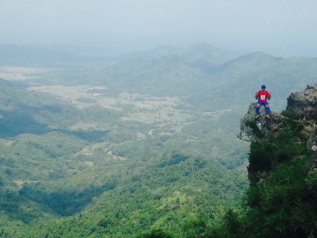
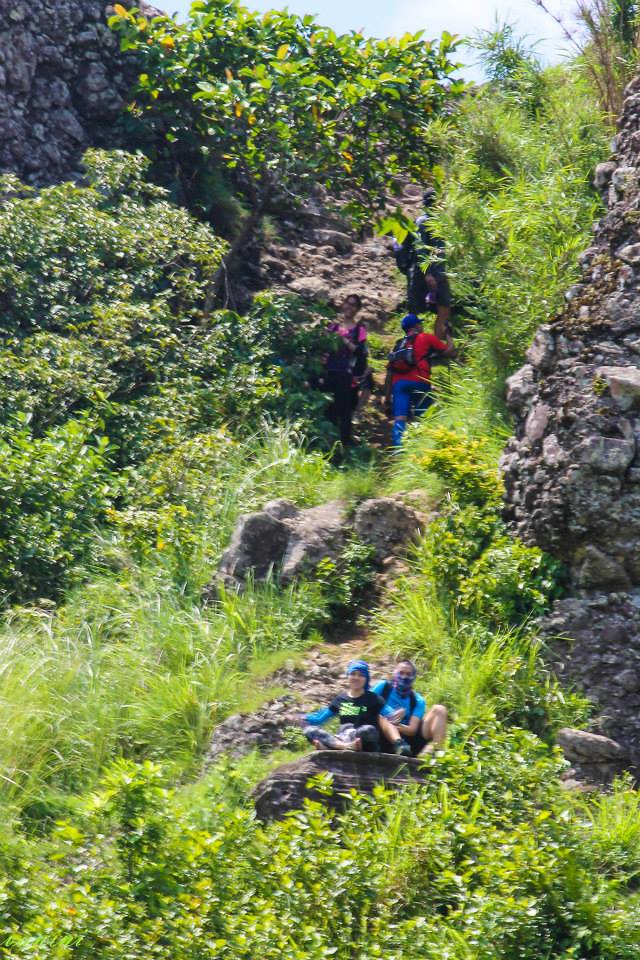
Sittng at Silyang Bato and Admiring the Beauty that Surrounds It. – Photo by JC Igos
When it comes to climbing mountains, it’s never easy as each assault humbles us and makes us in a better position to appreciate the beauty from the top. Mount Marami not only gives you the view of the neighboring mountains, it also gives you a seat (Silyang Bato) to serve as your throne as you’ve conquered your self in another tough terrain. Each breathless moment climbing Mount Marami is rewarded with a thousand-folds worth of magnificent views. Get the Chance to Trek Mount Marami in an Actual Race as the 1st Mount Marami – Silayang Bato 21 Km FKT Trail Run Challenge is happening on August 9, 2015 with 21 km, 14 km and 8 km Categories. #TaleOfTheTrail #Merrel #Capra #Suunto #Ambit 2S #BerghausPH #LiveForAdventure #RunnrPH #UnderArmourPh #2XU
Read about:
- Climbing the 12 Peaks of Mt. Batulao
- Cordillera Mountain Run
- #TaleOfTheTrail Dragons Back (Hong Kong)
- #TaleOfTheTrail Camp John Hay Trails (Baguio City)
- #TaleOfTheTrail Mount Talamitam (Nasugbu, Batangas)
- #TaleOfTheTrail Mount Cabuyao (Tuba, Benguet)
- #TaleOfTheTrail Maysawa Trail (Tanay, Rizal)
- #TaleOfTheTrail Mount Kinabalu (Kota Kinabalu, Sabah, Malaysia)
Mount Marami
Before the Climb – Photo by Vanessa Tagaro
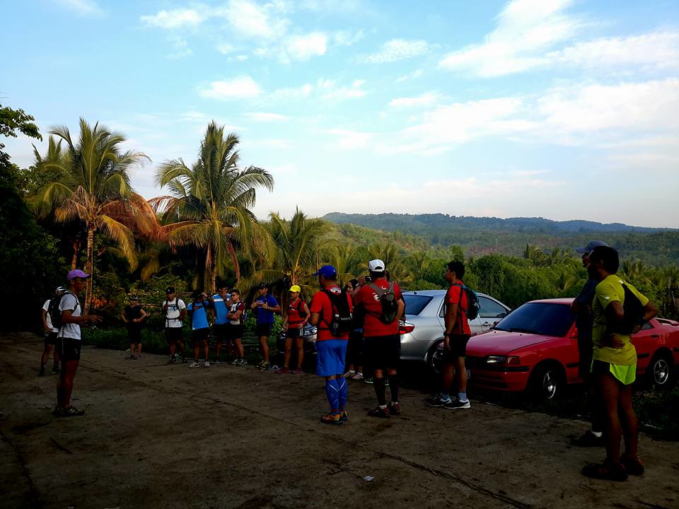
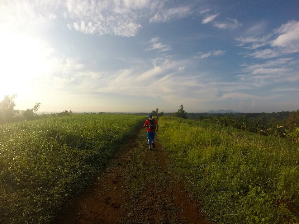
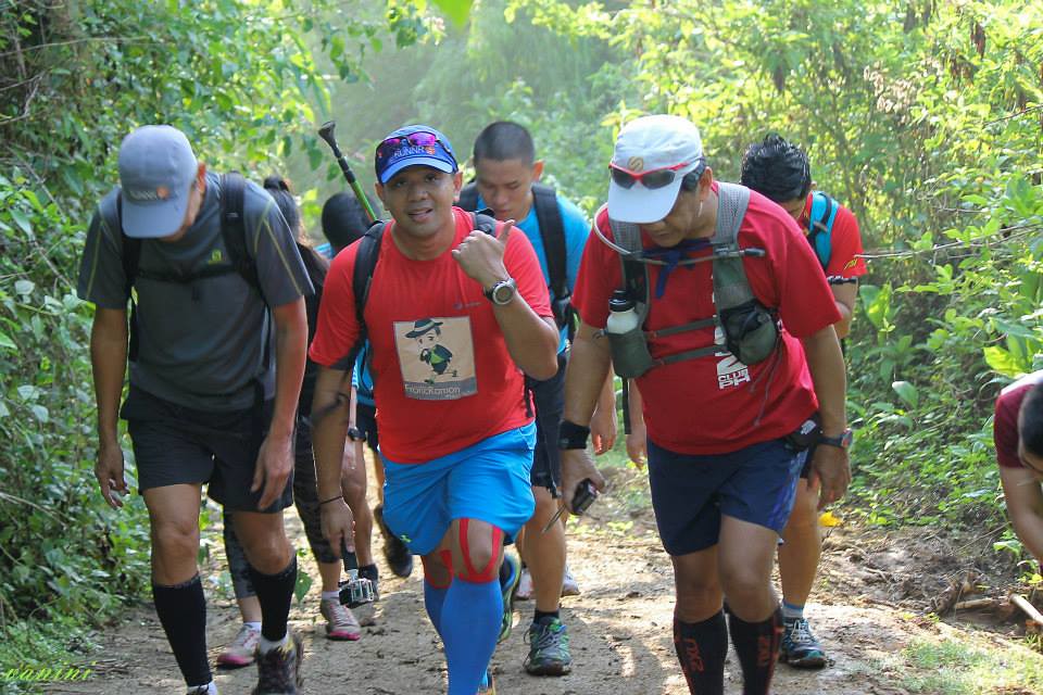
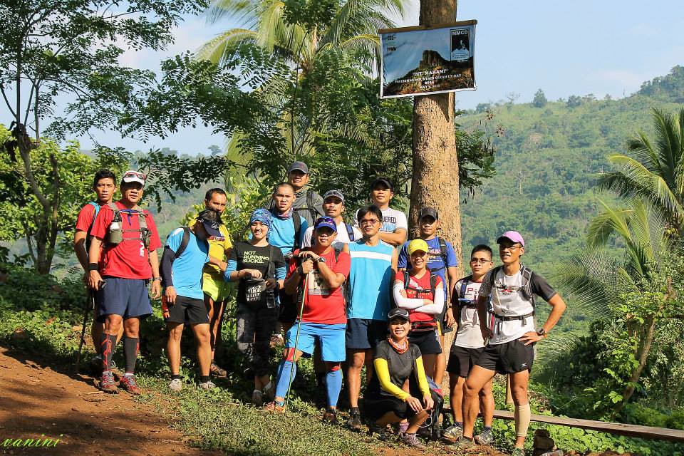
Mount Marami was a late addition to my weekly calendar but trekking another mountain is just too tempting to miss even when I had cough and colds. It was a recon for the upcoming Mount Marami – Silyang Bato 21 Km FKT Trail Run Challenge happening in August 9, 2015. We had set our meet up points early at 4 am at SM Bacoor so we can start early. We were a group of 18 runners joining this trek and this was a fast bunch of runners. Mount Marami is located at Barangay Talipusngo, Maragondon, Cavite, which is accessible via Cavitex and a drive via Naic to Maragondon Town. From SM Bacoor, we had breakfast and met other participants and eventually reached the jump off point by 6 am. It’s a dormant volcano with a summit of about 600 MASL and is popular for its rocky pillars adjoining the summit including one popularly called as Silyang Bato. You can check out their event page for more details: 1st Mt. Marami- Silyang Bato 21 Km FKT Trail Run Challenge. Mt Marami-Silyang Bato offers a lot to trail runners, from muddy trails (during rainy season), 3x river crossings, grassy, two and single track trails, 360 Degrees stunning view of Cavite and Nasugbu, Batangas from the Summit (with Pico De Loro on its sight).
Map and Elevation
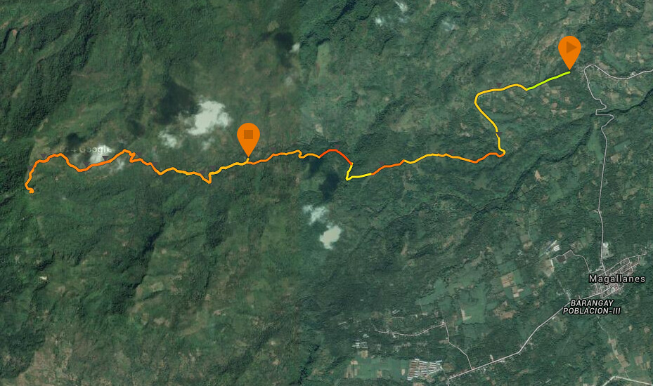
Map Powered by Suunto Ambit 2S and Suunto Movescount.
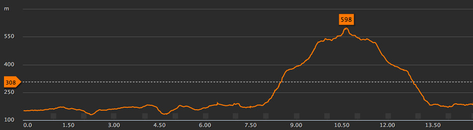
Elevation Profile is powered by Suunto Ambit 2S and Suunto Movescount – Note: Elevation Profile is only for the first 16K, the remaining 6K is a rolling terrain back to the start area.
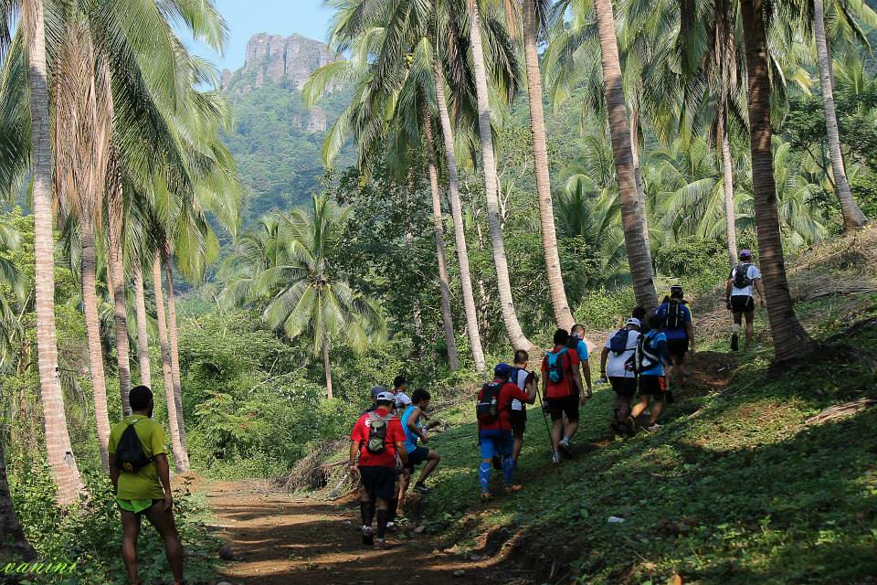
The route starts at Barangay Talipusngo, Maragondon, Cavite with a rolling terrain for the first 8 kilometer with moderate ascents and descents passing by several river crossings and Nuestra Senora Dela Paz Grotto/Chapel at kilometer 6. After 8 kilometers, the course shift to single track dirt tracks with an assault of about 410 meters of elevation over the next 3 kilometers. After the u-turn at the summit, the race descends back for the next 3 kilometers and goes on a rolling terrain for the next 8 kilometers to the finish.
Trekking Mount Marami
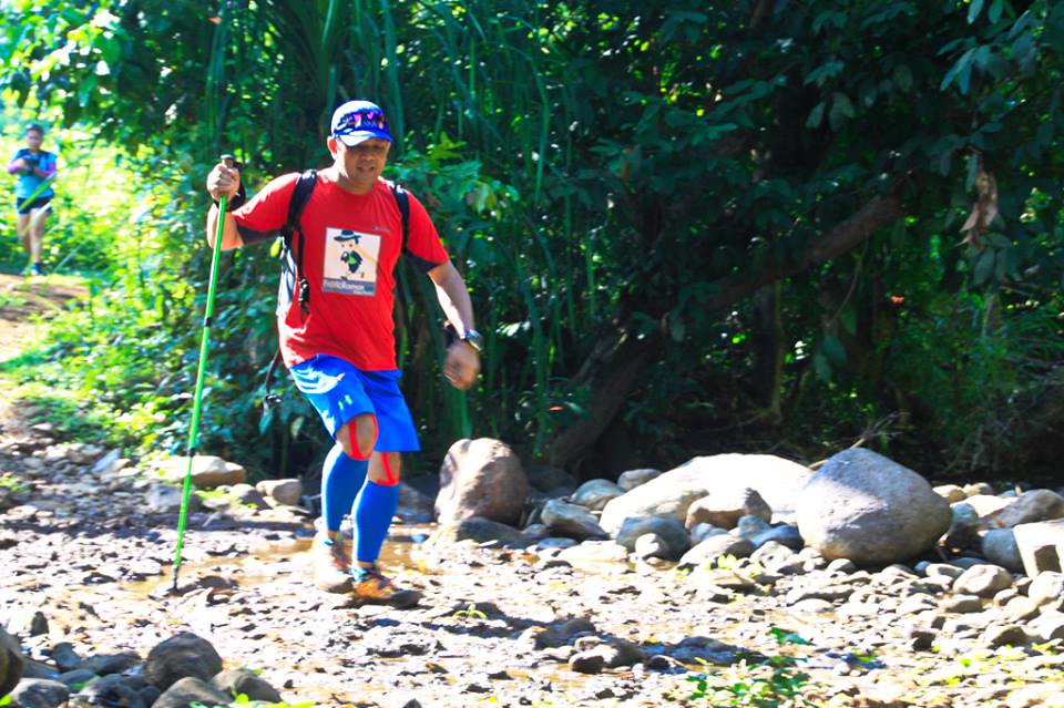
Run – Franckee – Run
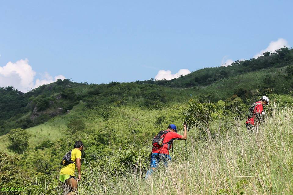
This would be a recon for the race on August 9, 2015. We started on muddy fire trails as it’s been raining the past few days. The trails are not too technical but with a muddy trail, you get to deal with the accumulation of mud in your shoes and it gets heavier. For race day, expect it to be a mudfest as August would be right in the middle of the rainy season. The ascents and descents are moderate so you can go at a consistent pace without getting winded. Since the terrain is rolling and easy to navigate, the kilometers just kept trickling in and you’ll barely notice the time.
Trail Time – Photo by Vanessa Tagaro
This was the faster part of the trek as we just kept going at a steady pace. The mud is a challenge though as it keeps accumulating at each step but once you get the hang of it, it becomes routine. Though there were some stretches of small climbs that’s a bit of a challenge especially before and after a river. We’ve covered about 5 kilometers in an hours time.
River Crossings!!!There are several river crossings that you get to enjoy and appreciate. At this time of the year, the rivers are a bit dry but the rivers would definitely be a larger stretch come rainy season. It’s always scenic passing by river ways and would really be a lot of fun. I also started using my trekking pole here since I get winded easily because of my cough and colds. A trekking pole really helps you move faster on the treks and reduces the impact of your strides. I kept hydrating or having candy to keep my throat from drying. A few more kilometers, we are in the 6 kilometer mark which is the Nuestra Senora Dela Paz Grotto/Chapel and we took a rest here as well as some photos.
6 kilometer Mark – Photo by Vanessa Tagaro
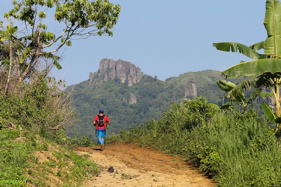
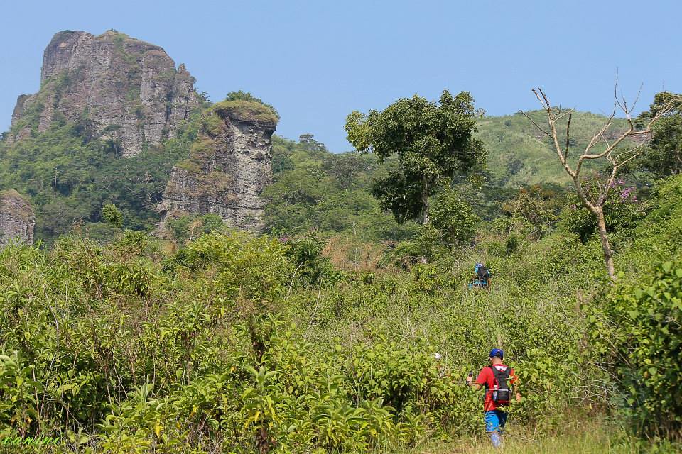
There is a shade in this area and come race day, there would be fresh buko for hydration too. You already get to see a portion of the rocky pillars from this point. You see your destination and how far you still have to trek to go to the top.
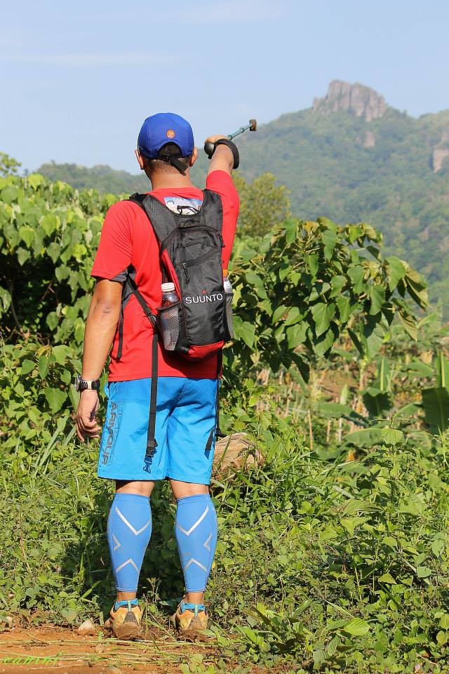
So far yet so far – Photo by Vanessa Tagaro
This was a traverse and not a direct assault so it means we would be going around the mountain heading to the summit. Seeing the rocky pillars at this point is both a challenge and an admiration of its beauty from afar.
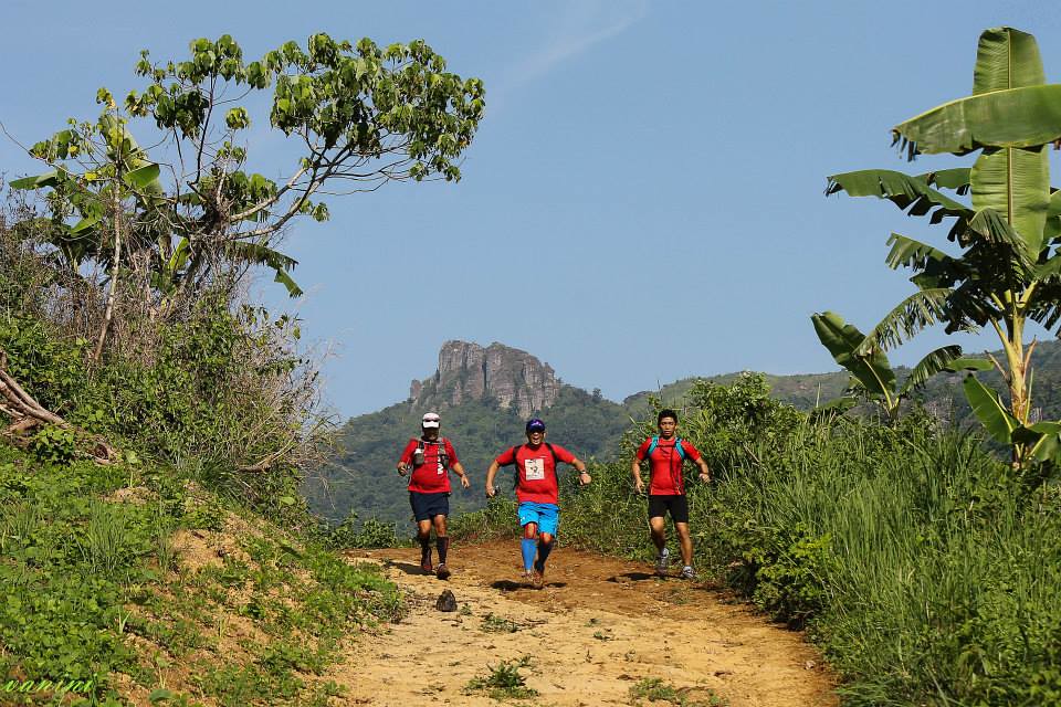
The road to your goal takes one step at a time. – Photo by Vanessa Tagaro
I was also with bloggers Rene Villarta of JazzRunner.Wordpress.Com and Jham Mariano of JhamJham.com. Mountains are a test of patience and I guess, the appreciation comes with the hard work and perseverance.
With The JazzRunner and The Jham Jham.
It would be two more kilometers before the assault though you’d start to feel that the inclines are starting to be tougher at this point. I started to slow down at this point and start preserving my energy for the assault. It was a lot difficult climbing a mountain when you keep huffing, puffing and coughing. Thanks to mint candies, I was able to relax my throat for most of the times while climbing.
And the Assault Begins – Photo by Vanessa Tagaro
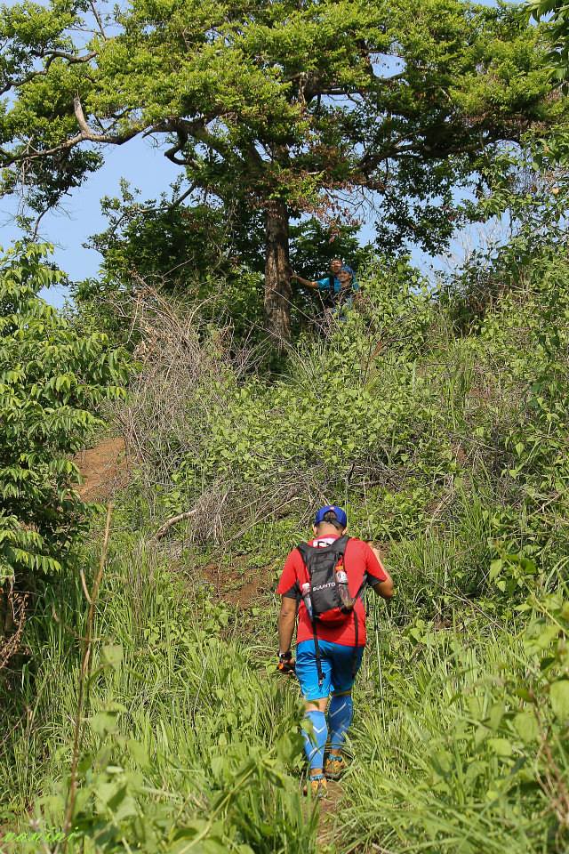
At kilometer 8, it was the start of the assault with the fire trails shifting to single track ascending trail. I positioned myself at the back of the pack with Vanessa and Da Bull, who was our sweeper. It was a crawlfest for me at this point but we just made it one push after another. A few more kilometers, we were at a fresh stream, which was a natural water source. I refilled my already depleted water supply with fresh stream water. I made a wrong estimate in my water supply since I had to consume more because of the dryness in my throat. I brought 1 lightwater and 2 gatorades.
And the long hard climb resumes.
Aside from the regular rest stops, we also had long stops at some enclosed areas with huts or shaded trees. It was a struggle you are still several uphill kilometers away but you just inch your way through all the climbs. This was climbing 400 meters of elevation spread out in 3 kilometers distance with a single track route and uneven terrain.
Inching our way to the top – Photo by Vanessa Tagaro.
Aside from the terrain, heat is also a factor as the assault area has less shade so you really get the feel of the sun’s heat at this point. We also had to manage our water supply so we’ll have enough by the time we reach our next water source. The good part is that you get to see your destination closer but we are still on the other end of the mountain.
We’re closer to the top now.
There’s something in seeing the summit up close that renews your energy to push yourself further. We had one finally rest about 500-600 meters to the summit and at this time, you can feel that you are nearby and the excitement is there to push you further. There was a short shaded descent before we saw the final trail to the summit.
We’re nearly there- Photo by Vanessa Tagaro
It was one final push to the summit. After the shaded area, it was all uphill. With the excitement of reaching the summit, we took this part faster and just had a few short rest. It was a bit slippery with loose soil near the summit but good thing I had a trekking pole and a good traction in my shoes. I crawled my way to the rocky surface heading towards the summit and then headed to the Silyang Bato area, which was adjacent to the summit and had the majestic view of the mountains. It was a bit scary though since there is a part where there is a gap between the rocks so a misstep can really lead you down the cliff.
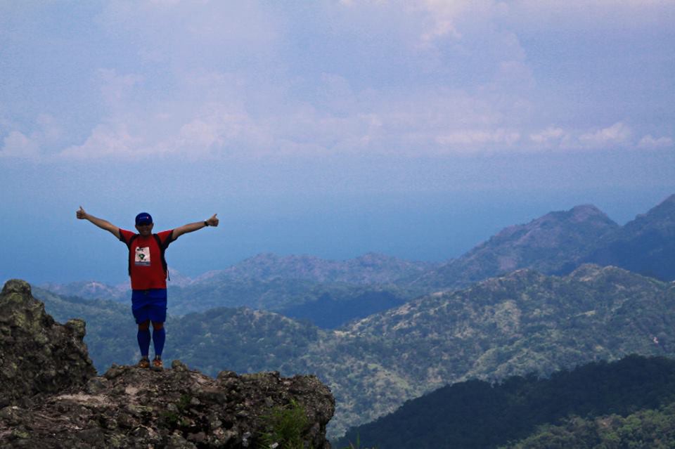
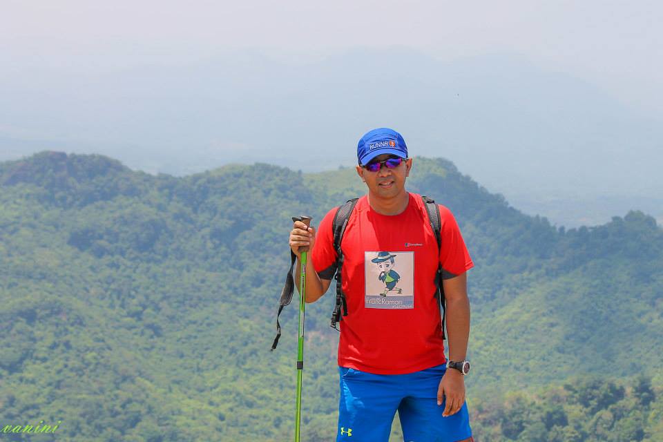
I’m on top of the World – Photo by Eric Tipon
I made my way to the Silyang Bato, which is said to be only for the brave and worthy. I guess the pictures speak for itself as one wrong move and you sure would wish you were Superman. It was a struggle and not to mention I was not 100% healthy for this climb by I did earn my way to this throne and to the top of Mount Marami. The view from he top sure makes you forget of the struggle to get there. You just get humbled by nature’s raw beauty and the wonder of God’s creation.
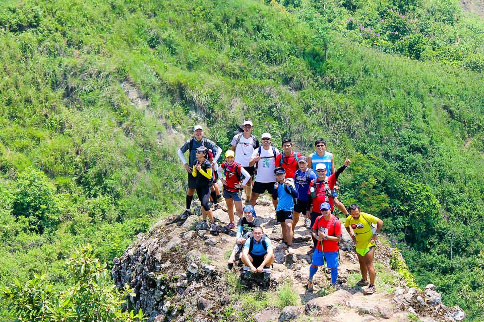
Summit!!! – Photo by Vanessa Tagaro
We then headed to the summit so others can have their photo at Silyang Bato. Reaching the summit is always a milestone as it never comes easy but one thing for sure, it’s always worth the effort. We started comparing notes and we all had a shortage of water so JC Igos suggested we make a fast descent headed for the water source about 2 kilometers away.
Mission Accomplished!
It was a fast descent. The first group made a really fast descent by running the descent. I joined the second grouped with Jun who made a fast-paced walk heading downwards. We just went on consistent with our pace and made our way to the rest stop, which is a hut. There was a part with a lot of cows in the area so we took a longer route to avoid them. After a short rest, we then headed to the water stop and it felt like paradise. We started refilling our bottles, pouring water into our heads (more like taking a bath) and drinking as much as we can. It was as if we accumulated too much heat in our system that we are now dousing off. After a while we then made our way back to Nuestra Senora Dela Paz Grotto/Chapel.
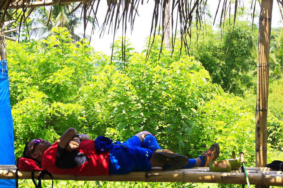
Buko and a short afternoon nap – Photo by Eric Tipon
We had fresh buko at our rest stop at Nuestra Senora Dela Paz Grotto/Chapel while awaiting the rest. We also were able to catch some sleep here. After the last group had arrived and rested, we then made our way to the last 6 kilometers. The muddy trail in the morning is dry now with the Sun’s heat. At this point, the battery of my GPS watch was empty so had to make do without the watch. I just went on and on and it was a mental challenge as you had no idea how long was 6 kilometers without the watch. I just continued walking at a fast pace and after about an hour, I was back at the start area and the first stop was the nearest store for some refreshing cold drinks. That’s about 22 kilometers worth of Mount Marami. I can say this trail can be an excellent one for both experienced and newbie trail runners and mountaineers.
Outfit Of The Trail
Optimus Prime – Photo by Eric Tipon
- Top: Berghaus #TaleOfTheTrail Design by Breakout Design
- Bottom and Socks: Under Armour
- Shoes: Merrel Capra
- GPS Watch: Suunto Ambit 2S
- Compression Sleeves: 2XU
- Trekking Pole: Columbia
- Cap: Runnr
- Muscle Tape: Rock Tape
97 Responses to #TaleOfTheTrail Mount Marami (Maragondon, Cavite)