

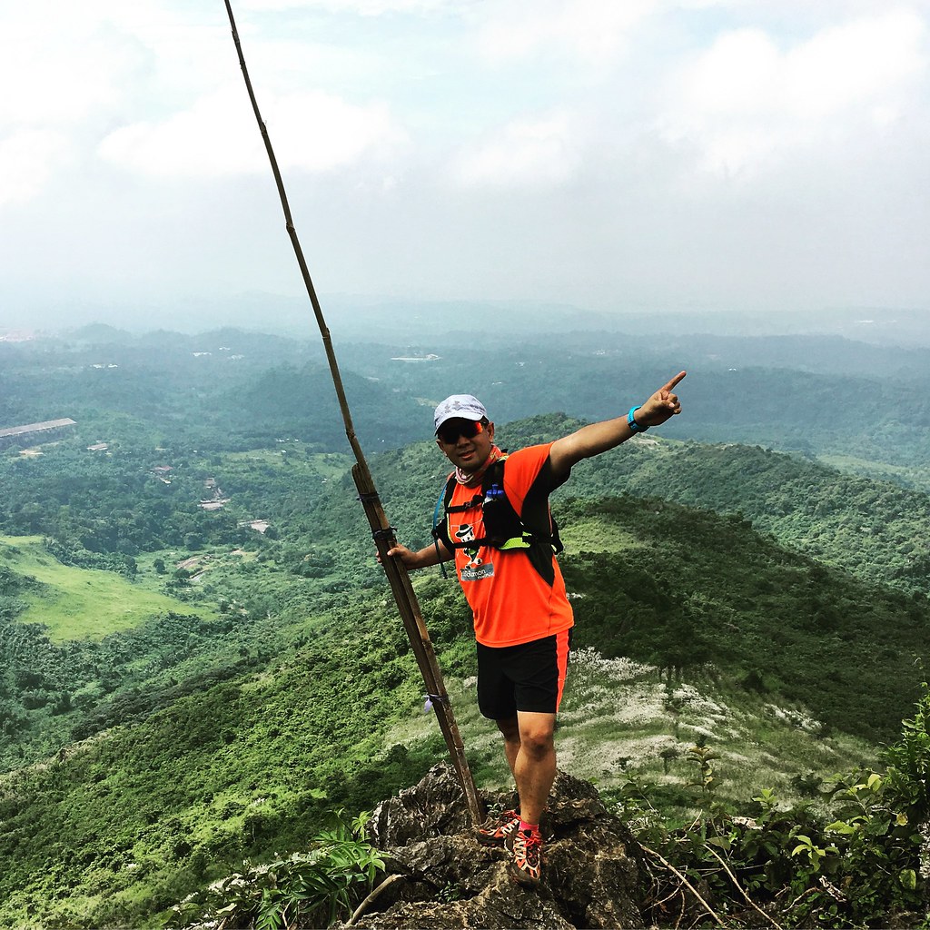
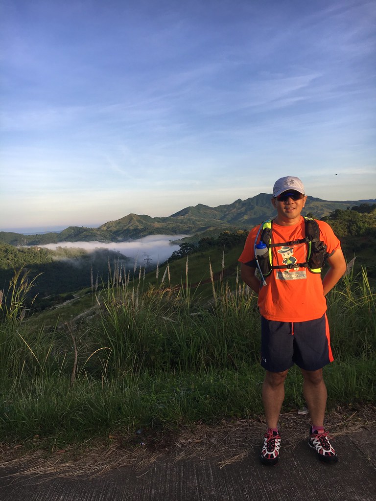
Top of Mount Paliparan
Mount Paliparan was not an easy climb. There were steep ascents that came with the really warm morning. We also had to maneuver our way to sharp rocky cliffs. The muddy surfaces also came into play. It was hard but as all things in life, there is always a way to overcome them. At the end of the day, we end up stronger and more appreciative of the beauty that surrounds us.
Read About:
- Climbing the 12 Peaks of Mt. Batulao
- Cordillera Mountain Run
- #TaleOfTheTrail Dragons Back (Hong Kong)
- #TaleOfTheTrail Camp John Hay Trails (Baguio City)
- #TaleOfTheTrail Mount Talamitam (Nasugbu, Batangas)
- #TaleOfTheTrail Mount Cabuyao (Tuba, Benguet)
- #TaleOfTheTrail Maysawa Trail (Tanay, Rizal)
- #TaleOfTheTrail Mount Kinabalu (Kota Kinabalu, Sabah, Malaysia)
- #TaleOfTheTail Mount Marami (Maragondon, Cavite)
- #TaleOfTheTrail Lantau Peak (Lantau Island, Hong Kong)
- #TaleOfTheTrail Lion Rock (New Territories, Hong Kong)
- #TaleOfTheTrail Ampucao – Sta Fe Trails (Ampucao, Itogon, Benguet)
- #TaleOfThe Trail Casile/ Bajo River / PG / Pintong Bukawe (San Mateo, Rizal)
- #TaleOfTheTrail Mount Makiling (Los Banos, Laguna)
- #TaleOfTheTrail Sierra Madre Trails (Tanay, Rizal)
- #TaleOfTheTrail Mount Kalugong and Mount Yangbo (La Trinidad, Benguet)
- #TaleOfTheTrail Ambuklao Dam (Ambuklao, Bokod, Benguet)
- #TaleOfTheTrail Camp Sinai, Pintong Bukawe, Casile, Inigan (San Mateo, Rizal)
- #TaleOfTheTrail Wawa Inigan Casile (San Mateo, Rizal)
- #TailOfTheTrail Dalupirip – Bantik (Itogon, Benguet)
- #TaleOfTheTrail Tangadan Falls (San Gabriel, La Union)
- #TaleOfTheTrail Mount Maculot (Cuenco, Batangas)
- #TaleOfTheTrail Mount Mabilog (San Pablo, Laguna)
- #TaleOfTheTrail Mount Fuji (Fujiyama, Japan)
- #TaleOfTheTrail Mount Takao (Hachioji, Japan)
Tale Of The Trail
Got surprised by the technical difficulty of Mount Paliparan
Tanay has been our constant playground for weeks. While we’ve been doing most of our recons in Maysawa and Laiban, we decided to try something new. We wanted to check out Mount Paliparan looking for a feel-good climb. It turned out more than we expected. We got different inputs on the distance to Mount Paliparan, which left us more puzzled on the degree of difficulty of the climb was. It turned out to be a difficult climb but once we descended. we found a route that is gonna make you love trail running even more.
Map and Elevation
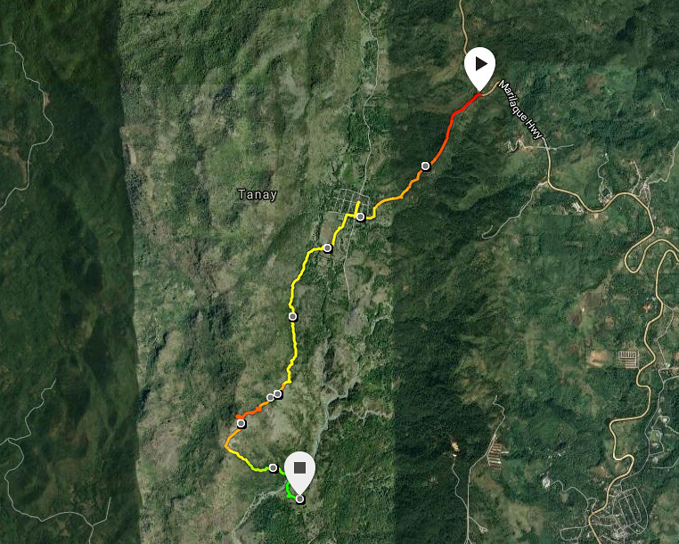
Powered by Suunto Ambot 3 Sports – Pertains only to first 8K of the Route.
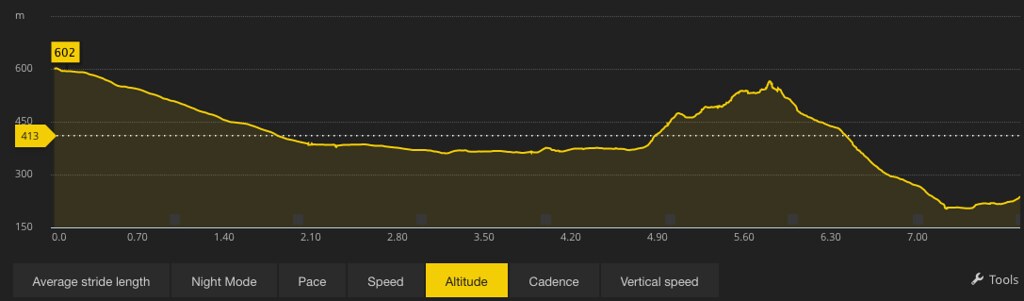
We started out at the Marilaque Highway heading down towards Barangay Cuyambay for the first 2.5 kilometers. The next two kilometers of the route is a slightly ascending forest trail. It then goes on a steep and technical climb to the summit for the next 1.5 kilometers before descending to the river for the next two kilometers. The route goes on a rolling terrain for the next 6-7 kilometers back to Barangay Cuyambay.
Trekking Mount Paliparan
Weekly dose of Vitamin #SeaOfClouds
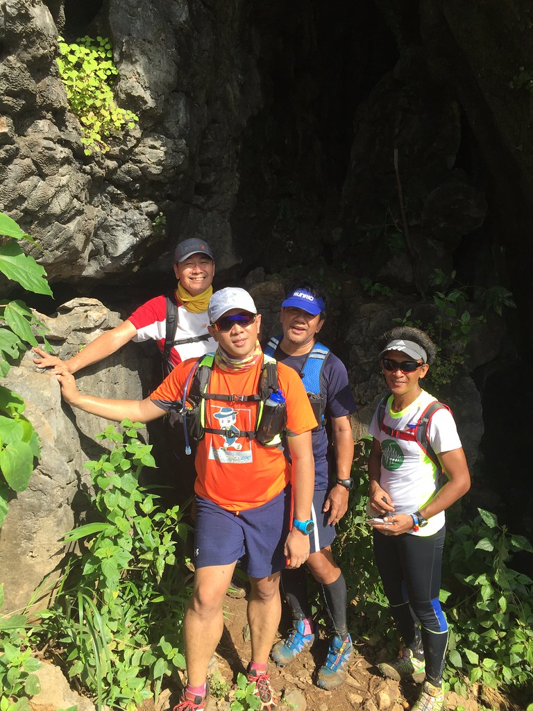
We started with an early meet up at QC and started by 6 am at Pico De Pino in Tanay, Rizal. The first 2.5 kilometer was a sweet descent on paved roads going to Barangay Cuyambay with a view of the early morning sea of clouds in Tanay. We had our breakfast at Barangay Cuyambay and registered at the Barangay Hall. Climb fee is P30 per person while guide fee is P500. Once we have registered and then we were off to the trek.
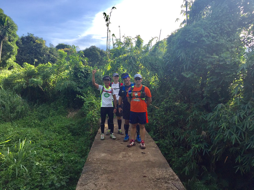
Passing to rice filed and we enter the forest trails.
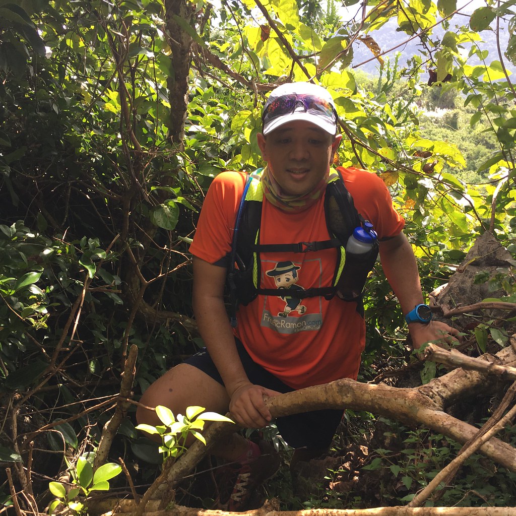
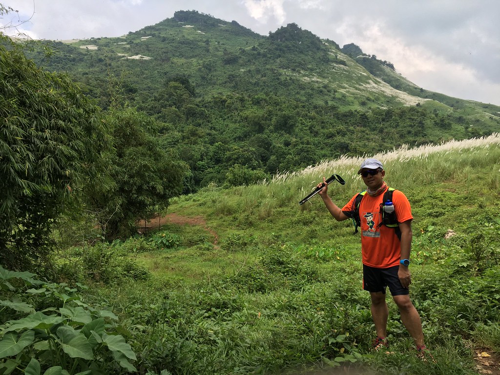
We started with some irrigation passageway and some fields with an overlooking view of the Mount Paliparan. We then shifted to forest trails, which was a bit slippery coming from the rain the previous day. The trail had some stony surface that were a bit difficult to navigate so we took it slow on this part. It then shifted to muddy single track trails with a slow ascent. The area is covered by trees and plants, which makes it a lot cooler to explore. The cover also meant that it will take a lot more time for the surface to dry up.
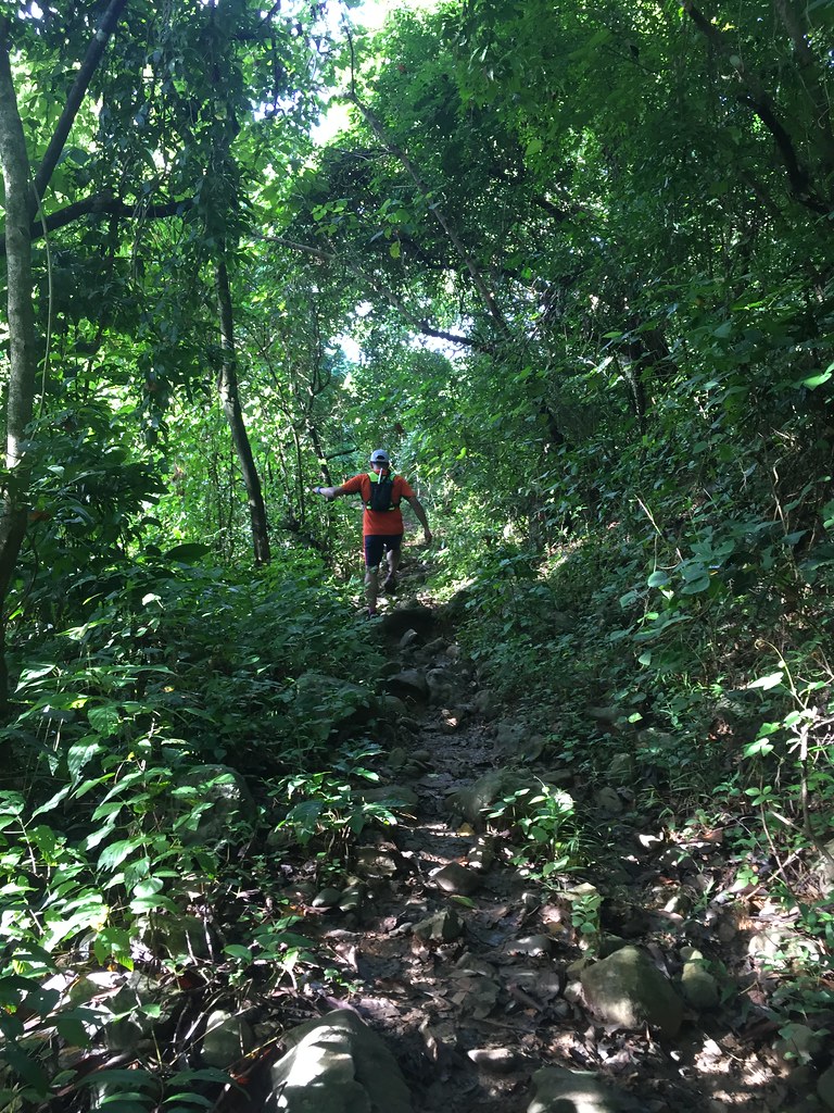
Forest trails
I was hoping that we’d be in the forest trails forever while the trail slowly ascents to the summit. It was refreshing seeing the green surrounding and the forest cover protected us from the sun’s rays. The forest trails lasted 2 kilometers. We were out of the shade and we were welcomed by the warmer temperature, a view of the top parts of the mountain and a challenging climb ahead.
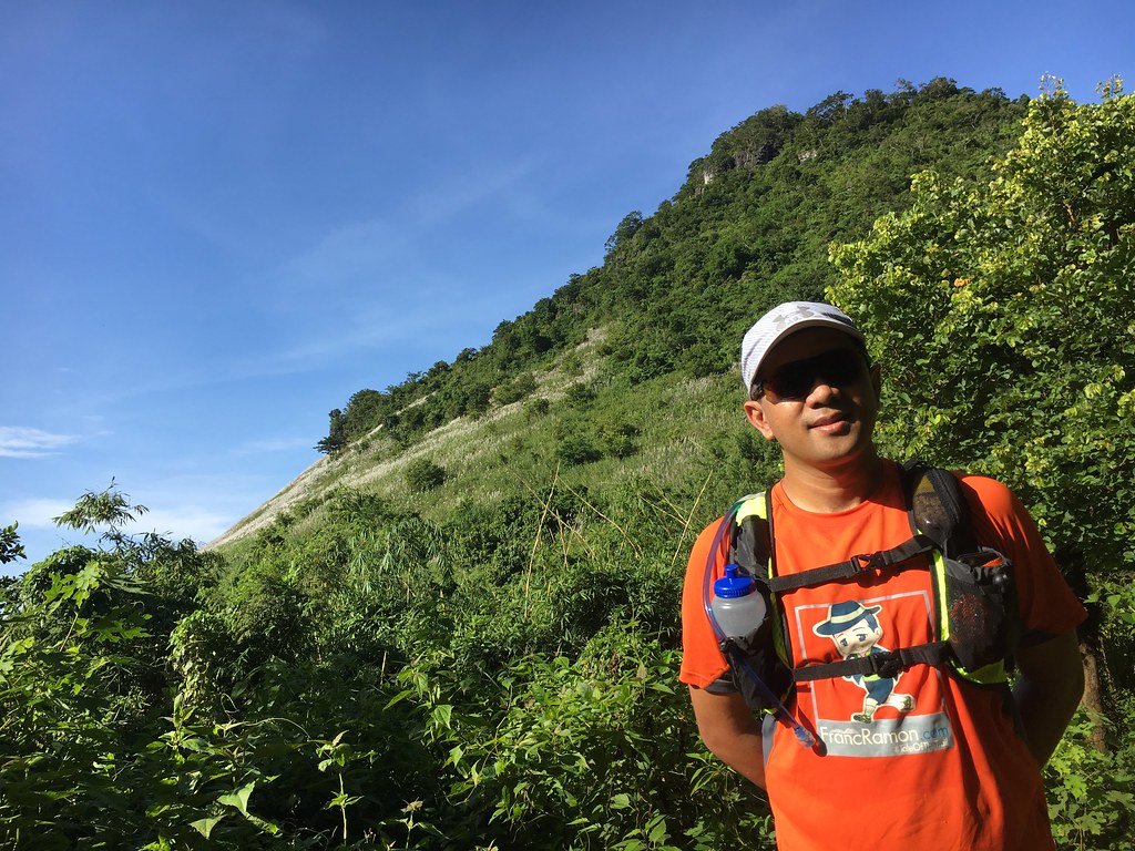
The Sun is Out.
The sun is out and we were going on steep ascents on single track trails with cogon grass. One of the rare times I don’t wear arm sleeves and calf sleeves and I end up on a grassy trail. I got a lot of small cuts and irritation from the cogon grass. It was energy draining as the climb goes steep and the heat can be overwhelming. We had to stop at some point to recover. We only had short resting breaks because it was too hot to stay fixed at one area.
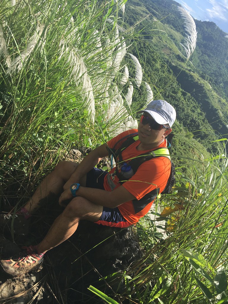
Look at the mud all over my feet.
The view was worth it though. One end you had to see the seemingly insurmountable climb and the other end was a birds eye view of the Sierra Madre Mountain Range and you could even see the windfarm from this vantage point. It was exhausting up to the point that I was starting to doubt if I can still go on but on the other hand, there were just no bail out options.
Taking a break at one of the rock structures.
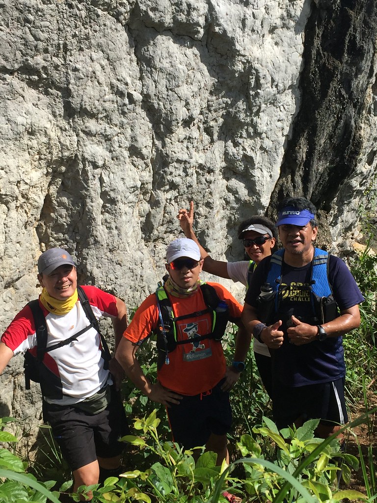
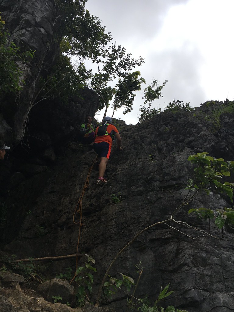
When we reached one peak of the mountain, we had to traverse to the other side of the mountain with the higher peak. It was a descent on covered trails with some slippery stretches. While we thought that the worst is over. We were wrong. We then had to climb several rock surfaces that was technically challenging to navigate and a bit dangerous too as one wrong step could mean falling off cliffs and ravines.
When the going gets tough.
The degree of difficulty immediately leveled up. It was time to be strategic. You had to see every edge you can hang on as you pull yourself over the rocky structures. We came to climb a mountain, we ended up rock climbing. The thing is when the going gets tough, you just find a way to get past it. Even on a slow mode, we endured on the climb, adjusted on the terrain and made our way past the long rocky climb.
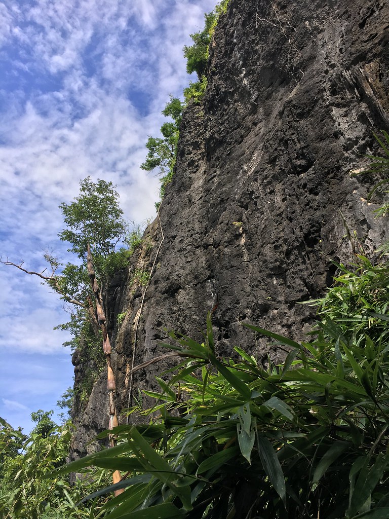
One last climb.
After the tough part, we then saw the destination so near. We took a short downward trek to go to the other side of the access point, which also was the way down. We then made the final climb over the slanted grounds and over rocky surfaces on the way to the summit. We had to rappel heading to the summit.
The things I do to have a selfie at the summit.
The rappel part was a tough one as you had to look for areas which you can step on as you slowly pull yourself to the top. It has been a challenging journey, might as well do this part.
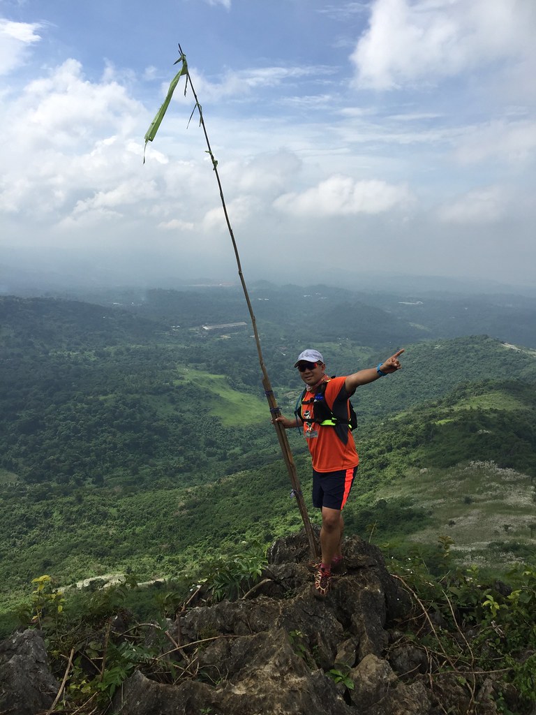
The Summit
The view of the summit was worth all the effort. It was just around 3-4 K from Barangay Cuyambay but it took us hours reaching the summit. You can see the very rich Sierra Madre Mountain range and it was all the effort going to the top.
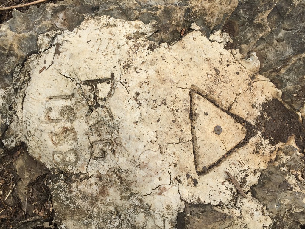
Stone Marker at the Summit
We then our made our way down. While it was not as hard as the climb, it did take us a lot of time descending the mountain. The trails were steep and slippery. I think I feel 3 times on the descent. We made our slow descent from the top over forest trails. The muddy part took away some of the traction from our shoes making it a lot slippery. After another eternity in descending, we finally hit the river and it was the perfect place to cool down.
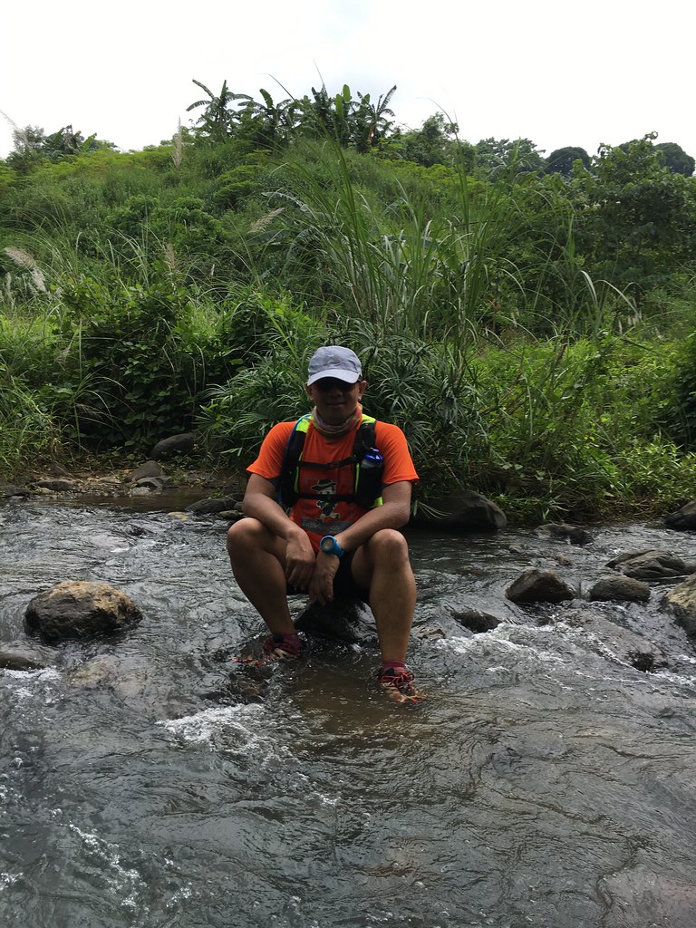
The river was refreshing.
We waited for the rest at the river and took time to clean ourselves and get refreshed by the waters. We did hang out a long time at the river before we went on the journey. We then headed back to Cuyambay and at the start of the climb, my phones and my watch were all fully drained so I wasn’t able to measure the distance or document the trails.
Mount Paliparan on my background.
On the way back was a long rolling trail, with a variety of surface from wide dirt tracks to knee high muddy surfaces. I did enjoy this part because of the variety when it comes to views and surfaces. I also enjoyed the part where it rained and it was instant refreshment after having to deal with the heat most of the time. It was a long way back but it’s definitely a trail worth exploring. It was a tougher trail than we expected and it was a nice mental test for the future trail adventures.
57 Responses to #TaleOfTheTrail Mount Paliparan (Tanay, Rizal)