

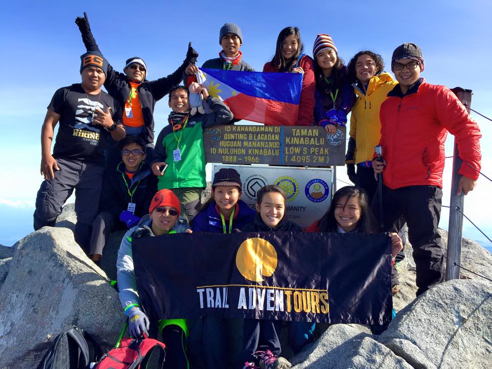
4,095 MASL!!! Photo by Onick Valero
Mountains are not meant to be conquered but by climbing it we conquer ourselves – our own limits, fears and inhibitions. The climb humbles us with its tough terrain that make us revisit our sanity, patience and perseverance. It also gives us a better appreciation of the beauty of nature at its raw form. Trekking Mt. Kinabalu’s 4,095 meters of elevation is really tough but each difficult step makes you stronger and in a better condition to reach and appreciate the out-of-this-world view from the top of Mt. Kinabalu. #TaleOfTheTrail #TrailAdventours #LiveForAdventure #BerghausPH #Fitletic #UnderArmourPH #Suunto #Ambit 2S #Nike #Brooks #Oakley #Rayban #NewBalance #Vamos #GoProPH

Focus on the destination and appreciate the journey.
Read about:
- Climbing the 12 Peaks of Mt. Batulao
- Cordillera Mountain Run
- #TaleOfTheTrail Dragons Back (Hong Kong)
- #TaleOfTheTrail Camp John Hay Trails (Baguio City)
- #TaleOfTheTrail Mount Talamitam (Nasugbu, Batangas)
- #TaleOfTheTrail Mount Cabuyao (Tuba, Benguet)
- #TaleOfTheTrail Maysawa Trail (Tanay, Rizal)
Kota Kinabalu
Let’s Do This!!!
For someone without an official bucket list, I do manage to tick off bucket list locations and races a lot. Kota Kinabalu is one dream location especially for mountaineers. Mount Kinabalu’s peak at 4,095 meters above sea level entices climbers to take their climbing gear on and go for the challenge. The idea of climbing Mt. Kinabalu was nowhere near my frame of thought but since my friend Inja and her friends are going, I just took the plunge. I immediately booked my slot at Trail Adventours for the 4-day Kota Kinabalu trip set for May 8-11 mid January. I am not much of a climber with only a few mountains climbed (Mt. Batulao, Mt. Talamitam and Mt. Pulag by joining the Cordillera Mountain Run) and it’s not among my strong points but knowing me, I’ll find a way. Weeks before the climb we had a pre-climb meeting where I met Coby of Trail Adventours. That’s the time I found out, I need some new gears or improvise on gears I have. I also spent more time at trails weeks prior to the event. I have to credit Trail Adventours as they have a really well planned trip and they are also flexible on the itinerary. This is gonna be fun.
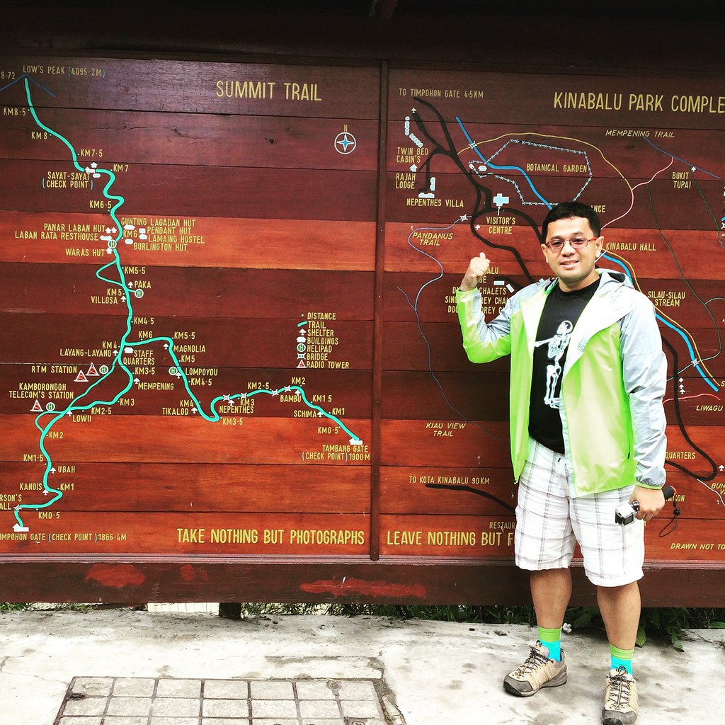
Trek Route and Elevation
The trek is divided into 3 sets of hikes. The first hike was via Mesilau Trail to Laban Rata, which is about 8.5 kilometers.
Mesilau Trail to Laban Rata
The Mesilau Trail was set on May 10 at 9 am where we had to traverse about 8 kilometers of distance covering about 1300 meters of elevation. The first kilometer is a climb before it descends to the river and waterfalls on the next two kilometers. After crossing the waterfalls, it’s 2 kilometers worth of climbing. The next 2 kilometers is on a rolling terrain which crosses a ridge before heading to the intersection of the Timpohan Trail. The last 2 kilometers going to Laban Rata is pure uphill with a very challenging and technical surfaces.
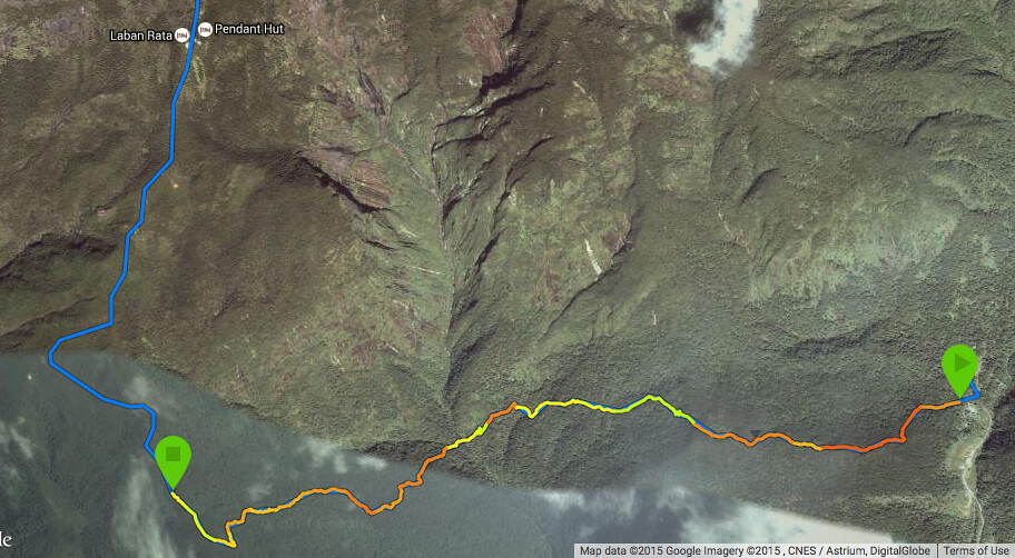
Laban Rata to Low’s Peak
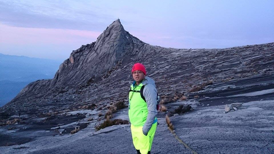
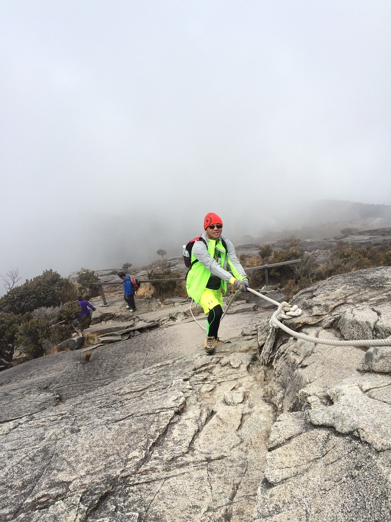
The trek to Low’s Peak Summit which is mostly climbs with a total ascent of about 825 meters heading to the Summit, which is 4095.2 MASL (Meters Above Sea Level) started at around 3 AM. The first 700 meters was on tough trail surfaces and shifts to the large granite formation of Mount Kinabalu which required some ropes to ascent. The trail goes on a hilly granite trail path going to the summit. The last 100 meters to the summit was a steep incline that required ropes to traverse.
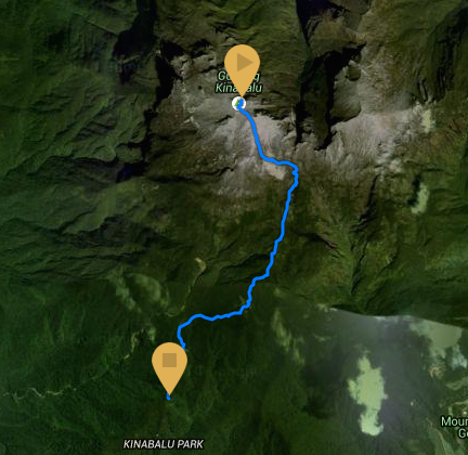
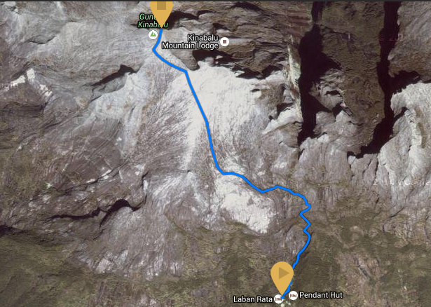
Lows Peak to Timpohan Gate
The last route is from Lows Peak Summit to Timpohan Gate covering about 2200 meters of elevation. It starts with a 2.5 kilometers descent from Lows Peak to Laban Rata and another 6 kilometers descent from Laban Rata to Timpohan Gate with the last 200 meters being a climb to the Gate.
#TheTaleOfTheTrail
First Day was spent to acclimatize with the elevation and weather.
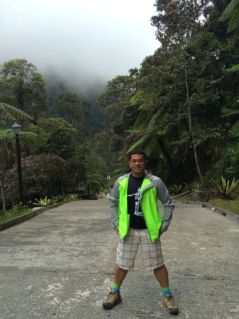
The Group met at NAIA Terminal 3 since most would be taking the same Air Asia flight to Kota Kinabalu arriving about lunch time. We had our lunch before we took our 2 hours bus ride going to Mt. Kinabalu Park and eventually to our home stay at Mesilau Nature Resort. We took our time to sort our stuff from those we would be bringing in the trek and those we would leave at our home stay. Since we’re new to this, we had a big luggage. I eventually just picked up one set of clothes for day two hike, a poncho and two extra jackets. I cramped them up on my Oakley back pack (Mental note: I need to invest in a trek bag). The extra jackets was for layering as we can just add layers when we feel cold and pack it away when we feel warm. After dinner, I took a bath already and already wore my next day clothes since I’ll just freshen up the next day to save time.
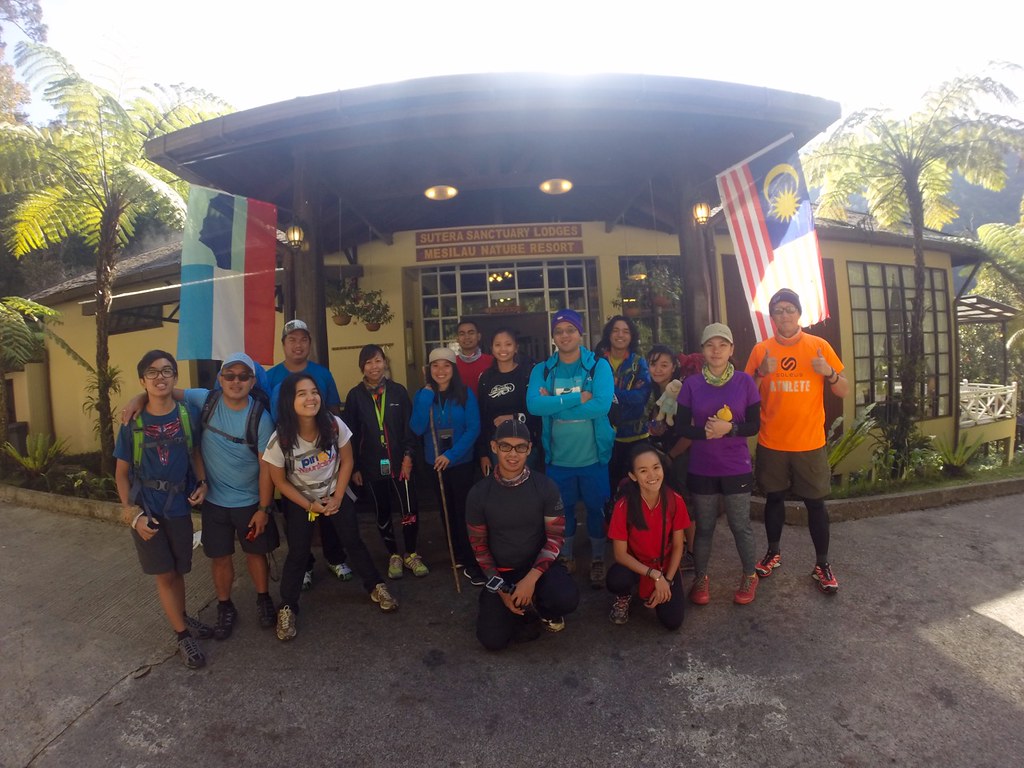
We’re ready to rumble!!!
The next day was for breakfast, briefing and preparing our stuff for the long trail. We were starting to warm up with each as a group. We had a last minute change in itinerary, which was to take the Mesilau Trail, which was longer by 2 kilometers compared to the Timpohan Gate. So we’ll get to experience both, we’ll ascend via the tougher Mesilau Trail and descend on the Timpohan Trail on the way back.
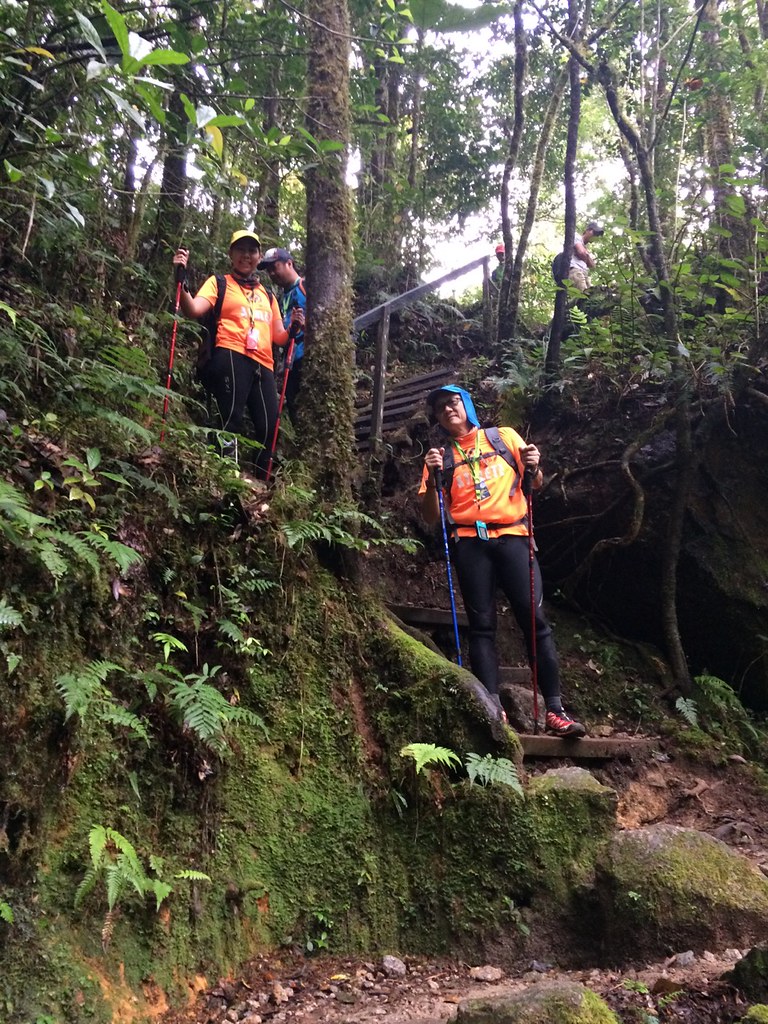
Mesilau Trail

Mesilau Trail
We had briefing at around 9 am before proceeding to the start of the trek. It starts with a climb along a combination of dirt tracks, wooden planks, rocky and stoney paths. It was my first time for me to use a trekking pole and funny how I was using it as a cane. Good thing Lester of Trail Adventours thought me later in the trail that it’s best to have it stretched out for maximum effect. It was a lung-busting start but this is just the start of the trail for all of us. The steps were wide apart so it took more effort for each step.
Oh yes, we still have a long way to go.
After a kilometer of ascent, we hit the first kilometer. After the first kilometer, we met the rest of the group at the first shade, which had a view of the mountain from the bottom. The next two kilometers were descents and had two rest stops. The first stop, we played with squirrels as they were all around the place and the next stop, we had our lunch. The descent took the same time as the ascent but it just required less lung power so you can go longer without huffing and puffing. The steps were technical, uneven and took time to navigate. It was also tough on the knees but good thing the trekking pole was cushioning the landing. After lunch, the trail led to the river at the third kilometer.
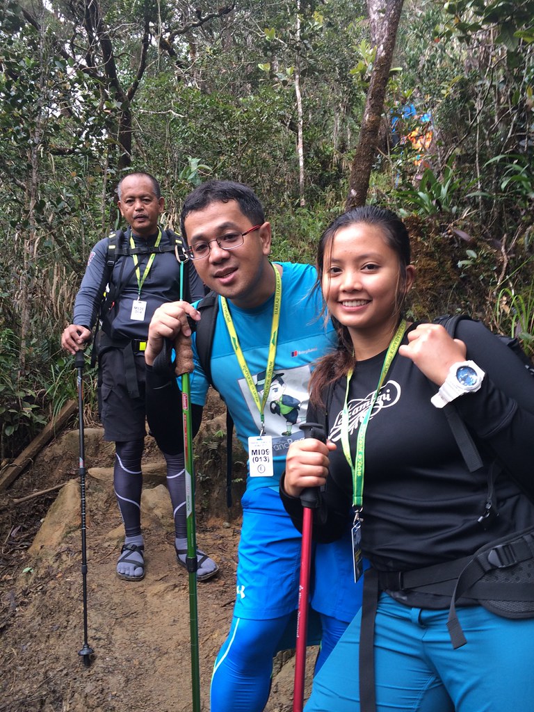
Found my trekking partner in Cheena and her Dad Sir Boyet.
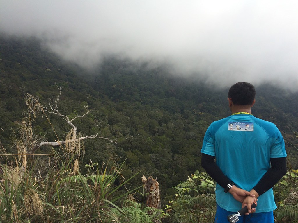
After crossing the falls at kilometer 3, the going gets tough and when the going gets tough, you got to find someone to share in your miseries. I find my pace group in Cheena and her Dad Sir Boyet. The 2 kilometer climb felt endless and forever. It also had granite structures, big steps, sharp rocks, wooden planks, slippery steps, limestone formation, dirt tracks and practically all the surface there is. I’m very glad that my Berghaus has great traction on all terrain and surface. I let Cheena set the pace and we would rest after each big climb. Aside from the really tough terrain, the mossy forest was very scenic with the lush green backdrop and giant trees dwarfing you with the cold mist starting to sweep to your skin and cheeks while you are walking. It also rained towards the end of the climb so we switched to our Ponchos towards the 5th kilometers.
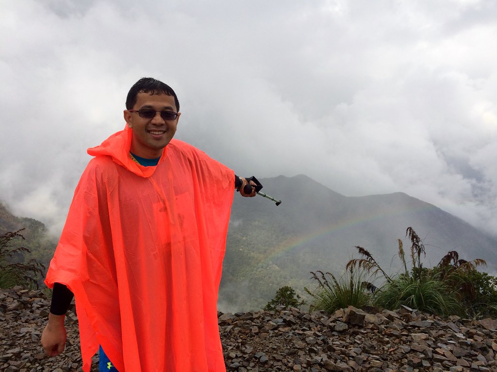
With the rain comes the rainbow.
We rested a bit at the shelter in kilometer 5 to allow the rain to slow down a bit then we went on with the trek. After a few hundred meters we were now on the ridge part of the mountain with a view of the top. And since it was raining, we were lucky enough to see a rainbow. I think only our group was able to see the rainbow as when we left, there was no more rainbow. We took time at the ridge because it was just scenic seeing the foggy panoramic mountain view and the rainbow.

Rocking our Poncho look.
We then proceeded with the trail and it started with a descent and then went on a rolling terrain. It was more relaxed at this part. We found a shelter around kilometer 5.5 and we had a few snacks there as well as had to wear our jackets as it was already getting cold approaching nightfall. We then proceeded to the route which then led us to the intersection of the Timpohan Trail.
The last two kilometers climb felt endless.
At the intersection, the trail became a lot more technical with long stretches of rocky steps, boulders, dirt tracks and wooden planks. It felt forever and ever and ever (x 2,000). We’ve been walking for about an hour already until we saw the sign that we’ve just reached the first 500 meters of the last 2 kilometers. The next 500 meters also felt that tough and the last stretch was us traversing through a big granite structure. It was really difficult how the kilometers were moving so slow when you’ve been walking for hours and with a heavy backpack. I just thought that I just need to survive this stretch and we’ll be trekking the summit on a lighter bag the next day.
At nightfall.
We took our restroom break with the second to the last stop with 1 kilometer to go before Laban Rata. We also had to use our headlamps by this time as it was dark already. One good thing though was that my Fitletic headlamp had a strong lamp so I was able to navigate myself in the dark trail even if the terrain was changing. It felt even longer now since it was dark and we took longer getting out of the trail. We had a few snacks with 500 meters to go and resumed groping in the dark until we reached Laban Rata at around 8 pm.
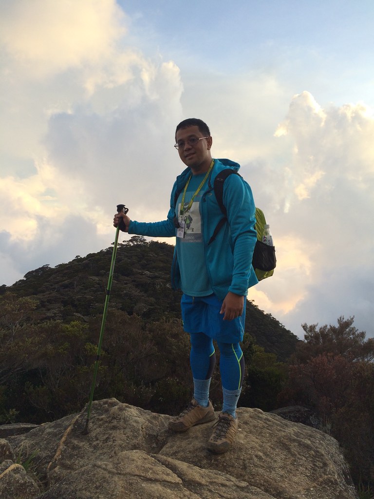
Outfit of the Trail (Photo by Cheena De Guzman) Shirt – Berghaus #TaleOfTheTrail designed by breakout design, compression tights, shorts and bonnet – Under Armour, Shoes – Berghaus, GPS Watch – Suunto Ambit 2S, Jacket and Bag – Oakley, Socks and Arms Sleeves – Nike, Eyewear – Rayban with Transition Lenses, Pole – ColumbiaWe had a quick dinner at Laban Rata and it was time to prepare for the next day. I switched to my day two clothes and tried to get a short sleep (which I didn’t) before the next hike at Dawn.
Laban Rata to the Lows Peak Summit
Up Next – Summit (Photo by Cheena De Guzman)
I barely had sleep before the 2 am wake up call for the next trek. Since I was already in my Day 2 trek clothes, I just needed to freshen up a bit for the next climb. Everybody was wearing cold gear trekking pants while I was wearing my Under Armour compression tights which was much thinner than trekking pants. The plan was to be in constant motion so I wont get cold on the legs. We started at around 3 am for the trek at kilometer 6 at Laban Rata.

The Top of Mt. Kinabalu was one Giant Granite Structure
We started trekking at past 3 am and it was straight ascent on regular trails, which mean large steps on uneven terrain on varying tough surfaces. There was a bit of a queue at the start, which meant that the pace was much more controlled. This is better to avoid altitude sickness which happens when you reach 3,000 meters of elevation. I paced myself with Cheena at the back of the pack. When the others were resting, we just went on to proceed as we didn’t want to rest too much so we won’t feel cold. We just went on and on and we were surprised we were already in front of the group. That was surprising since we were among the last the other day.
Lester of Trail Adventures joined us on the trek.
Since Lester was in charge of the first group, he joined us on the trek. After 700 meters, the trail shifted to the large granite structure of Mt. Kinabalu. We had to navigate through ropes just to climb. At first, it felt difficult because you have to pull your body weight. It didn’t help too that it was dark and we had no idea how long the rope climbs were. We had a lot of stops here to rest and prepare for each major rope climb. It really helped that we had to carry heavy bags on day 1 as it made us stronger for this part. Lester was also a good guide as he had to tell us on where it would be easy to walk and when to use the ropes.
When your outfit glows even on Silhouette effect
We’ve reached the checkpoint area at kilometer 7. The inclines were more tolerable at that point. The climb was still long though but Lester kept pushing us to have several walks before rests in order to reach the ridge area. So we went on with one push after the other and we were able to cover a lot of distance already. The area is also starting to brighten up already as you can now see the structures. It felt like another planet with you standing on one big granite structures with several formations around and a sea of clouds below you.
It’s still early time to sleep. Photo by Cheena De Guzman
We were impressed by the structures and Lester went ahead of us. Cheena and I started to have a walk rest strategy walking 50 steps before resting again. One effort after another and we were at the top. We can see all the structures and the summit. We took a lot of photos in this area since the light was much friendlier already. Sir Boyet was also able to catch up with us. We shifted to a 30 steps effort before a rest and we were able to catch up with Lester who was at the foot of the Summit.
We rested a bit since the Summit was crowded
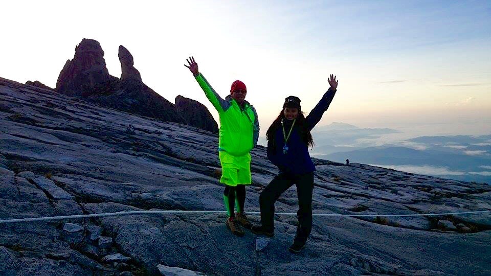
We took our rest and had a a few snacks since the summit was still crowded. After a while, we started to walk to the Summit. It felt easier at this point since we were well rested and we were so close to the summit. The last 100 meters to the summit was the tough part since you had to navigate through ropes and slopes. I went first and unlike the other trails, the summit had several options to climb. There are parts where it was better to use a rope and there were parts you can just walk through the granite structures. You just have to decide which is faster for you. I managed to go up to the top fast and part of the first group. Hello Lows Peak Summit!!!
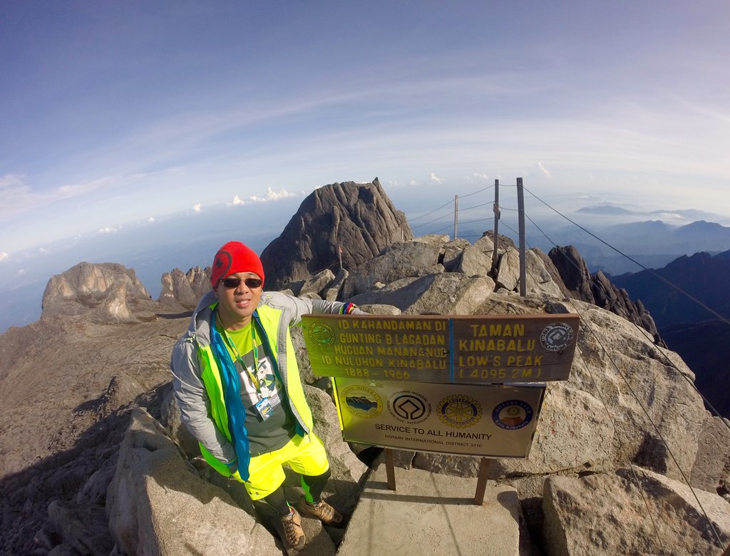
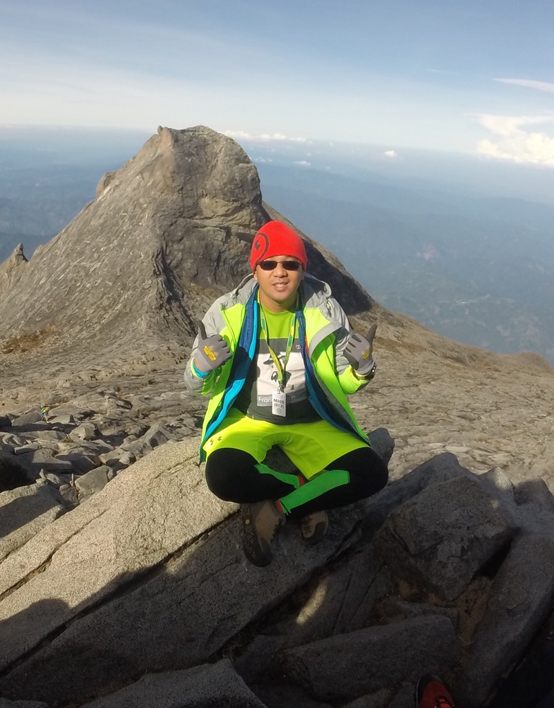
4,095.2 MASL!!!
The view from below the summit was already worth the trek but at the Summit you can see everything. It was humbling to be at this point as you get to see the magnificent views and you get to appreciate the journey that brought you here at this point. You’ve climbed the peak and you conquered yourself – your fears, limits and inhibitions as you’ve reached one of the highest peaks in Asia. I’m also proud on how I manage my energy and heart rate for this one.
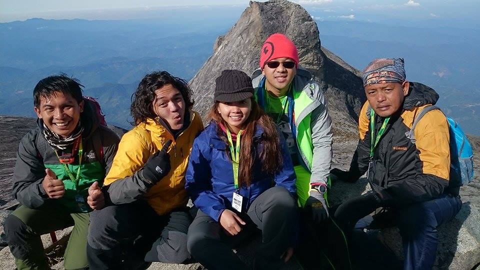
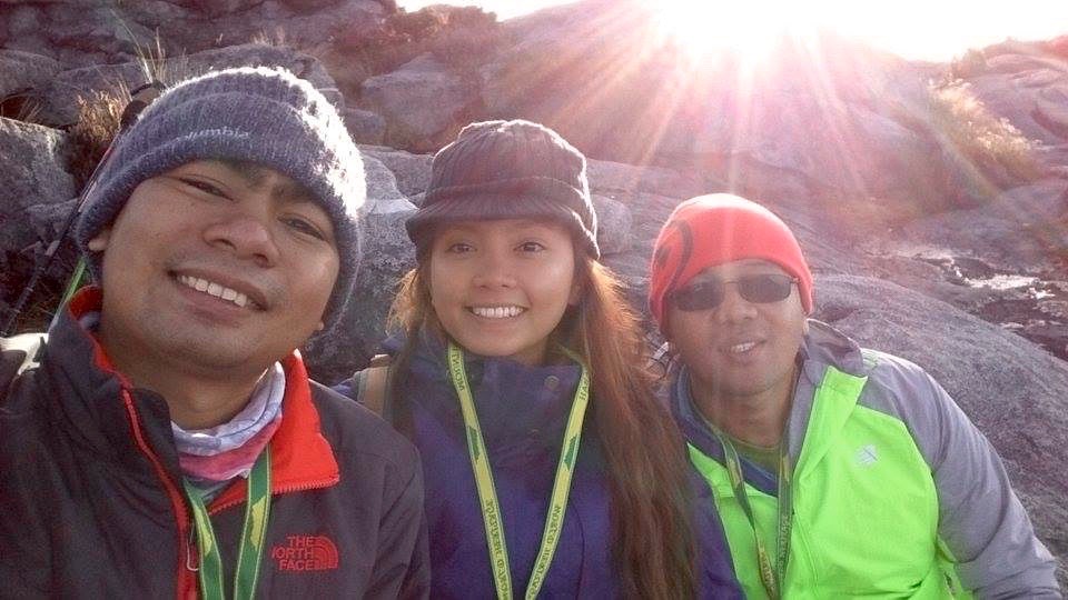
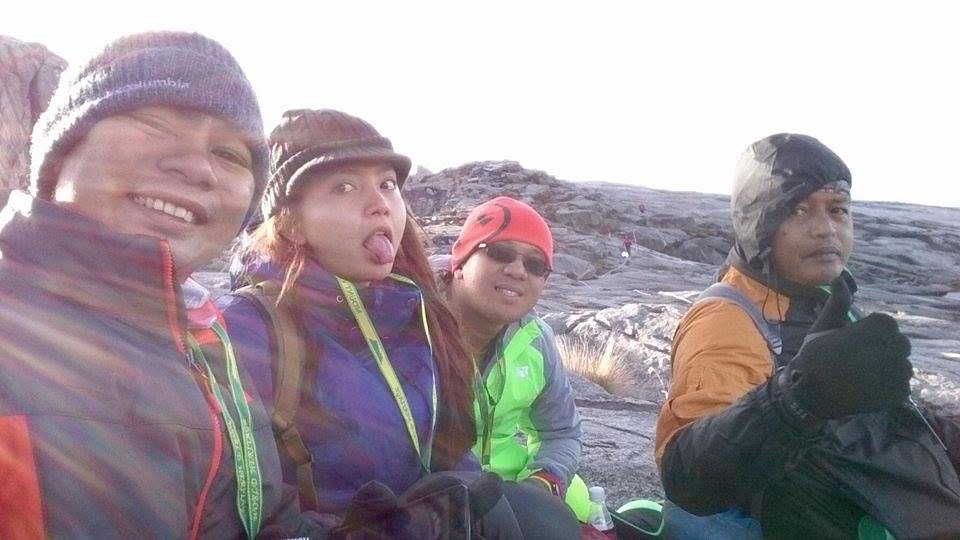
With Ryan and Coby of Trail Adventures and Cheena and her dad, Sir Boyet.
Since we were the first to come up, we spent so much time at the summit. It also helped that we waited for people to clear up so we didn’t have to rush our time at the Summit. After a while, our group went down with me forgetting that Inja was planning a birthday surprise for his boyfriend at the Summit. Since I descended so fast, I missed that surprise but did hear the greetings from below.

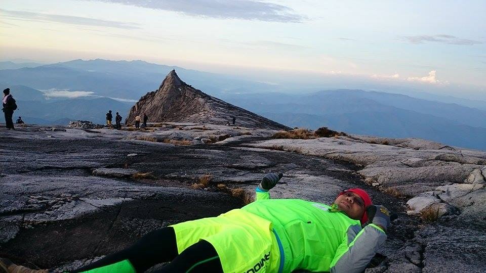
Who says you can only do this at the beach?
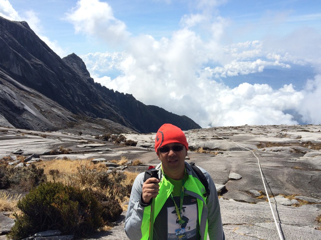
We chilled at the granite structures below the summit. The good part was that it was already warm and we took out our other layers of clothing. Surprisingly, it felt comfortable lying on the granite structure. We took our time going down the summit to enjoy the views.
On our way back
It was a long walk along the granite structures. It was easier than climbing it but it also tough on the knees too. It was good that we had our trekking pole with us to cushion each foot landing. We stayed at the checkpoint a bit to rest before we resumed our descent.
Rappelling down
Upon seeing the rappel part this time. It felt shorter compared to when we were climbing it at the dark of dawn. We descended here fast and proceeded to the usual trail, which was tough on the knees and the quad. After a while, we’re now back to Laban Rata.
Laban Rata to Timpohan Gate
Paced with Inja and Francis’ group going down.
We fixed our stuff and ate our lunch and our group (Cheena, Sir Boyet, Inja, Francis, Alvin and Me) left Laban Rata at 3 pm. Since we were trying to cut time, we decided to use porters going down. The porter gave us five hours to finish the trail or else we’ll have a time penalty of 50 Ringgit per hour. That was tough to navigate 6 kilometers of trail this technical in 5 hours but since we needed to motivation, we went on. The first two kilometers of the trail was really tough and ended up spending so much time here.

Villosa Pitcher Plant along the Timpohan Route
The Timpohan Route was less scenic than the Mesilau trail so it was great that we did the Mesilau trail the first day. We tried to speed up in the last 4 kilometers taking advantage of easier parts of the trail. The last two kilometers was already dark so we had to use our headlamps. We just went on and on until we reached Timpohan Gate at the end of trail. About 200 meters into the gate, there is a small water falls and the trail ends on a climb. We did miss beating the 5 hours though but it was all good since we did this part as fast as we could.
Mission Accomplished.
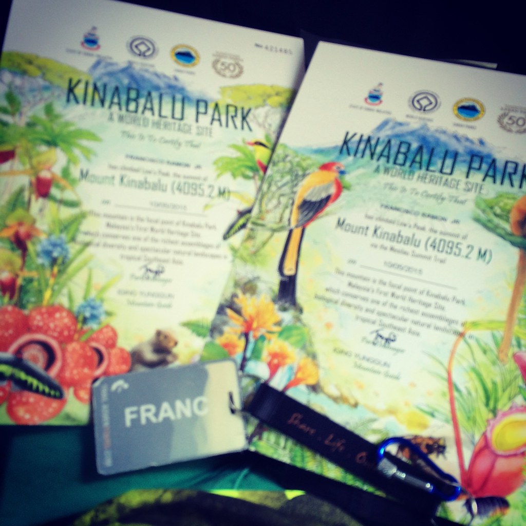
We got two certificates for reaching the summit. The other one is by passing through the tougher Mesilau trail. We spent the remaining time at our hotel in Kota Kinabalu and had some hawker food at Dawn before leaving in the morning. I have to commend trail adventours for this one as they were really flexible in their itinerary to put premium on our own trail experience. It was also nice meeting new found friends and maybe we’ll bump into each other in the next mountain. Let’s see!
Outfit of the Trail (Photo by Cheena De Guzman) Shirt – Berghaus #TaleOfTheTrail designed by breakout design, compression tights, shorts and bonnet – Under Armour, Shoes – Berghaus, GPS Watch – Suunto Ambit 2S, Jacket – New Balance, Bag – Oakley and Suunto, Socks – Vamos, Arms Sleeves – Brooks, Eyewear – Rayban with Transition Lenses, Pole – Columbia
More photos at Francramon.com Facebook Page
94 Responses to #TaleOfTheTrail Mount Kinabalu (Kota Kinabalu, Sabah, Malaysia)