

The most breathtaking sites comes from the things that keep you breathless.
“You find the most breathtaking sites on the activities that make you breathless. That’s what I found out trekking the Dragon’s Back of Hong Kong as it gave me a panoramic view of the mountains, the islands, the forest and the high-rise buildings in Hong Kong. The #TaleOfTheTrail gives you a perspective of the outdoors and the appreciation of nature in its raw beauty.”
Read about:
#TaleOfTheTrail
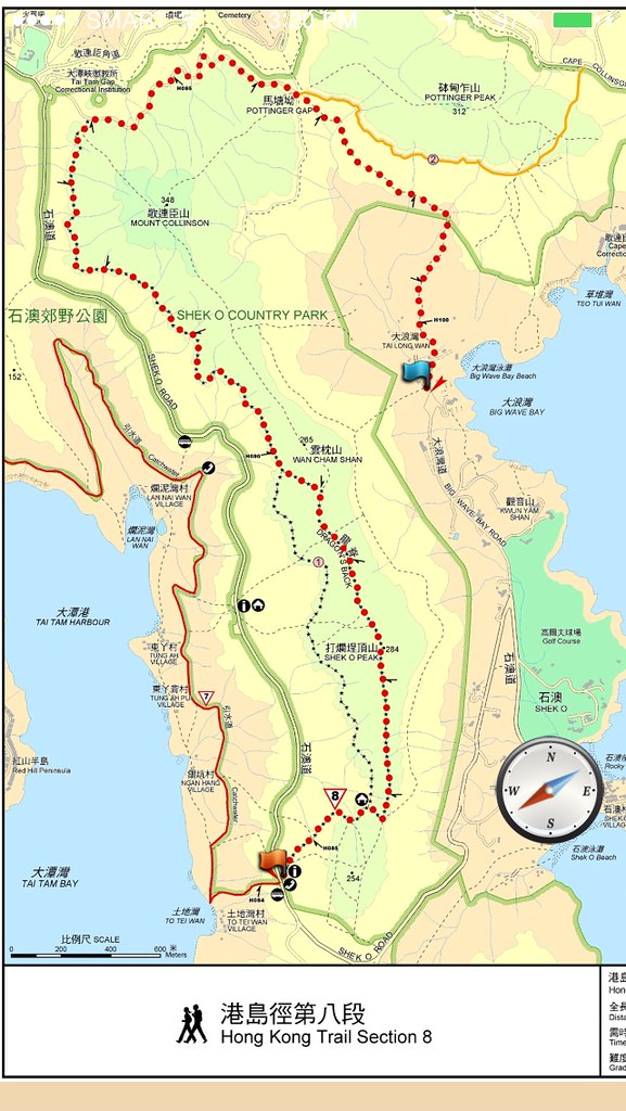
The Map of the Trail from Enjoy Hiking App.
Sometimes, you don’t realize how busy your life is until the time you finally rest up. I felt burned out from all aspects so I decided to spend some time in Hong Kong for a short 5 day breather. I’ve been looking for an activity that won’t require much financial resources yet would be something I’d enjoy. Then I started to google trails in Hong Kong and found Hong Kong’s Dragon Back, which was rated best hiking route in Asia by international magazines. Then I found the Enjoy Hiking app in apple that basically gives you a step by step guide in finding the starting point up to the full map of the trail. The thing about trails is that is that you can actually get lost in them and this being on a foreign land make it even a lot more scarier. The Enjoy Hiking app had my confidence up high that I won’t get lost in this trails plus I had my Suunto Ambit 2S that has its trackback features. Download Enjoy Hiking App which is available for itunes and Android. I hope we can also develop something similar for the Philippine trails.

Enjoy Hiking: Everything You Need to Know about Hong Kong Trails at the palm of your hands.
Getting There
The instruction of getting there was simple which starts from taking the MTR to Shau Kei Wan and take exit A3 where the buses are located. I’m coming from Tung Chung and for those who are new in the area can also download Hong Kong MTR Mobile where you can just input your trips and then it’ll give you the lines you should take. I’m coming from Tung Chung so here’s mine.
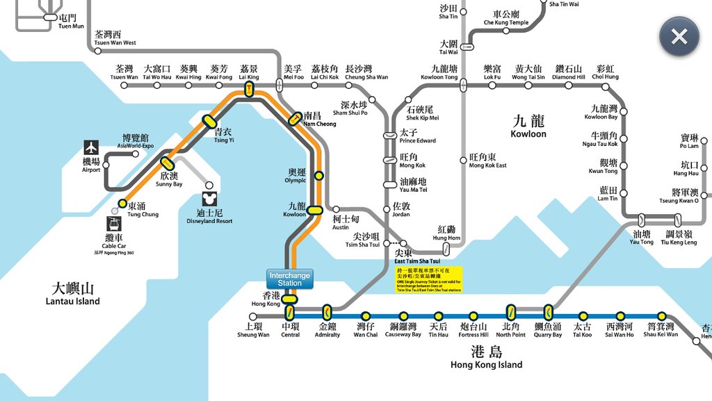
This trip takes about 57 minutes based on the MTR Mobile App
From Shau Kei Wan, exit A3, you’ll see the bus terminal station. Look for Bus 9. Bus 9 was towards the far end of the station and just so I won’t be surprised, I took at the photo of the various stops to my starting point, which is To Tei Wan in Shek O Road. The road was going uphill from this region, which gives you an idea that you are really going to a high vantage point. After ticking one stop after another, I finally reached To Tei Wan and I’m Read to Go!!!
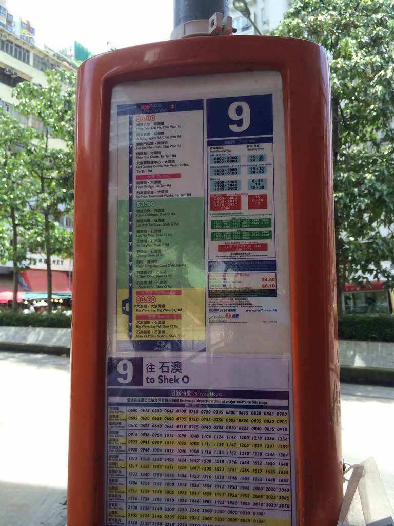
The Route of Bus 9
The Map and the Elevation
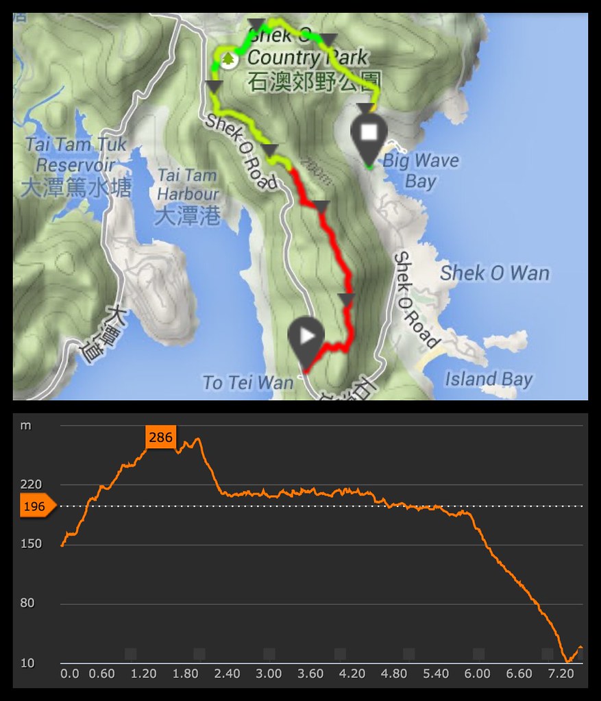
Map and Elevation powered by Suunto Movescount
The area starts at To Tei Wan and gives you about 150 meters worth of climbing in the first 2 kilometers going to Shek O Peak. The trail then descents sharply about 80 meters on the next 500 meters going to the Tai Long Wan trail. The trail moves on to a flatter terrain on the next 3 kilometers worth of Forest Trails. The surface shift to concrete over the next kilometer and another forest trail on the last kilometer while the route descends sharply 200 meters going to Big Wave Bay.
[wpbanners-show id=”10″]
Trekking the Dragon’s Back
The Trail Starts at To Tei Wan in Shek O Road
The Hong Kong Trail covers 50 kilometers worth of distance starting from Victoria Peak and ending at the Big Wave Bay in Tai Long Wan. It’s divided into 8 different segments. With last one being called the Dragon’s Back, which is about 7.5 kilometers from To Tei Wan in Shek O Road to Big Wave Bay in Tai Long Wan. I started my climb at the heat of noon, which is not the best of time to climb the area but I did load up on Gatorade and a few breads for this trail.
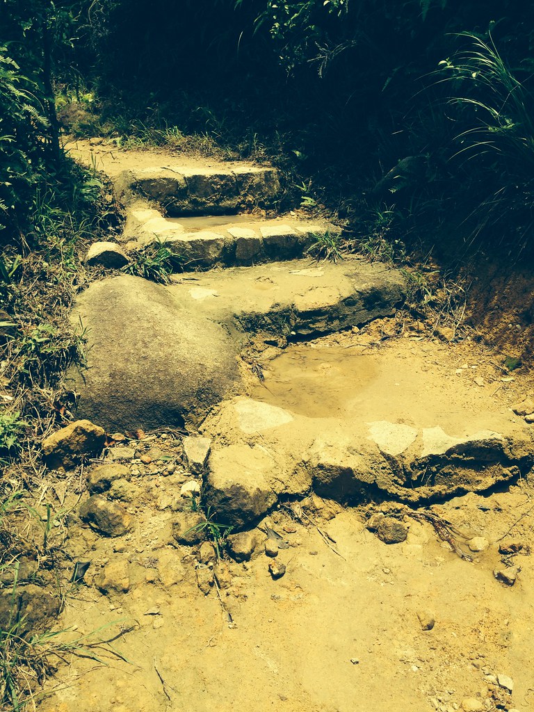
And let’s begin with stairs.
The trail starts immediately with a climb. It follows dirt paths and stairs and rocky climbs welcomes you to the trail. Midway into the first kilometer of the trail you already get to take a peak of the view which was the forested islands with the high rise establishment in the area.
Despite being urbanized, Hong Kong maintains a large percentage of their area still forested.
I really like how you can see the largely green landscape even with the numerous highrise buildings surrounding Hong Kong. This view was just a few minutes from the start of the trail.
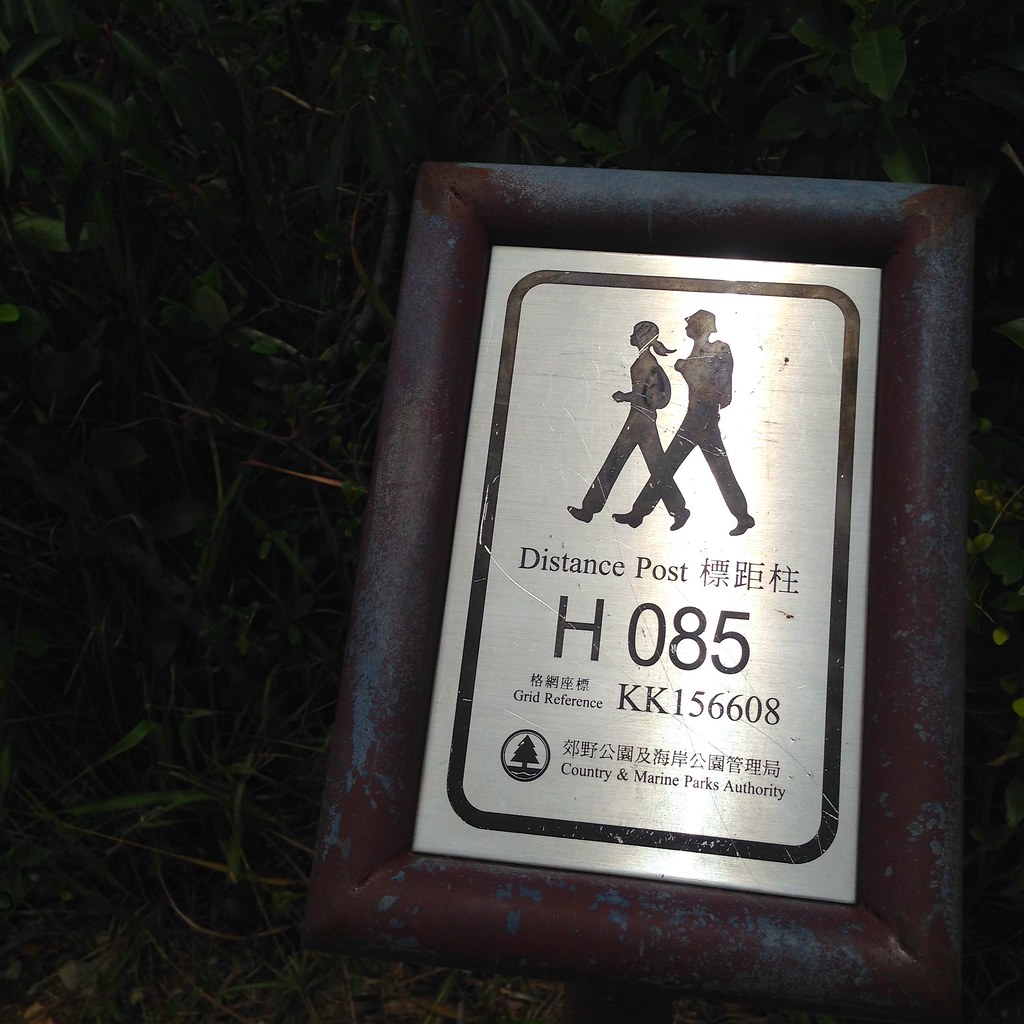
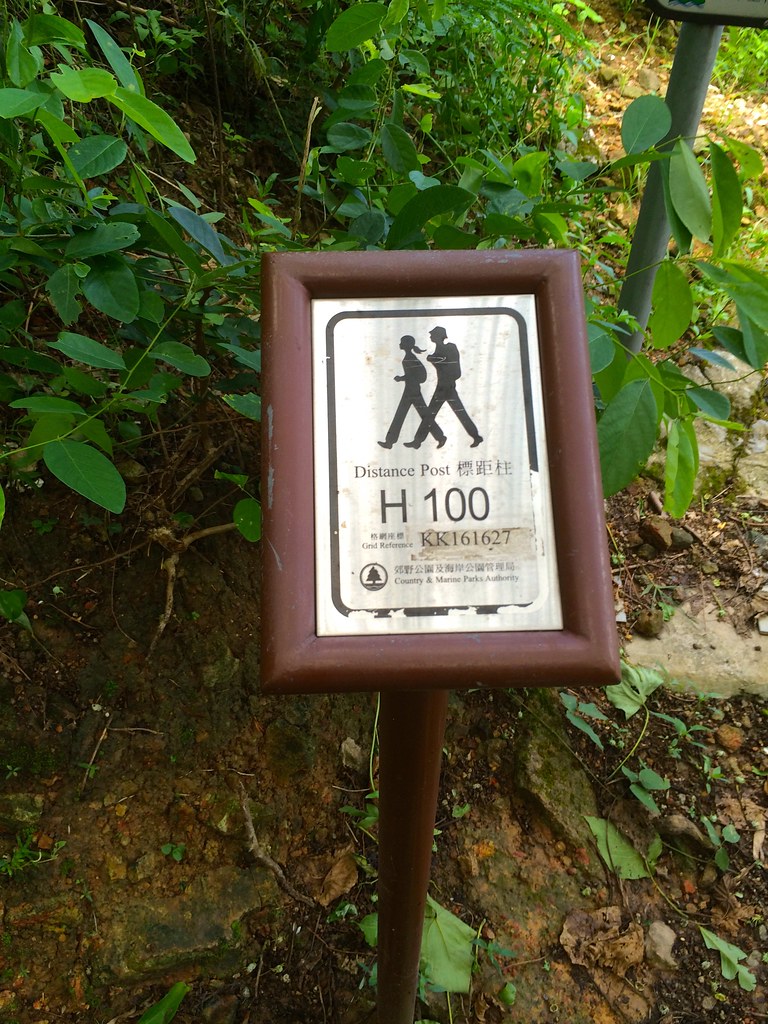
Distance markers at every 500 meters of the trail
I started before 85 and I have to reach 100 for the end of the trail. At first, I didn’t get how the distance were apart until I noticed through my Suunto Ambit 2S that it was 500 meters apart.
Weapon of Choice: BerghausThere was a storm the day before I trekked the Dragon’s Back so it was really slippery at some point. I’m glad that I was using my Berghaus which has excellent traction on any surface.
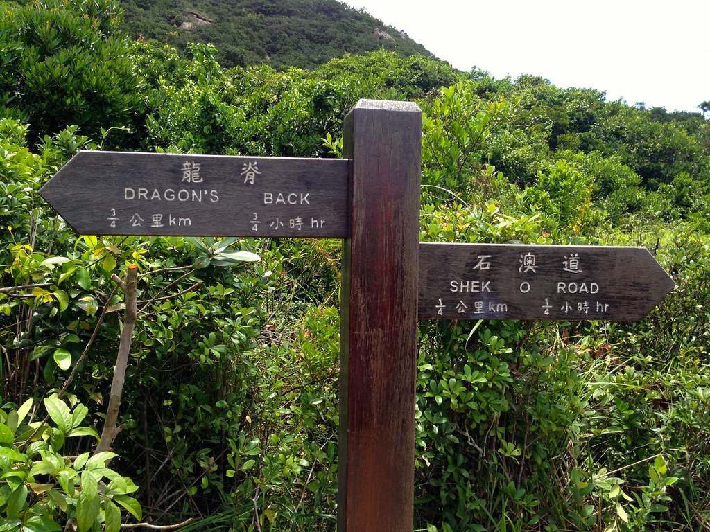
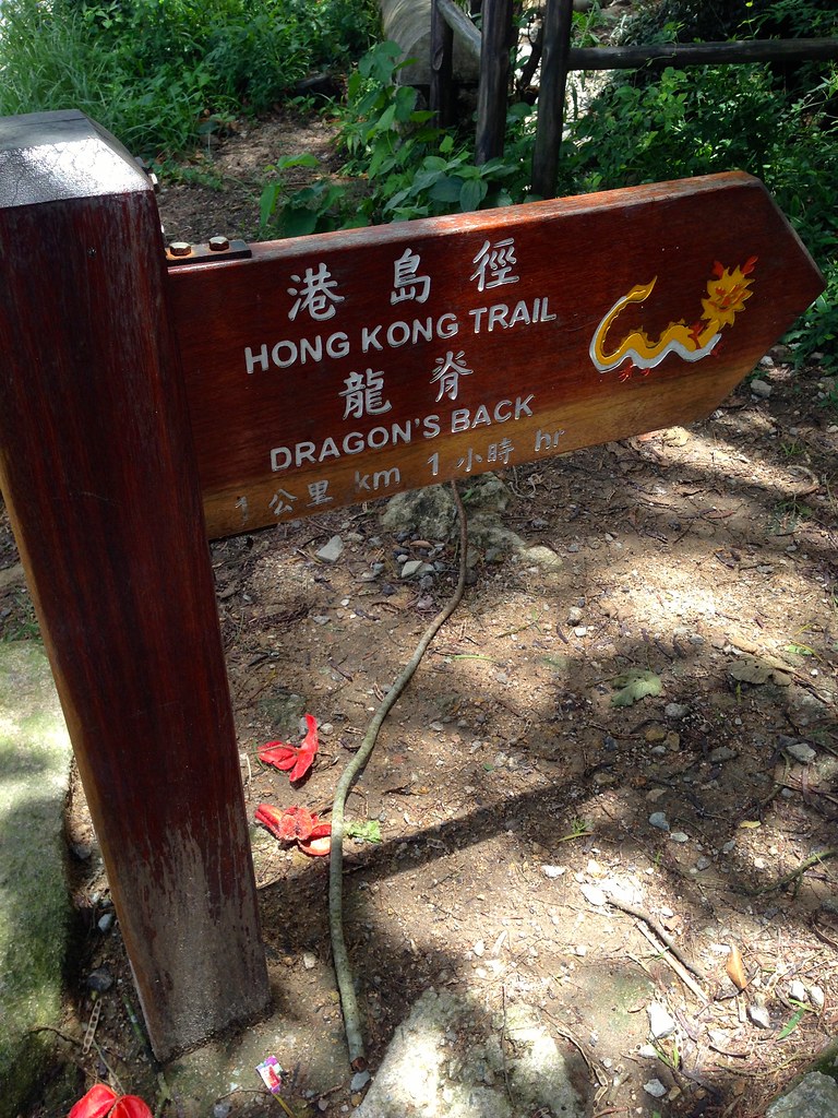
There are signs to guide you on the trail.
There are not much crossroads in the trails but in the few cross roads, there are directional signs to guide you.

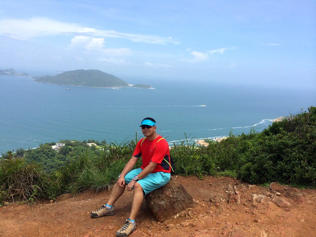
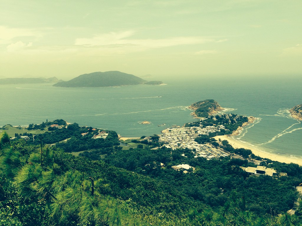
Sitting on the Dragon’s Back
About a kilometer worth of climbing and you get this view at Sheck O Peak. It does look like a tail of a dragon. This does goes on a ridgetop path from Sheck O Peak and Wan Cham Shan that look like the Dragon’s back. This leads to a really scenic lookout point. The top part of the trek was hot and had minimal shades which meant it was really hot up there but at the same time, it gave an open view of the scenic backdrop. I had to take lots of sip from my Gatorade from time to time to keep hydrated.
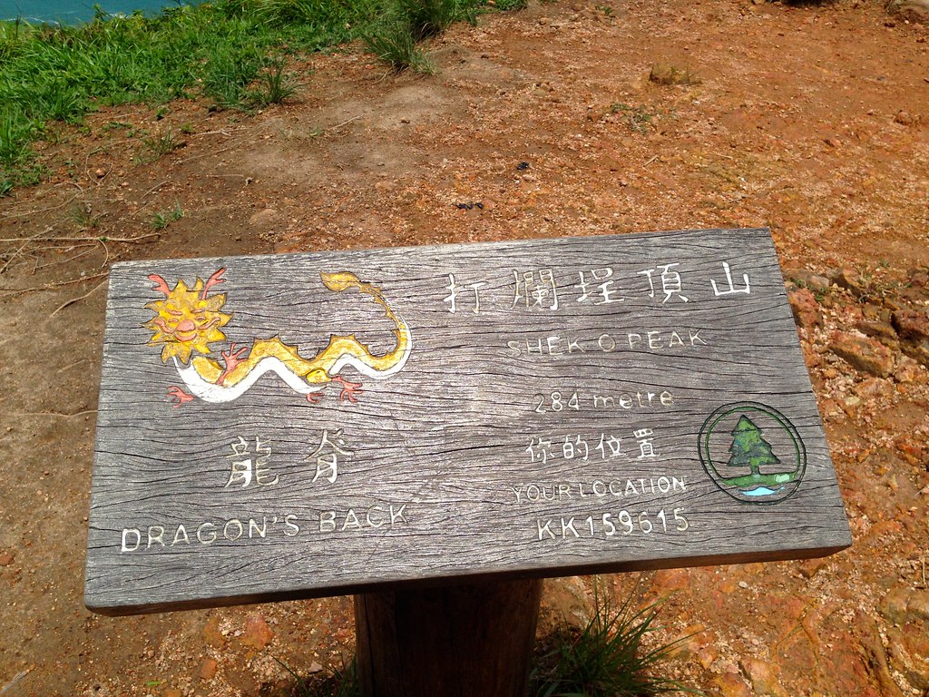
Shek O Peat at 284 meters
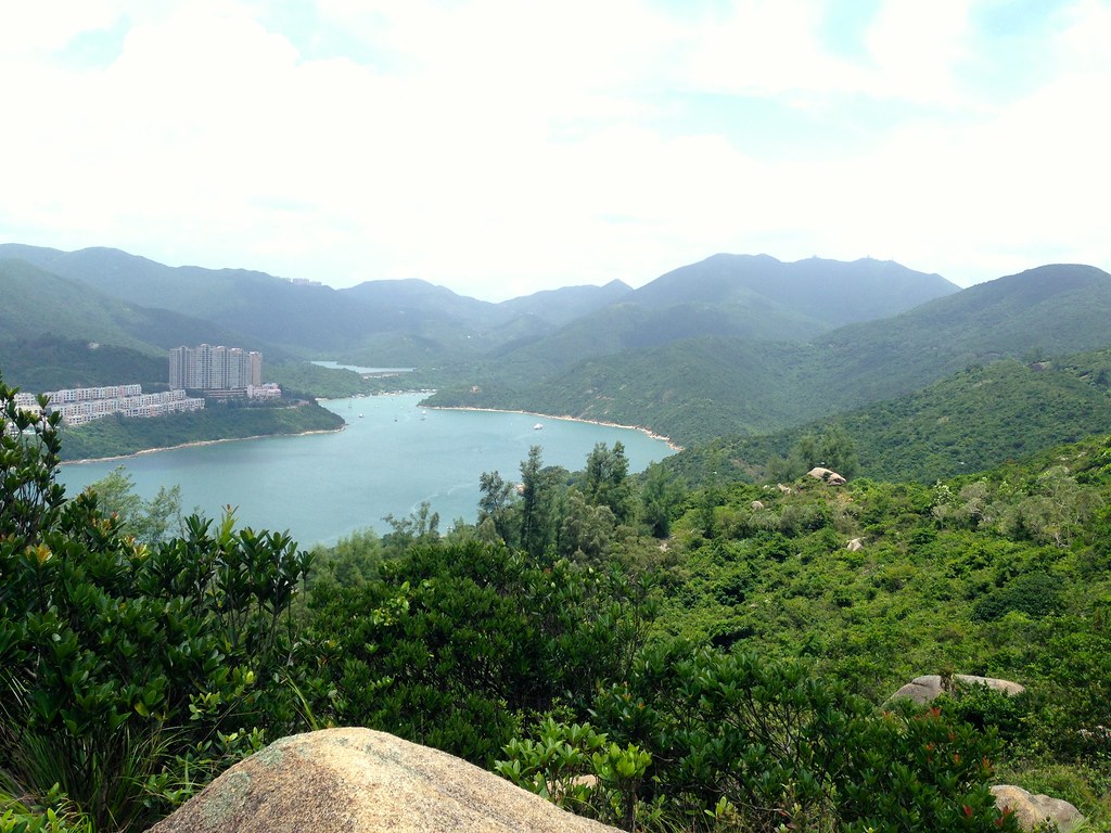
The lookout gives you an almost 360 degrees Panoramic View from east to west taking in Shek O, Shek O Peak, Tai Tam Harbour. Stanley, Redhill, Peninsula, Mount Parker, Wan Cham Shan and Mount Conllison.
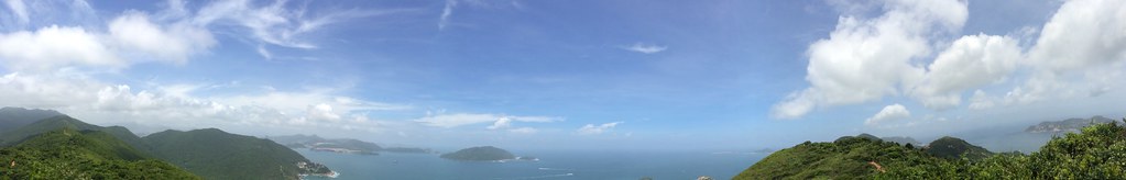
Panoramic View of the Dragon’s Back
The heat of the sun plus going on a climb can make you breathless but at this vantage point, it’s also breathtaking!!!

Nearing the summit and the view is just magnificent.
At this point, I met an elderly couple trekking the trail and they were kind enough to tell me the story of the trail from the super exclusive golf course in the area to the house of the richest persons in Hong Kong and to the spectacular beach called Big Wave Bay. This is also were I rested up while chatting with the couple and some other trekkers who joined the group for the chat.
What goes up must go down.
After 2 kilometers of trekking, it was time to go for a sharp drop in the next 500 meters. The road down ward had slippery dirt trails and a portion with uneven stair and stony tracks. After the descent, you get an option of proceeding to Shek O Road where you can take the bus back or go on the Tai Long Wan part of the trail. I went with the Tai Long Wan part as my goal is to get to see the Big Wave Bay.
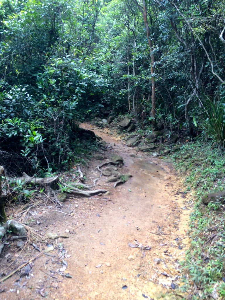
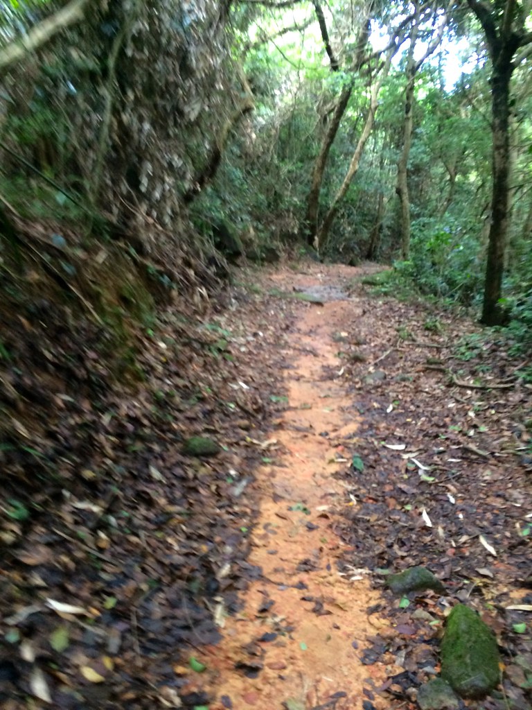
What followed was 3 kilometers worth of Forest Trail
While it was hot and open at the top. It was cool and shaded at the bottom of the trail as this part of the trail had dirt tracks surrounded by trees that gave you a feel of the rain forest. This is a 3 kilometer stretch of flats terrains that also had huge rocks and flowing streams along the stretch.
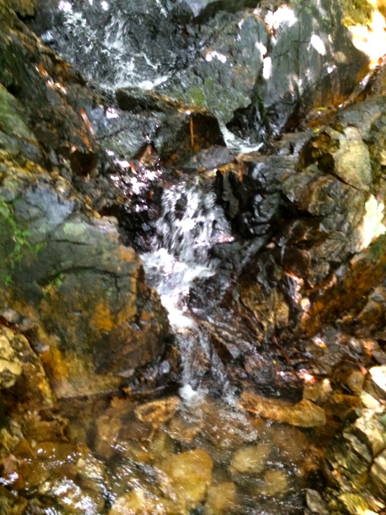
The flowing streams from the top of the mountain had clear waters.
There were several streams of water along the course and it was really clear and should be good for drinking. I used this part to freshen up by splashing water on my head. The streams also added a variety in the long forest stretch which also came with a challenging rocky surface and uneven terrain.
After the long stretch of forest trails comes about a kilometer of concrete.The Mount Collinson area of the trail was the start of the descent and had a concrete surface. Since this is a road and it goes on downwards, you can run this stretch with ease or you can still go on with a leisurely walk as you still get a view of the bottom of the forest trails and the streams.
The view from Mt. Collinson stretch.
While you get to appreciate the panoramic view from the top, you get to appreciate the mountain-view from this stretch. This is also the part that I started to eat my bread and reloaded again with Gatorade. I did have a problem when the concrete road ended since there were several dogs in the way in the short road heading back to the trails and they were really watching me so I thought that I would just go back the trail and exit at Shek O Road after 3 kilometers. Fortunately, a local came and went on to shoo away the dogs and I was back on the trail.
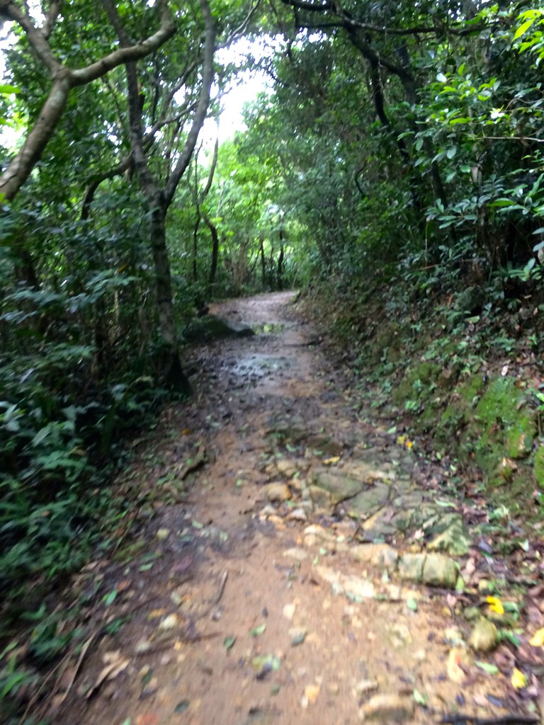
I was back on the trail and ready to wrap things up.
This was more than a kilometer stretch worth of forest trail and was similar to the previous forest trail with dirt tracks, rocky surfaces, streams and trees. The difference was that this was a steep descent and since it was wet from the rain the day before, there were some slippery stretches here. I passed marker 98 and 99, which means I’m nearing the end of the trail which would have the 100 marker.
And here’s the end of the trail.
The 100 marker meant the end of the trail and if you started from the first segment of the Hong Kong Trail that’s kilometer 50 but since I started at marker 85, this was my 7.5 kilometer mark. The end led to a stretch of houses, restaurants and lodging for the Big Wave Bay.

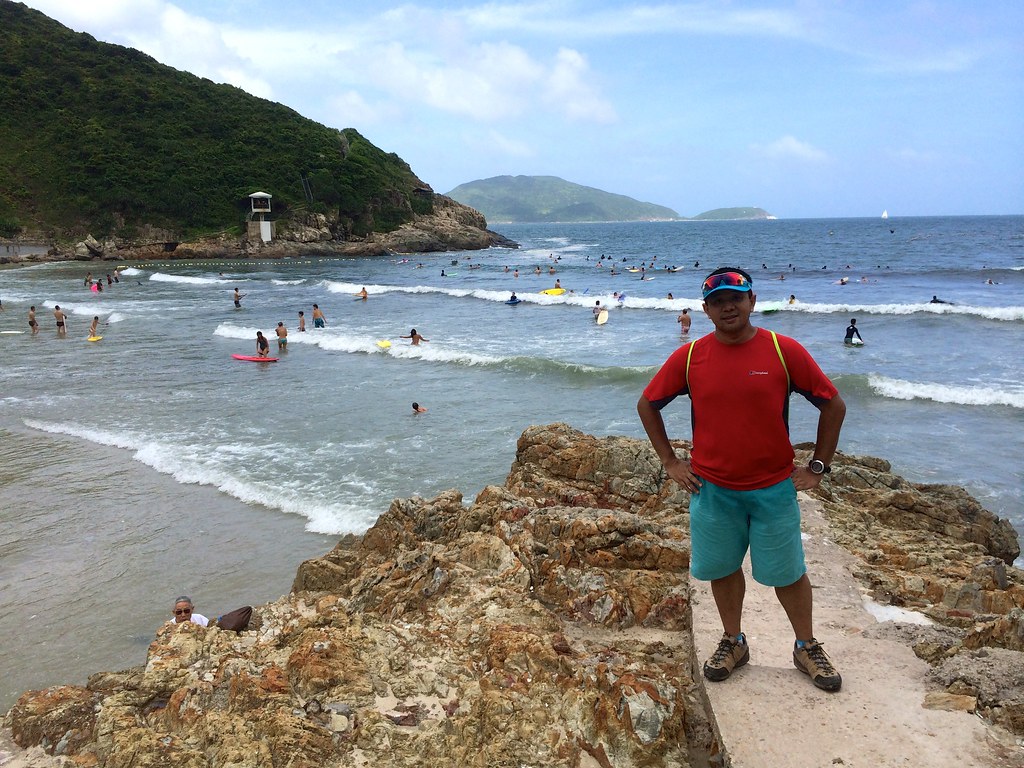
This was my finish line – Bog Wave Bay
A few more walk, you’ll be headed into the beach front of Big Wave Bay, which is a haven for surfers. The Beach had fine white sands that’s perfect for those who love to enjoy the Beach. There were rock formations at the side of the beach, which was an added attraction to the beach.
It took me 2:30 minutes to navigate the trail at an easy pace
I ate the remaining bread I had and the second bottle of Gatorade to wrap up the trail. I then went to the bus stop at the top of Big Way Beach and instead of going to Shek O Road to take the bus. I took the Bus 9 that passed by Big Wave Bay, which had me ending up in the terminal station of Shek O Road. I mentioned to the driver that I was headed to the MTR and he said that I could just take the same bus and with that I can say I survived this one without getting lost. A proud moment for me.
And here’s another look of Dragon’s Back
I hope you enjoyed the #TaleOfTheTrail and I hope that this would be a common fixture in my blog especially as I drill down too in the various trails in the Philippines. I also highly recommend Jazz Runner Rene Villarta’s Site as he has chronicled some of the Philippine’s finest trails. I really like to promote how trails can be for anybody and they could give them a better appreciation and awareness of nature and its beauty.
See you all on the trails.
More photos here: Dragon’s Back Hong Kong
191 Responses to #TaleOfTheTrail Dragons Back (Hong Kong)