

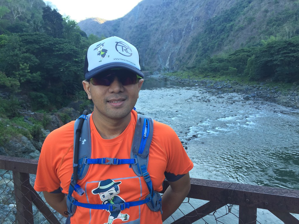
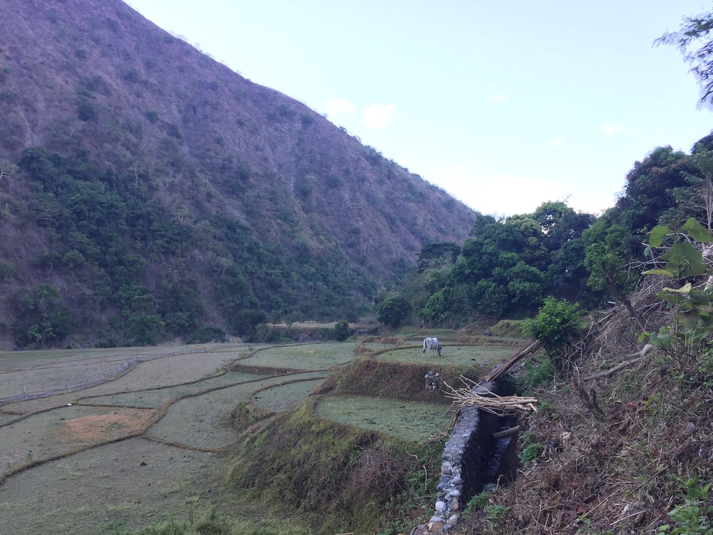
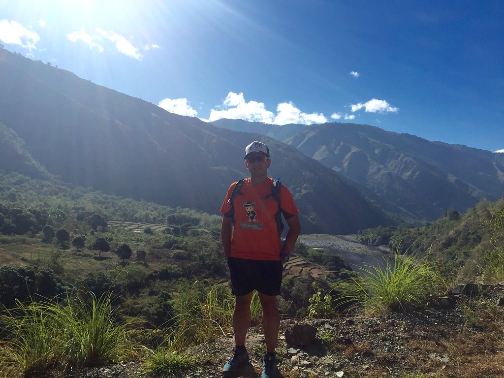
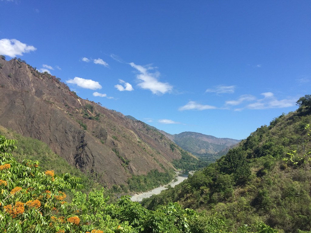
Approaching the Agno River
Dalupirip is the starting point of the Cordillera Mountain Ultra both for the 21K and 50K categories on June 5, 2016. The Dalupirip – Bantik stretch is a rolling course for most parts and ends with a vertical kilometer heading to Bantik. The beauty of the route is it goes you a view of the nearby mountain ranges and the Agno River. #TaleOfTheTrail
Read About:
- Climbing the 12 Peaks of Mt. Batulao
- Cordillera Mountain Run
- #TaleOfTheTrail Dragons Back (Hong Kong)
- #TaleOfTheTrail Camp John Hay Trails (Baguio City)
- #TaleOfTheTrail Mount Talamitam (Nasugbu, Batangas)
- #TaleOfTheTrail Mount Cabuyao (Tuba, Benguet)
- #TaleOfTheTrail Maysawa Trail (Tanay, Rizal)
- #TaleOfTheTrail Mount Kinabalu (Kota Kinabalu, Sabah, Malaysia)
- #TaleOfTheTail Mount Marami (Maragondon, Cavite)
- #TaleOfTheTrail Lantau Peak (Lantau Island, Hong Kong)
- #TaleOfTheTrail Lion Rock (New Territories, Hong Kong)
- #TaleOfTheTrail Ampucao – Sta Fe Trails (Ampucao, Itogon, Benguet)
- #TaleOfThe Trail Casile/ Bajo River / PG / Pintong Bukawe (San Mateo, Rizal)
- #TaleOfTheTrail Mount Makiling (Los Banos, Laguna)
- #TaleOfTheTrail Sierra Madre Trails (Tanay, Rizal)
- #TaleOfTheTrail Mount Kalugong and Mount Yangbo (La Trinidad, Benguet)
- #TaleOfTheTrail Ambuklao Dam (Ambuklao, Bokod, Benguet)
- #TaleOfTheTrail Camp Sinai, Pintong Bukawe, Casile, Inigan (San Mateo, Rizal)
- #TaleOfTheTrail Wawa Inigan Casile (San Mateo, Rizal)
#TaleOfTheTrail
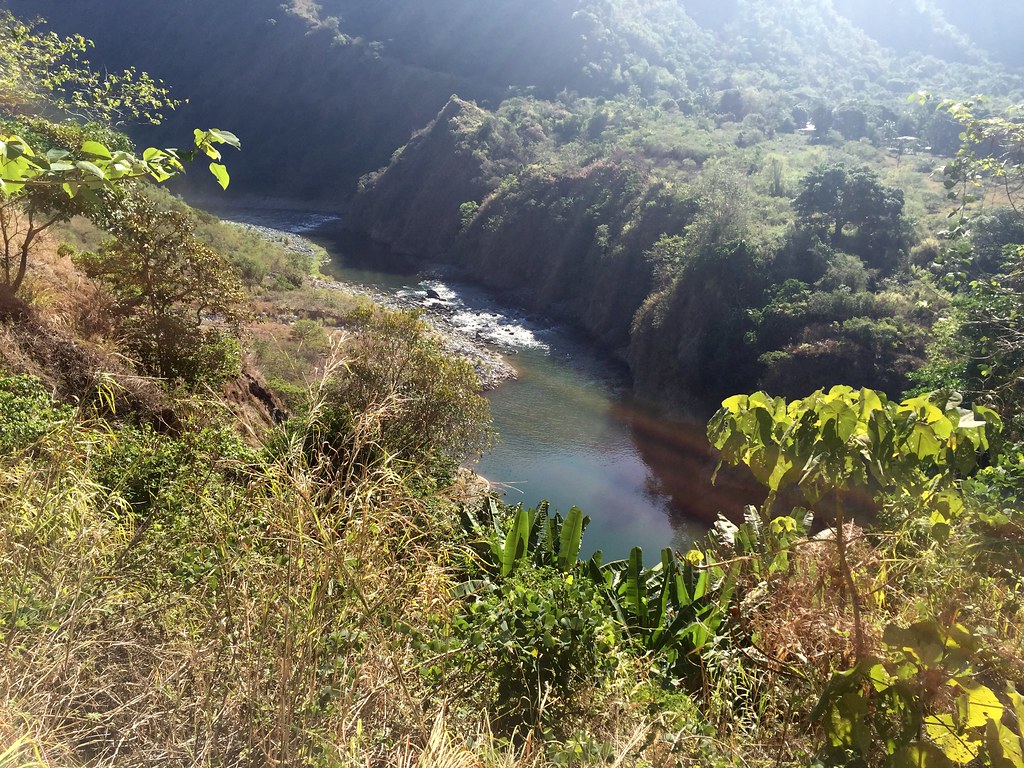
Agno River
Last year, I joined the 11K Cordillera Mountain Run. It was one of the most scenic trails I’ve joined since it was at Mount Pulag. They had a new venue this year, which was at Dalupirip, Itogon, Benguet. I’ll be joining the 21K category come June 5, 2015 so I did a recon of the place last week. The beauty of the trail was that it had the nearby mountain range and the Agno river as your scenic backdrop. The Cordillera Mountain Ultra is happening on June 5, 2016 and you can still register until May 20, 2016. Click the icon below for more details.
 Map and Elevation
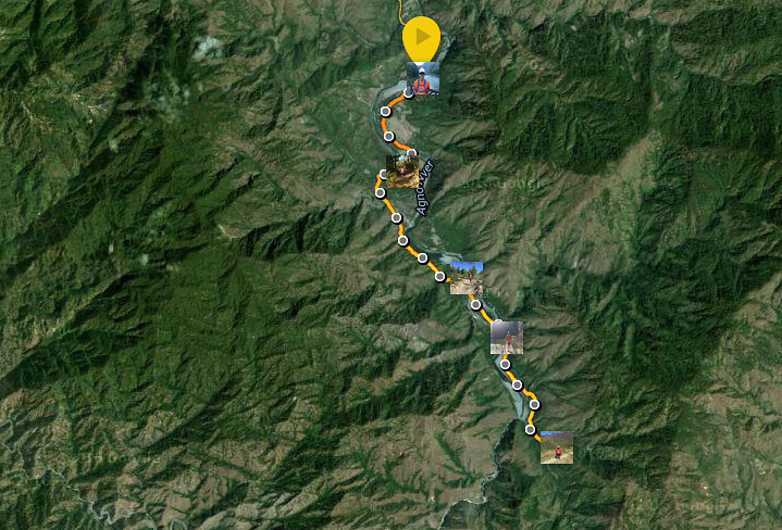
Map Powered by Suunto Ambit 3 Sports.
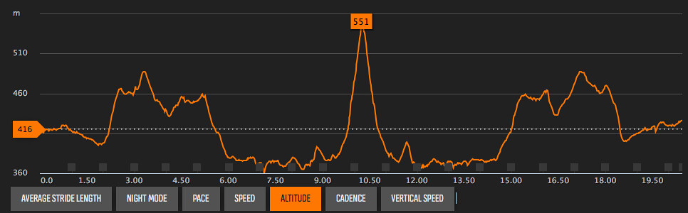
Elevation profile powered by Suunto Ambit 3 Sports.
The route starts at Dalupirip and goes straight to the hanging bridge to the other side of the Agno River in the first 2 kilometers. It then goes on a steep climb on the next two kilometers. The route goes rolling of the next 2 kilometers before the descent to the rivers at kilometer 6. You then traverse by the side of the river for the next 1.5 kilometers before crossing another hanging bridge. It then goes on a slow ascent over the next two kilometers before you get the steep vertical kilometer heading to Bantik for the u-turn slot.
Getting There
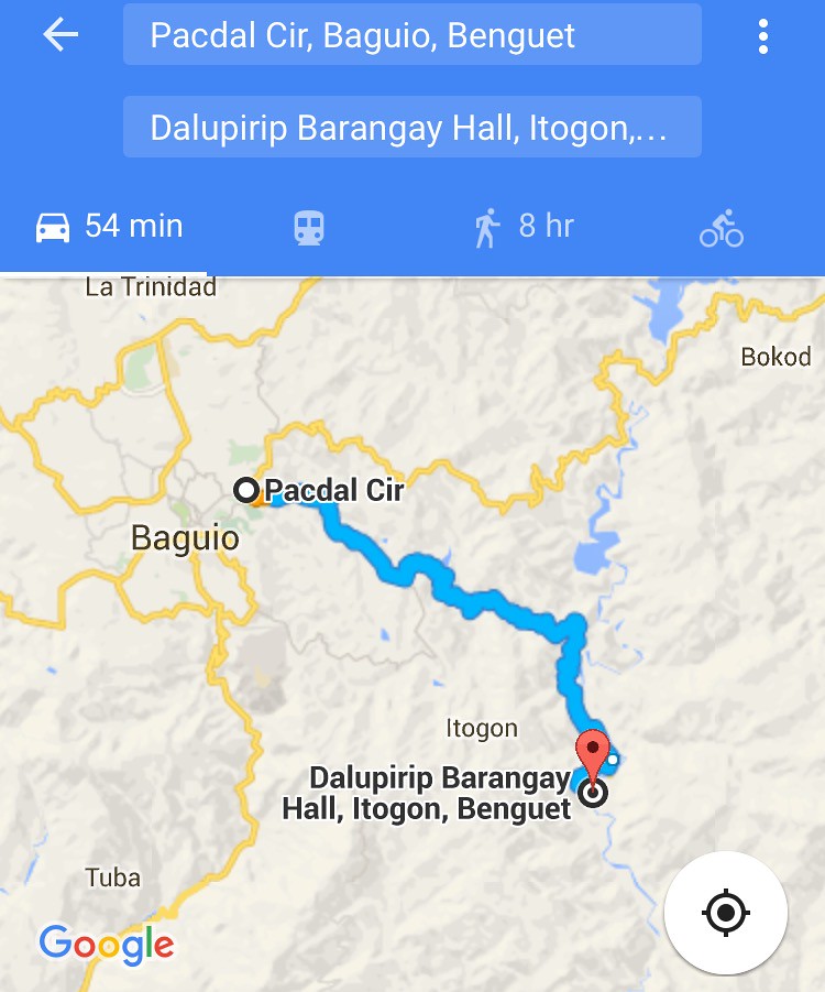
You can simply search via Google Maps or Waze, Dalupirip Barangay Hall (Google Map Link).
From Pacdal Circle, take Baguio – Bua – Itogon Road then Tinongdan Road and finally, Dalupirip Road. Total Route is about 28 kilometers from Pacdal Circle.
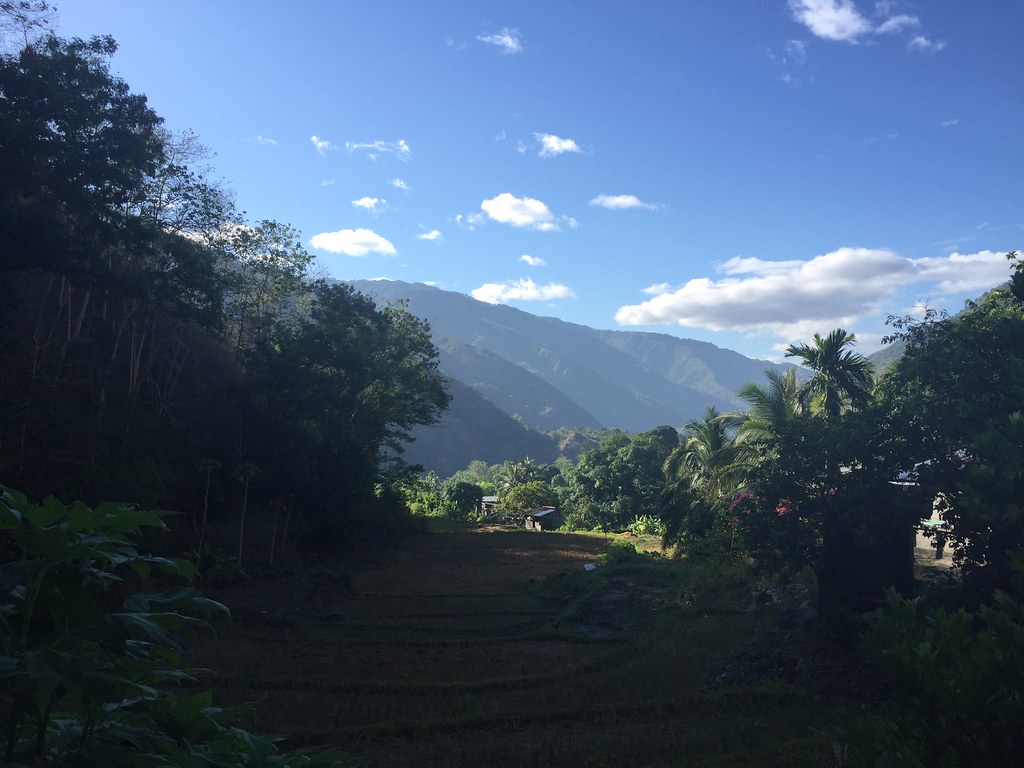
Trekking Dalupirip Trail
Starting the Trail
We left Baguio around 5:30 am and arrived at Dalupirip around 6:30 am. The Dalupirip road ends before a small bridge which can only accommodate human traffic or motorcycles. We started our trail by the bridge and followed the road heading to the Agno River. It was about two kilometers from the road to the first hanging bridge. It was already a hot morning since the area lies on a lower region.
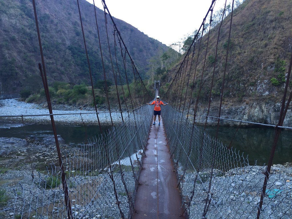
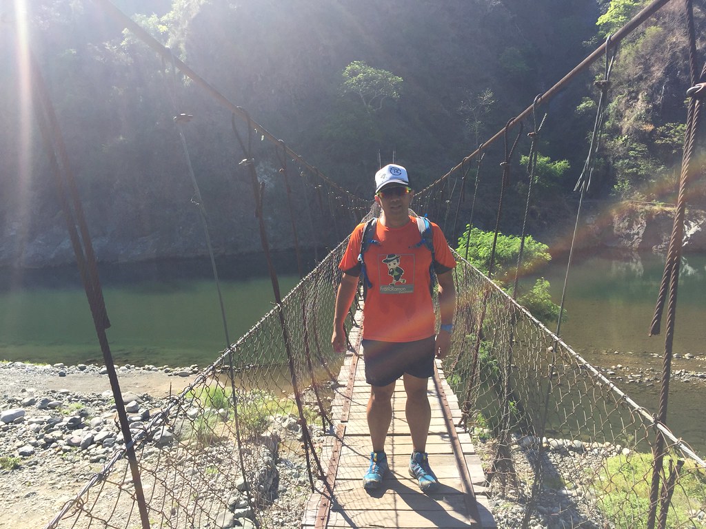
Hanging Bridge.
The hanging bridge led us to the other side of the Agno River. It had a mix of single track paved roads and trails. The area was a mix of residential and farmlands and it was the start of the climb. It’s about a 100 meter climb over the next 2 kilometers but since it was on paved grounds, it was faster to move in the area.
It was a mix of residential and farmlands.
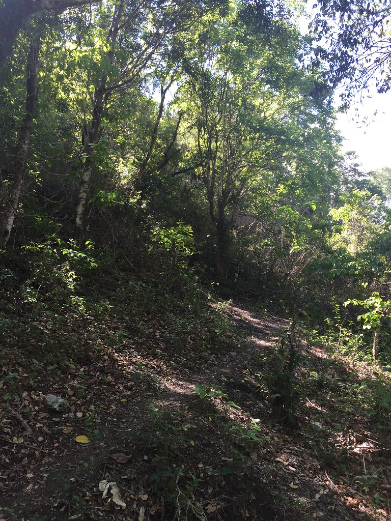
The first part of the single track area was a bit shaded. The continuous accent can be a bit of challenge especially since we were still warming up. It’s run-able but I’d like to take things slow while warming up.
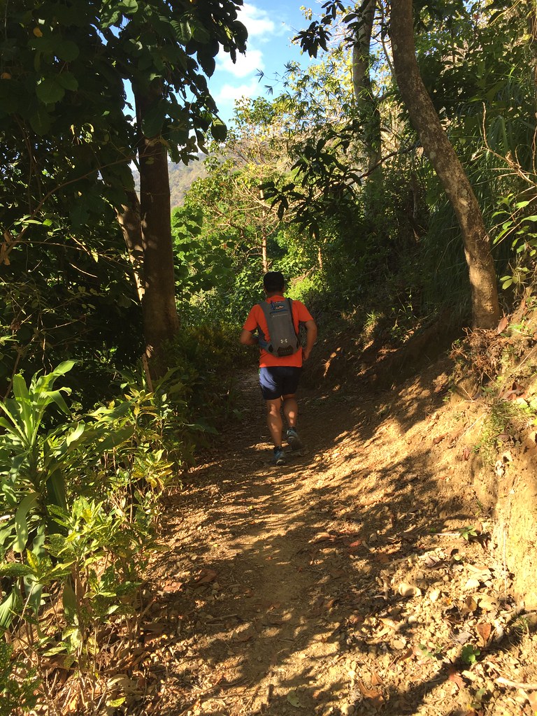
It’s a bit shaded on the single tracks.
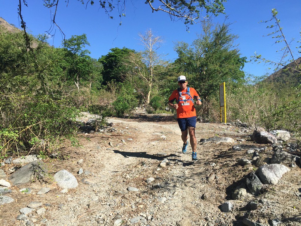
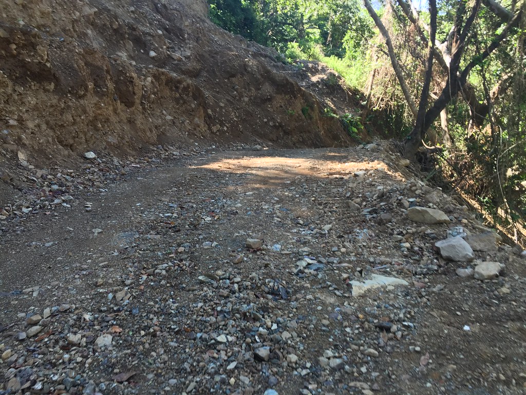
We were asking directions from the locals though it was easy to follow the trail. The single tracks then went on to be a main road after around 2 kilometers. It was a mix of paved and rough roads. It was open at this part so you’ll definitely feel the heat.
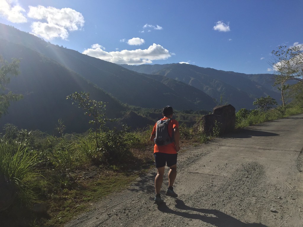
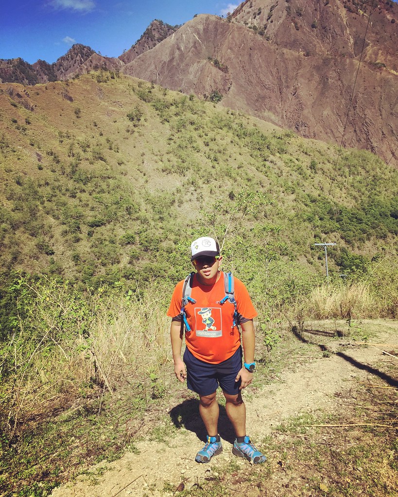
The view of the mountains.
As we shifted to the wider roads, we had the view of the mountains and the one heading to Bantik is towards the farther end of the mountain range. It was a rolling trail for the next 2 kilometers. We walked on the ascents and cruised on the descents.
It’s a run-able road/trail route.
The plan was just to do a 5 kilometer out and another 5 kilometer back. After 5 kilometers, we barely hit the trail area so we shifted to cover as much area in 2 hours then head back the next 2 hours. This area would be fun to run on race day as you can really speed up on the paved areas and the descents.
Surrounded by the mountains around you.
We just followed the road. You can really feel the hot climate at this point. Now, I know why the locals keep telling us we started so late. I was just amazed as when you look to the side you get to see the mountains and when you look down, you’ll see the Agno River.
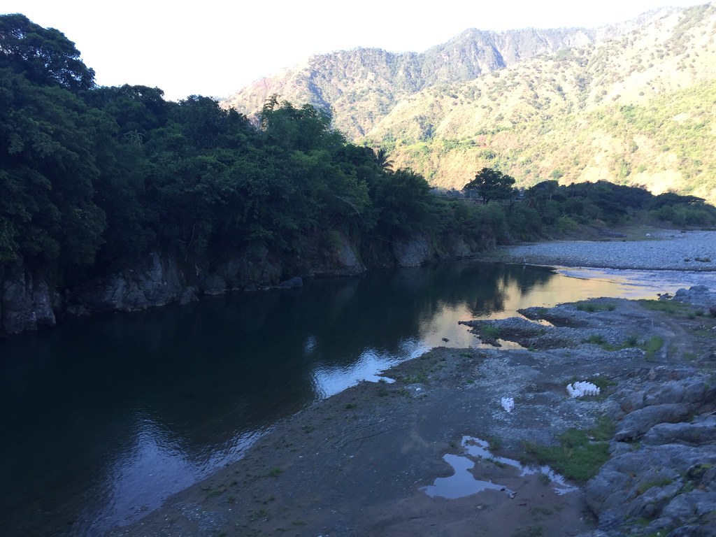
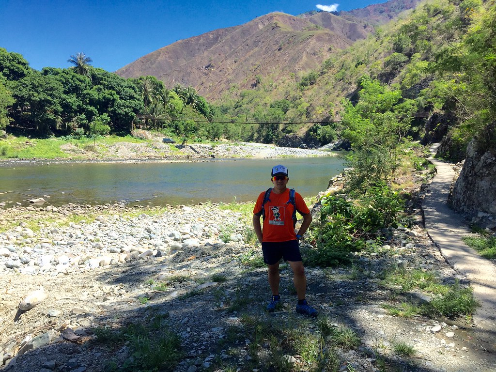
The Agno River
By the 6th kilometer, we started our descent to the river. This is a residential area so there where store just in case, you need to buy drinks or need to cool down. The mountains is on the other side so we had to pass by the river and eventually find a passageway to the other side. There were also locals who gave us directions.
Running to the River
After being on mostly concrete, it was a welcome part to be on the soft trails. It started with a mix of soft sands and stones. Being on this side, you could already see Agno river up close. We were basically moving by the strip of land by the side of the river.
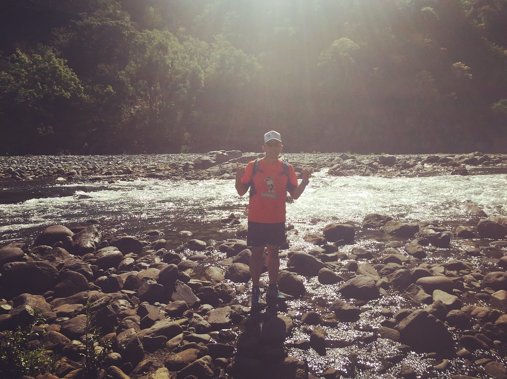
The Agno River up close.
After seeing the Agno River from the top, it was nice to see it at a lower vantage point. We followed the trail by the side of the river and led us to a wider trails with a view of the mountains and slightly above the river area. I really enjoyed running this part. Since the Bantik climb was towards the end of the mountain range, we got to pass several mountains by our side.
After around 7 and a half kilometer, we had to cross another hanging bridge towards the mountain side of the route. The first hanging bridge was walking on metal sheets and this one was a combination of metal sheets and wooden planks. The wooden planks added more stability to our steps.
Another Hanging Bridge.
After the hanging bridge, we were now running by the side of the mountain. We went ahead and got our directions from the locals. We had to follow the trail which had a mix of loose soil and rocks. The trail was rolling with mostly ascents. It was scenic being surrounded by all the mountains and the Agno river by the side.
The trails.
After about 2 kilometers of the rolling trails, we are approaching the start of the vertical kilometers. The landmark was to find a house by the side of the road. Once you see the house, look for the single track trail and proceed there instead of the road. We were a little over 2 hours in the course at this point, we decided to just try a bit of the climb before heading back.
Follow the Single Track Trail.
The single track trail was a really steep one and would really make you huff and puff on each step of the way. We went on to do it 20-30 steps at a time and would rest on the shaded part. It was a really tough climb and it was also really hot at this time of the day. Of course, the big incentive of stopping for a while to rest was the view that surrounds you.
The view from the top.
After a kilometer’s worth of climbing, we decided to head back. It was a kilometer worth of crawling and also our slowest kilometer. It’s always awesome to be at this vantage point because of the rich nature view that surrounds you. I’m sure it would even be better on race day as we go deeper in the Bantik area. For those doing the 50K, this would just be the start of a really long climb.
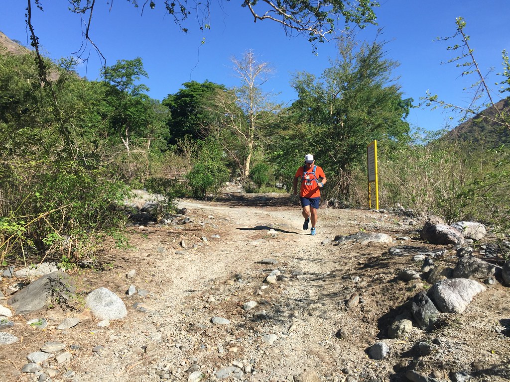
Tired!!!
Since it was a bit steep, we took our time going down the steep part. Then it was our trek back to Dalupirip area over the next two hours. We also had drinks at some of the stores before heading back. It was an exhausting test trail because of the heat and elevation but I’m sure that It’s gonna be an exciting race come June 5.
Outfit Of The Trail
- Shirt: Berghaus with #TaleOfTheTrail design by Breakout Design
- Shorts and Hydration Bag: Under Armour
- Shoes: Salomon Speed Cross
- GPS Watch: Suunto Ambit 3 Sports
- Trucker Cap: Gainz with #TaleOfTheTrail Design
- Socks: Ahon.PH
- Eyewear: Oakley Radar EV
39 Responses to #TaleOfTheTrail Dalupirip – Bantik (Itogon, Benguet)