

Camp Sinai
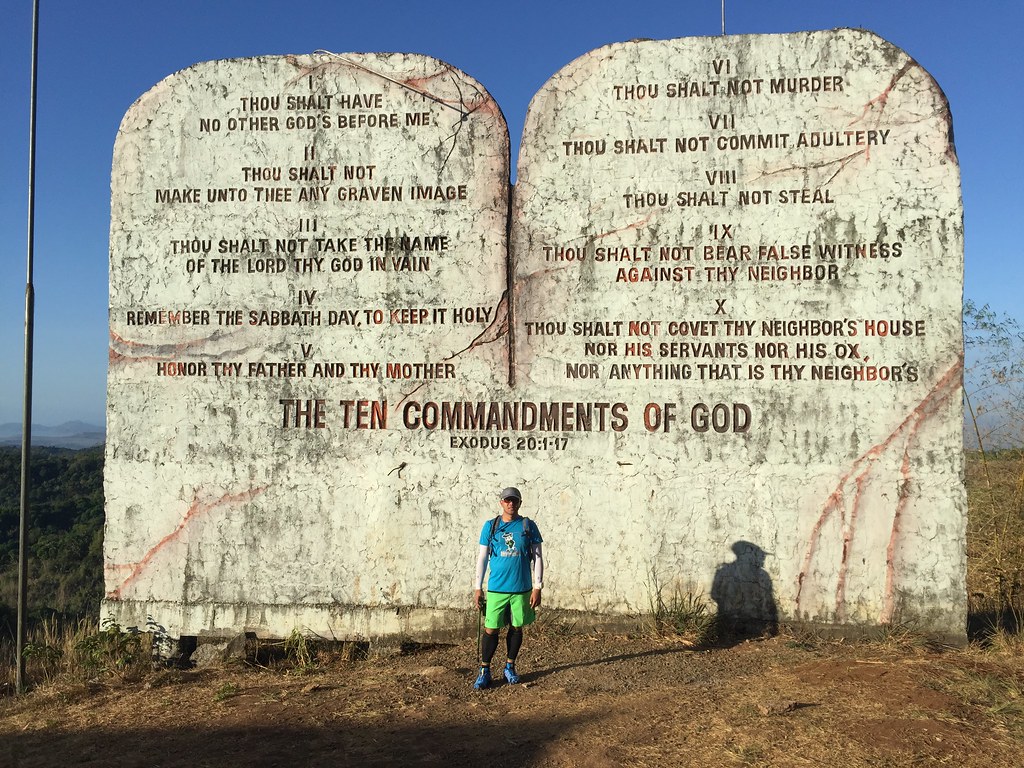
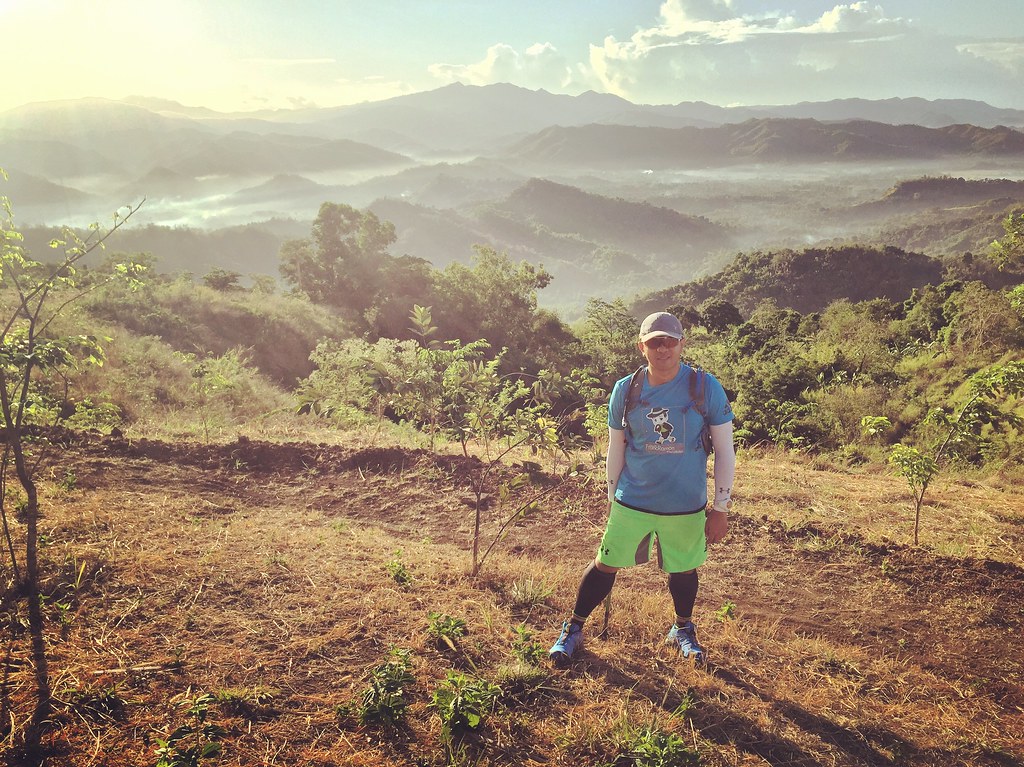
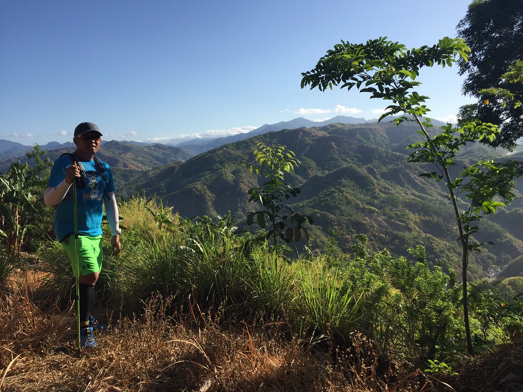
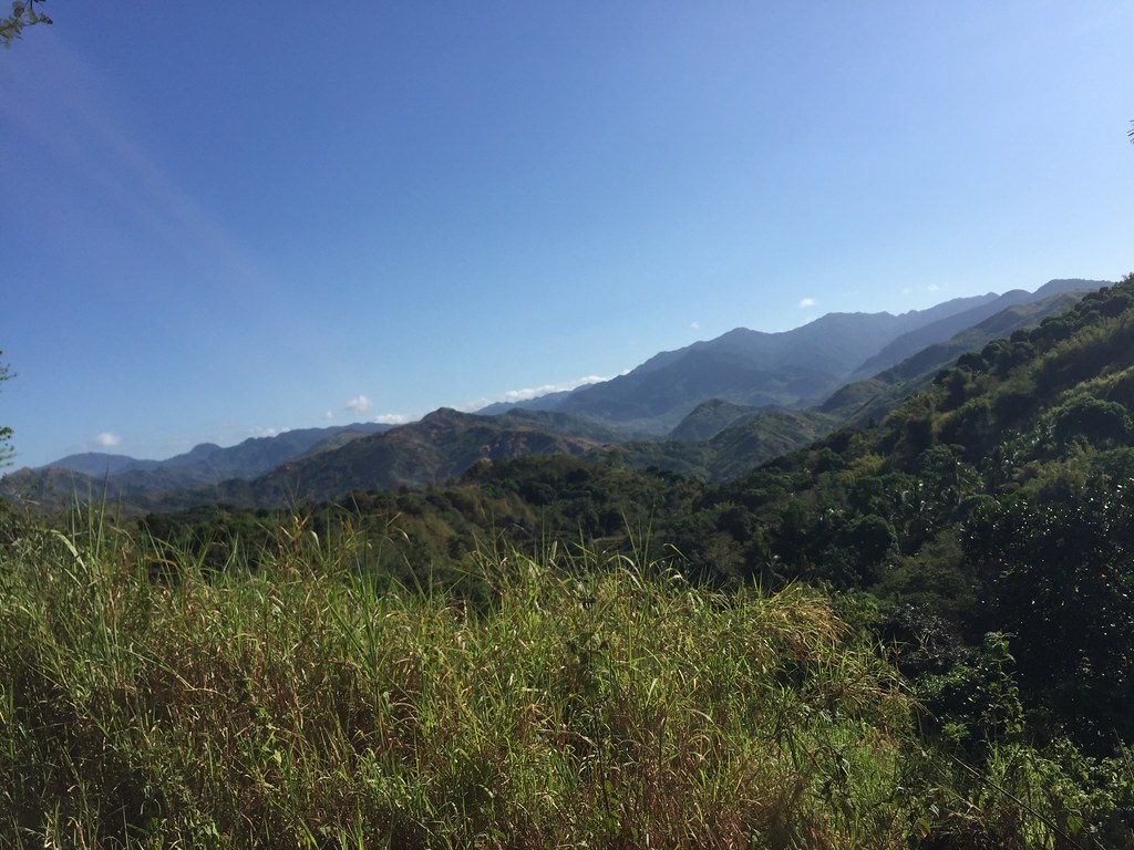
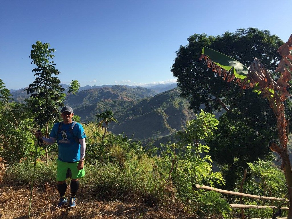
Camp Sinai has a giant tablet of the 10 commandments. Aside from that you get a majestic view of the Siera Mountain Range with the clouds and the mountains painting a beautiful picture. The fun part of this trails is that it’s run-able but do expect a really long and challenging climb on the way back.
Read About:
- Climbing the 12 Peaks of Mt. Batulao
- Cordillera Mountain Run
- Testing Out Brooks Pure Grit 4
- Brooks Run Happy 3
- #TaleOfTheTrail Dragons Back (Hong Kong)
- #TaleOfTheTrail Camp John Hay Trails (Baguio City)
- #TaleOfTheTrail Mount Talamitam (Nasugbu, Batangas)
- #TaleOfTheTrail Mount Cabuyao (Tuba, Benguet)
- #TaleOfTheTrail Maysawa Trail (Tanay, Rizal)
- #TaleOfTheTrail Mount Kinabalu (Kota Kinabalu, Sabah, Malaysia)
- #TaleOfTheTail Mount Marami (Maragondon, Cavite)
- #TaleOfTheTrail Lantau Peak (Lantau Island, Hong Kong)
- #TaleOfTheTrail Lion Rock (New Territories, Hong Kong)
- #TaleOfTheTrail Ampucao – Sta Fe Trails (Ampucao, Itogon, Benguet)
- #TaleOfThe Trail Casile/ Bajo River / PG / Pintong Bukawe (San Mateo, Rizal)
- #TaleOfTheTrail Mount Makiling (Los Banos, Laguna)
- #TaleOfTheTrail Sierra Madre Trails (Tanay, Rizal)
- #TaleOfTheTrail Mount Kalugong and Mount Yangbo (La Trinidad, Benguet)
- #TaleOfTheTrail Ambuklao Dam (Ambuklao, Bokod, Benguet)
#TaleOfTheTrail
The View from Camp Sinai
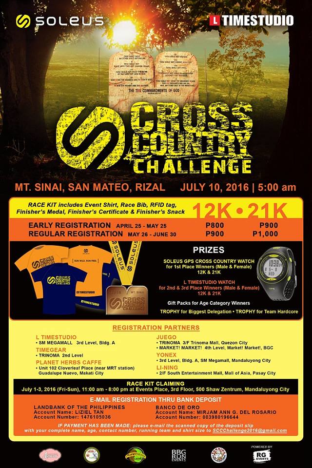
There are so many trail alternatives in San Mateo, Rizal and Camp Sinai is an excellent place to start your trail. Camp Sinai is popular for having a large tablet of the 10 Commandments like Mount Sinai in the Bible. Apart from that, they have an overlooking view of the Sierra Madre Range. It was a majestic picture as the clouds and the mountain combine for a masterpiece. Soleus would be having a Cross Country Challenge here and this is also a recon of the course. Check out the details below if you want to join Soleus Cross Country Challenge.
The Map and Elevation
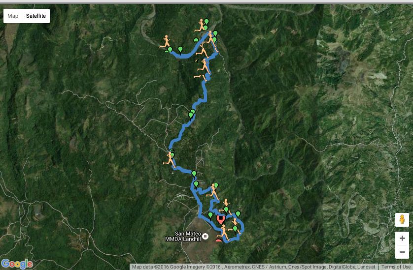
Map is powered by ASICS AG01 Run Watch
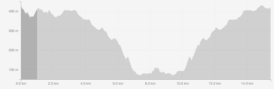
Elevation Profile is Powered by Asigs AG01 Watch and Strava
The route starts at Camp Sinai and proceeds to a rolling terrain for the next 3 kilometers before entering a brief road stretch heading to the Casile trails with a descent of about 400 meters over the next 4 kilometer stretch. There’s about another 1.5 kilometer to the u-turn slot in Inigan with two river crossings. The route goes back to Casile for the 10th kilometer. The route goes on a 4 kilometer climb the Casile trails with about 400 meters of elevation. The road has a 1 km access point back to Camp Sinai.
Trekking San Mateo, Rizal Trails
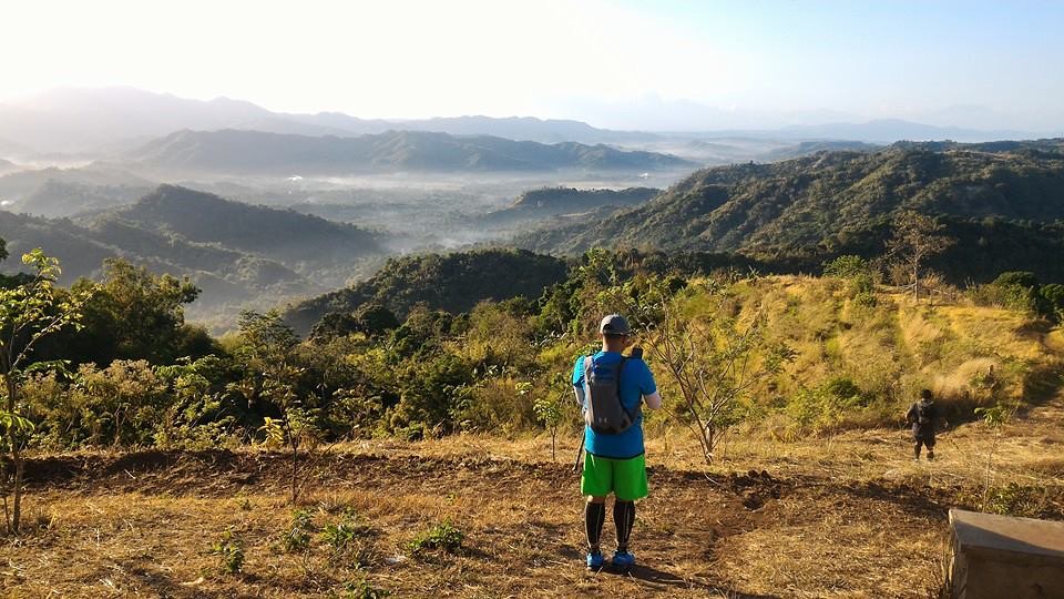
It’s a Magnificent View of the Sierra Madre Mountain Range – Photo by Del Villanueva
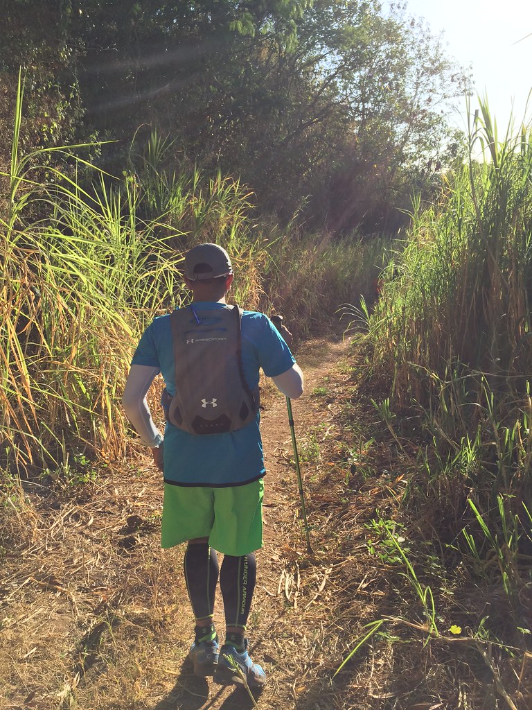
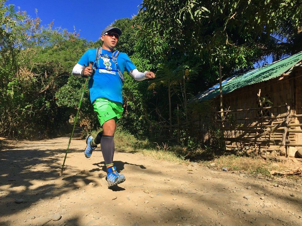
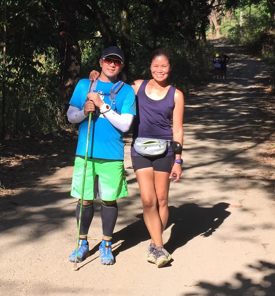
The trail started at Camp Sinai. It starts from a higher viewpoint so you’ll immediately appreciate the beauty of the surroundings. It was a hot morning and we started a bit late so this was a heat training as well. I opted to bring in a trekking pole to help me on the ascent back in the second half of the route plus I’m also training to use poles for races too.
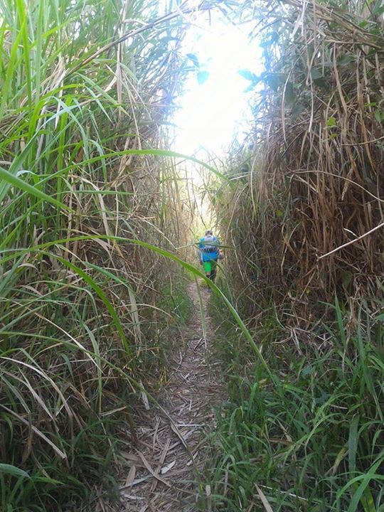
On Single Tracks – Photo by Del Villanueva.
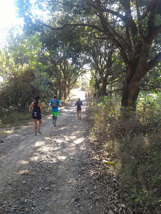
The first 3 kilometers were on single track trails that had a rolling terrain. I was expecting a much slower trail but it did turn out a lot faster than expected. The first kilometer had us descent Camp Sinai and enter the single track trails. We started at walking pace since there were several climbs already at this stretch. I positioned myself at the lead pack. On trail recons, I either go at the first part or at the middle because it’s the last runners who gets the least rest during stops.
It was a hot morning to be on the trails. – Photo by Del Villanueva
The pace of the trail shifted at the second kilometer as the lead pack went on to breeze to the descents and remain steady on the incline. We (Me and Del) followed their pace so it became a really fast-pace trail. It was also a hot morning so we might as well try to keep moving. The good part about the trail, which I know the trail runners would love is that it’s run-able. The descents can be long and the inclines are tolerable.
There was a small river around the 2 kilometer mark and it was a bit of a scene so we had pictures at this stretch as well as shooting the video above. After that stretch, we got separated from the lead pack but we went as fast as we could to catch up with the lead pack. There was a stretch that we got confused with the trail so we had to go back and ask directions. After finding our way back, we found the lead pack (Judith, Coach Roel and Jessa) waiting for us at the store for some refreshment around kilometer 3. We also waited for the rest of the pack here.
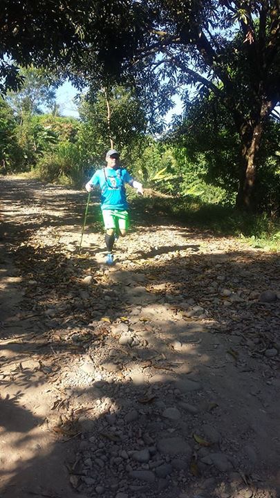
It was time to speed up. – Phot0 by Del Villanueva
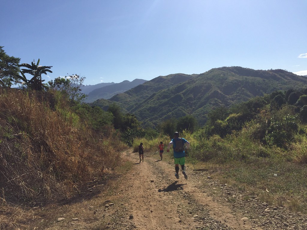
After the short rest, it was the long stretch of descent that would cover the next 4 kilometers. I joined the lead pack again and after walking the paved area, we started running when the trails resumed. It was time to speed up. It was rough roads with a lot of stones. It also helped that I had a trekking pole, which added some balance on the stony portion of the trails. It was fun to run at this pace on the trail as gravity was on our side.
Gravity was on our side on the descent – Photo by Coach Roel Amabao – Ano.
The roads was also a popular area for cyclist so from time to time, there were cyclists who would pass by on the trails. There were also trail runners preparing for the race next week. Runners would definitely enjoy this stretch and I also suggest that come race day, they should take advantage of this stretch as the second half of the race would really be a long climb.
You gotta love the scenery along the trail – Photo by Del Villanueva
Even with the fast descent, you had to really stop to appreciate the views around you. You had different vantage points of the Sierra Madre Mountain Range. That’s the beauty of trails like this even if you have to bare the heat and fatigue, you have the views to make it worth your while.
The adrenaline-rush of a fast run and the scenic delight of a great view – Photo by Del Villanueva.
We have covered the 4 kilometer descent in such a short time. The road intersected with the New Casile Road, which is included as part of the 21K distance. We took the Casile Road before the river and rested in the store to wait for the others. We also took a chance to have fresh buko juice to quench our thirst. It took some time for the others to reach the store.
The Fast Trails – Photo by Coach Roel Amabao-Ano
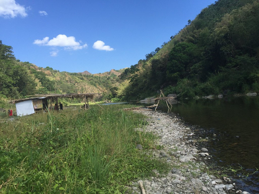
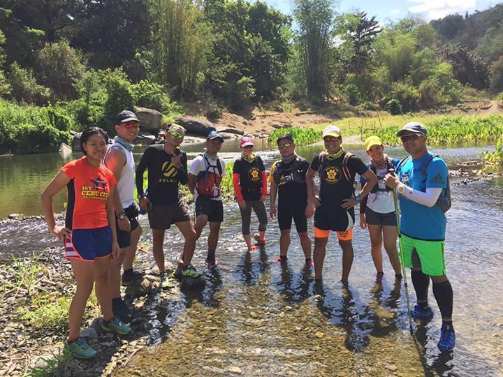
After the rest at the store, we then went to the rivers to find the u-turn slot for the 12 kilometer distance. I suggested to have the Inigan area as a u-turn slot as it’s among the most scenic part of the several river crossings we tried a week ago. There were two river crossings heading to Inigan area.
12K u-turn Slot.
After the first river, there was about a kilometer stretch of land heading to the Inigan area. It had a mix of rock, stones and sands for its surface. Expect your shoes to get messy from this stretch. It’s run-able if you want but it’s also great to take it slow to appreciate the view from the river.
The view from the River
I’ve been here a week ago but I’ll cover that in a separate Wawa – Inigan – Casile Tale Of The Trail. I like this spot because it felt like a scene from the Last Samurai movie. You had the clear rivers, You had the rich green surroundings and you had mountain ranges around you. This trail would give you both a view from the top and a view from the bottom and it’s both great.
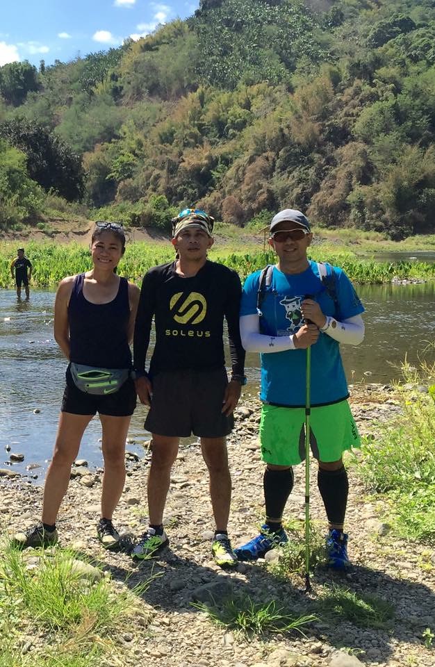
With Judith Staples of Soleus and Coach Roel.
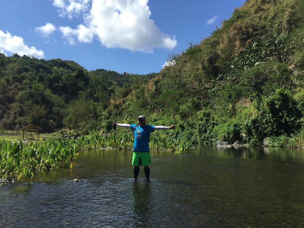
It’s a picture taking hot spot. There were also deep parts of the river where you could have a good swim, which is a perfect way to cool down on hot days like this. The 21 kilometer would have to go through 5-6 more rivers before they get to their u-turn slot.
With Team Soleus – Photo bu Judith Staples
We then took the way back. It was a relaxing walk back to the Casile area and we had a short snack break at the store near the intersection of Casile Road and New Casile Road. It was also our way to recharge a bit as the next four kilometers would be a really climb on a very hot day.
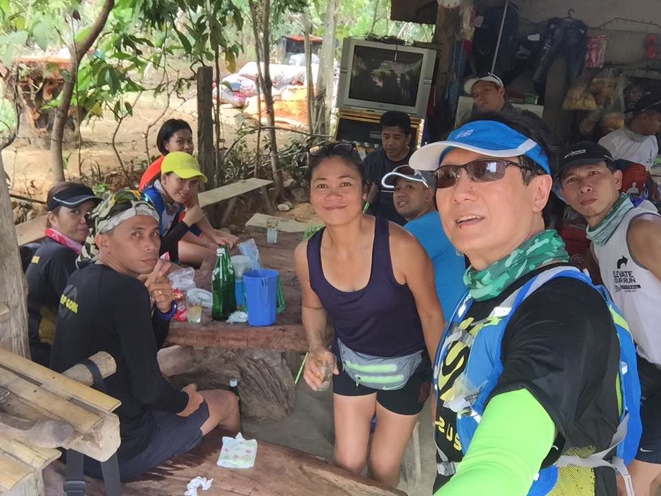
Last rest before the long run. – Photo by Kerwin Ng.
I started to condition my mind to toughen up on this stretch as it’s 4 kilometers climb on a hot weather. The plan was just to be consistent on the climb and stop if needed. The first kilometer of the climb was the hardest and mentally exhausting part of the climb. I can feel the sweat trickling down my face coming from the weather and the effort of the climb. It was a great help that I am using a trekking pole which helps me propel myself forward.
Hats off to Judith Staples, Marketing Head of Soleus, for being strong on this run.
After the first kilometer, I felt a lot tougher already. Exhausted but a lot more determined on the climb. It was a consistent effort on the climb and after each stretch I had to sip from my hydration bag so I won’t be dehydrated. I had a short water break after 3 kilometers of climbing at the store where the others were resting too. After the short rest, it was just routine getting over the last kilometer of climbing.
Different Views of Sierra Madre
We waited for the rest at the store at Pintong Bukawe and after that it was just 1 kilometer road access back to Camp Sinai. We then had lunch at BaseKamp at it was really tasty lunch after a really tough effort at the trail.
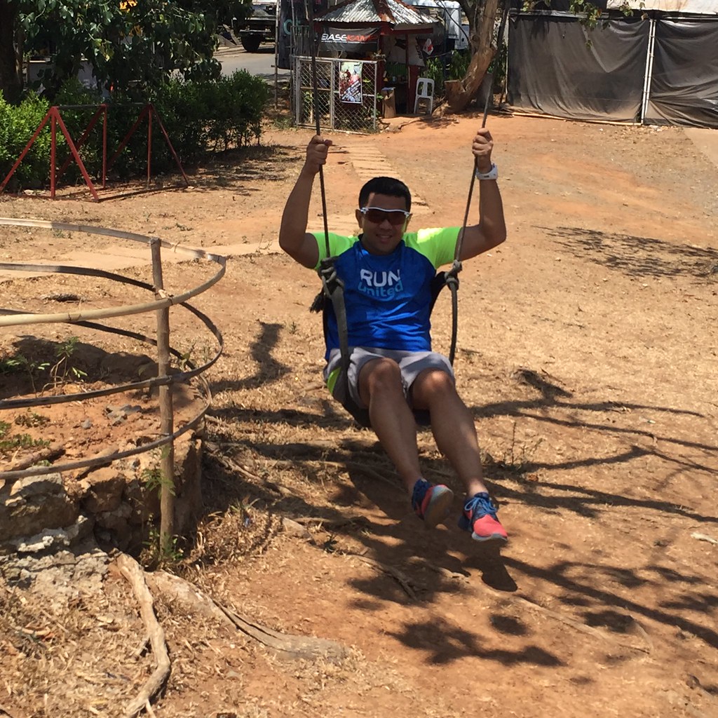
A Kid at Heart Playing at Basekamp.
Outfit of the Trail
- Top Adidas Climachill with #TaleOfTheTrail design by Breakout Design
- Shorts, Hydration Bag, Socks, Arms Sleeves and Calf Sleeves – Under Armour
- Eyewear: Suunto Radarlock Path Tour De France
- GPS Watch: Asics AG01 Watch
- Shoes: Salomon Speedcross
60 Responses to #TaleOfTheTrail Camp Sinai, Pintong Bukawe, Casile, Inigan (San Mateo, Rizal)