

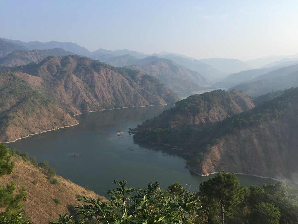
Ambuklao Lake
We were Trail-struck at Ambuklao Trail as it gave us a view of the Ambuklao Lake and the different mountain range as we went around the perimeter of the Lake. The trail is a bit raw and a bit dangerous in some portions because of the brittle soil but once you brave the tough part, you’re gonna be impressed by the beauty of Ambuklao Lake.
Read About:
- Climbing the 12 Peaks of Mt. Batulao
- Cordillera Mountain Run
- Testing Out Brooks Pure Grit 4
- Brooks Run Happy 3
- #TaleOfTheTrail Dragons Back (Hong Kong)
- #TaleOfTheTrail Camp John Hay Trails (Baguio City)
- #TaleOfTheTrail Mount Talamitam (Nasugbu, Batangas)
- #TaleOfTheTrail Mount Cabuyao (Tuba, Benguet)
- #TaleOfTheTrail Maysawa Trail (Tanay, Rizal)
- #TaleOfTheTrail Mount Kinabalu (Kota Kinabalu, Sabah, Malaysia)
- #TaleOfTheTail Mount Marami (Maragondon, Cavite)
- #TaleOfTheTrail Lantau Peak (Lantau Island, Hong Kong)
- #TaleOfTheTrail Lion Rock (New Territories, Hong Kong)
- #TaleOfTheTrail Ampucao – Sta Fe Trails (Ampucao, Itogon, Benguet)
- #TaleOfThe Trail Casile/ Bajo River / PG / Pintong Bukawe (San Mateo, Rizal)
- #TaleOfTheTrail Mount Makiling (Los Banos, Laguna)
- #TaleOfTheTrail Sierra Madre Trails (Tanay, Rizal)
- #TaleOfTheTrail Mount Kalugong and Mount Yangbo (La Trinidad, Benguet)
#TaleOfTheTrail
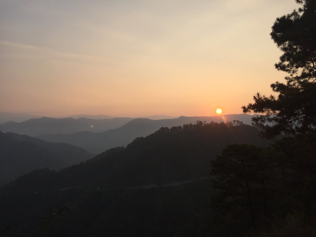
Sunrise along Bokod, Benguet
I’ve been wanting to explore the trails of Ambuklao since it was teased by Jonel Mendoza of Frontrunner a few months ago. I made sure that when I go back to Baguio, I’ll spend a day exploring Ambuklao. Rene Villarta (Jazzrunner) came along and my Uncle Ruben, who was familiar with the area took us to the venue. We left Baguio at around 5 AM so we can reach Ambuklao area by around 6-6:30 am. It was nice going out that early as we got a chance to see the sun rise. The sunrise along the highway partnered with the mountain was just a majestic view. When the sun was up, our eyes were feasted by the rich nature view of the area.

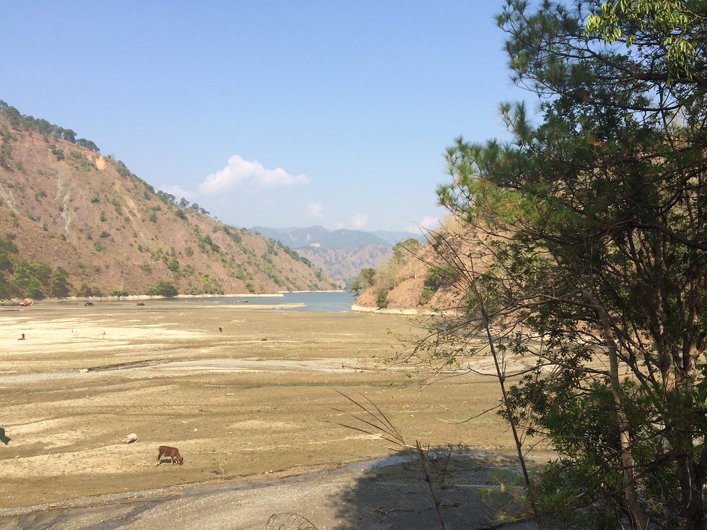
Ambuklao Dam
There’s so many ways to appreciate the view of the dam. There’s the Ambuklao lake which is several kilometers long. There’s the overflow area opposite of the lake, which was a bit dry owing to the summer months. After visiting the main dam area, we went to the view deck nearby to take a different vantage point of the lake.
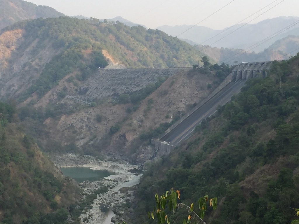
Another view of the Dam.
It’s not just that Dam that amazes you but also the surrounding mountain ranges. Bokod, Benguet has a very huge forest reserve and it’s really something worth exploring. Coming from the view deck, we then went to Lolo Cancio’s, which had a really magnificent view of the lake and the mountains. It’s just so calming having such a serene view while having breakfast.
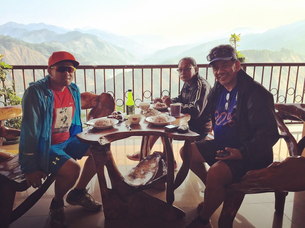
Lolo Cancio’s had affordable food and a really awesome view.
The Map and Elevation
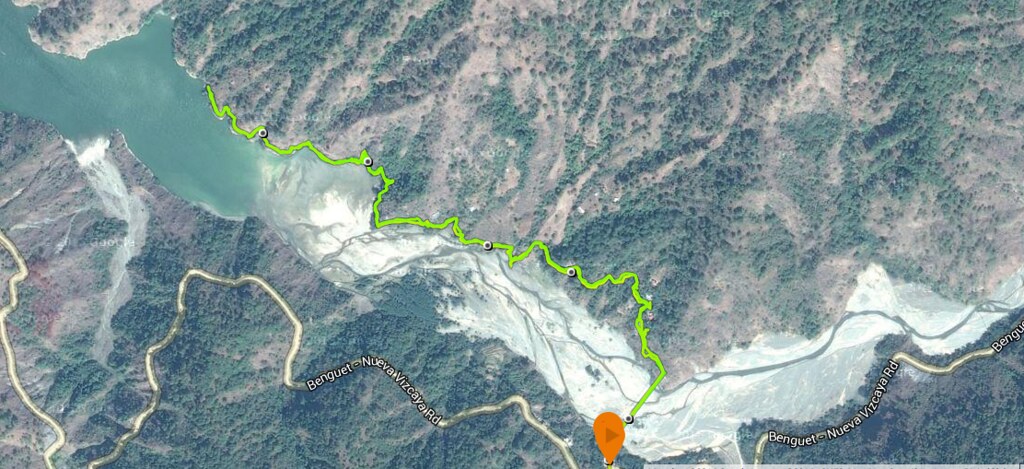
Map powered by Suunto Ambit 3 Sports
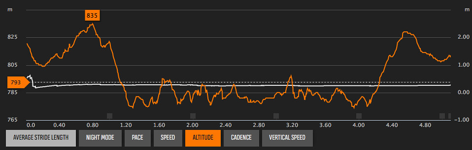
Elevation Profile is powered by Suunto Ambit 3 Sports
The trail starts at Jangjang’s Eatery. At the back of the eatery is Jangjang’s hanging bridge which is the access to the trail at the opposite side of the lake. The hanging bridge is about 300 meters. After crossing the bridge turn left and follow the trail by the side of the lake. After 1 kilometer, you get to exit to the lake area and enter the next trail. The trail is rolling and heads deeper into the lake. The trail goes around the perimeter of the lake and after exploring the lake area, just head back to Jangjang’s hanging bridge.
Trekking the Ambuklao Trail
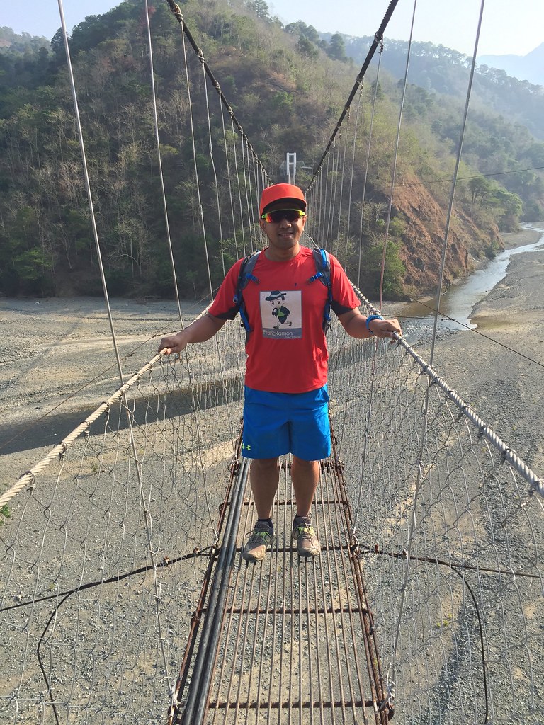
The Trail Starts at Jangjang’s Eatery and you get to cross 300 meters worth of hanging bridge.
We started around 7:30 am and we plan to do just 3 hours worth of trails as we would still be visiting the Sulfur Spring after. We started at Jangjang’s Eatery, which is also a popular stopover for those going to Mount Pulag because of the Hanging Bridge at the back of the Eatery. Coincidentally, I was also here about a year ago heading to Mount Pulag for the Cordillera Mountain Marathon.
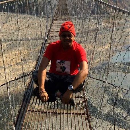
1 year ago at Jangjang’s Hanging Bridge and exactly the same top.
Crossing the hanging bridge was a real challenge since the bridge was shaky and its about 300 meters. The faster you move, the shakier it gets. It took us a few minutes to cross the bridge. The bottom of the bridge were rocky and sandy surfaces. After crossing the bridge, we went left. There were several houses in the area but we just followed the lower trail since we should be following the lake.
The trails
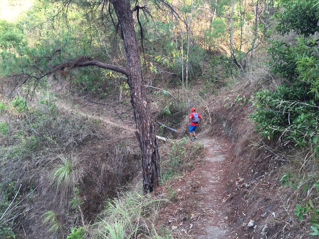
After the strip of houses, there were single track dirt roads. The trails are run-able and a bit solid. It’s a bit shaded at this part with several trees. It was nice that the area was shaded as the Bokod’s weather was really hot.

There are also some technical stretches of the trail
The trails had a rolling terrain and there are technical areas stretches too. We took our time in the trails since we were new to the trail. It was also great to slow down and appreciate the scenery. They also have make shift wooden bridges along the trail.
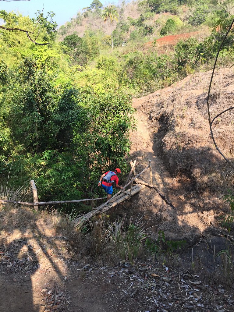
Bridges
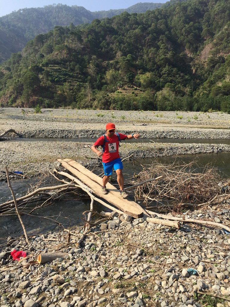
As we got deeper into the trail, it’s more barren and open. Hello to the hot morning sun!!! There are several trail alternatives. Some trails leads to residential areas so we had to ask directions. It’s always safe to take the lower trails. The trail exits to a barren rocky and sandy area with a few short river crossings. This can be an alternative route as this can lead you too the lake too as long as you can locate another trail opening when you get closer to the lake.
The lower part of the trail
Of course, we opted to head back to the trails. After descending from the first trail, there’s a wooden fenceheading to the next set of trails. There are stretches were you have to pass some twigs, stems and shoots. It gets tougher from here.
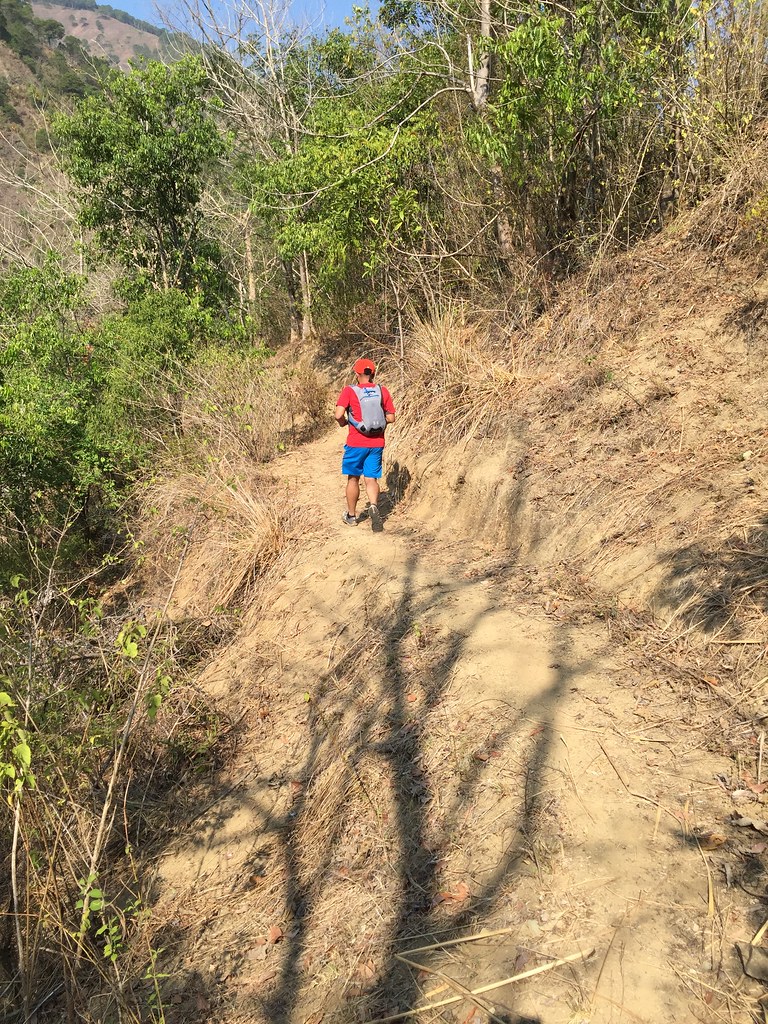
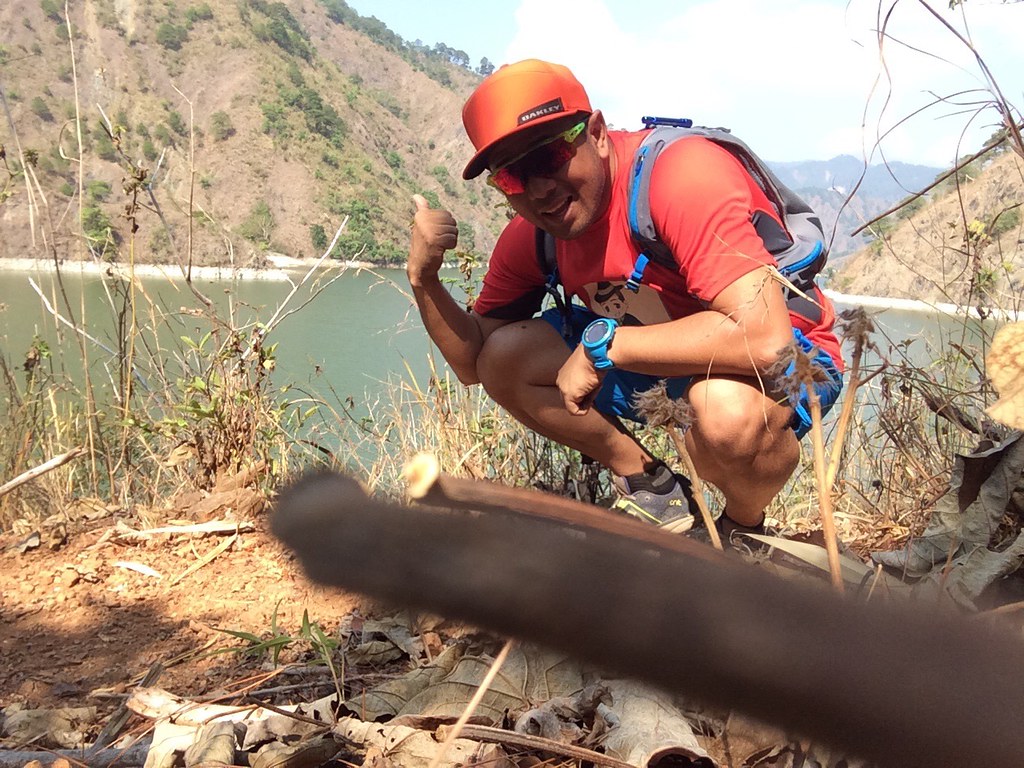
Walking on dry soil.
The trail area had several steep drops and it didn’t help that the soil was dry, soft and slippery. There were limited objects to hang on too when you lose your balance and when you try to grab some of the soil, it cracks on you. We went at a slow pace, which at times had us either crawling down or being on all fours. Rene had cramps on one of the steeper descent so had to assist him on some stretches as he recovered. He’s such a trooper though as he was still game to continue the trail.
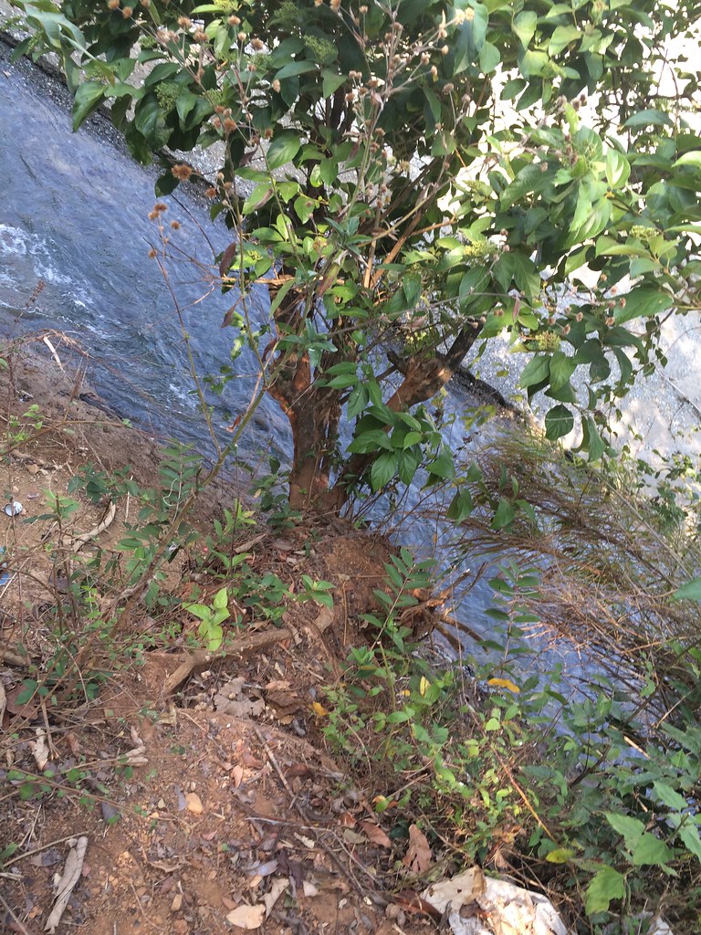
Just follow the waters.
We were running on the single track trails, which had tilted surfaces. One misstep and you’ll definitely fall. It’s really important to plan your steps and have a presence of mind. There were several dangerous paths and some were too soft to give you a stable step and some just cracks when you step at them.
We were nearing the lake.
While the lake gets closer, the trails gets even more challenging. One of the challenge was soft soiled surfaces that is tilted. I had to rely on the grip of my shoes, walk slowly and take shorter steps. Just in case I slipped, I would make sure that I reacted immediately to keep my balance.
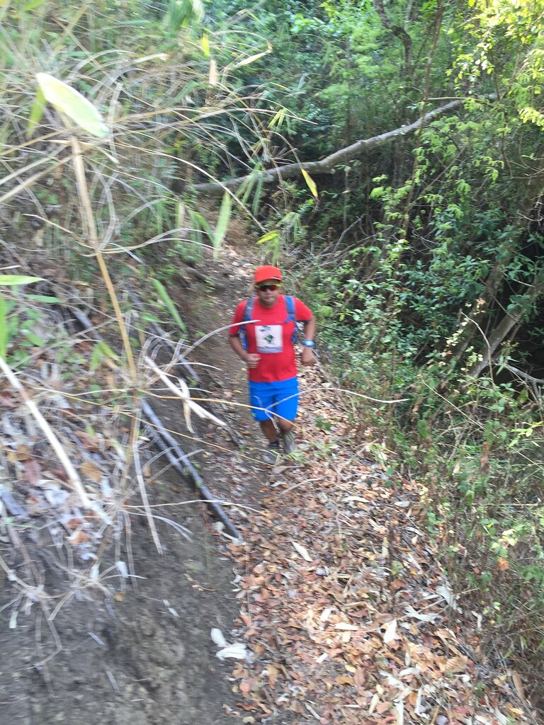
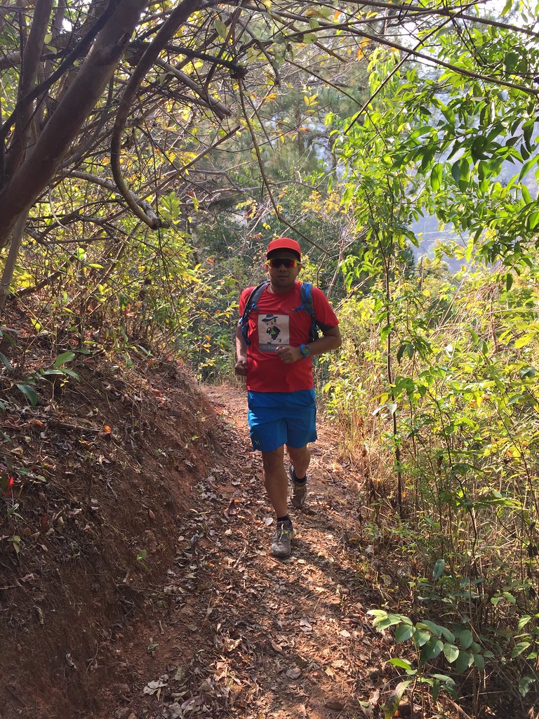
Trail Running
The next challenging part was about 10 meters worth of cracked soil just beside a ridge. How exciting, right? I noticed that there was a foot prints embedded along the cracked soil, which meant that someone was already able to pass that stretch. I followed the pattern of foot prints and it safely led me to the wooden bridge at the other side of the trail. There’s probably 3 to 4 trail areas similar to this and I also learned to step sideways using the rubber grip of my Brooks Pure Grit for better hold.
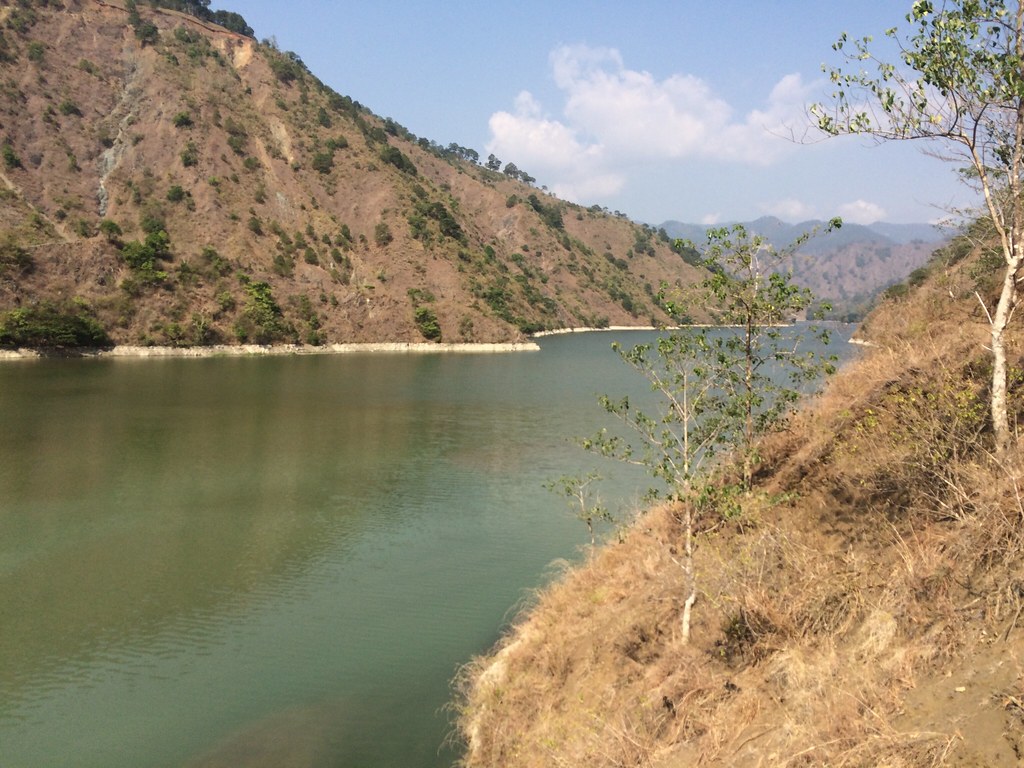
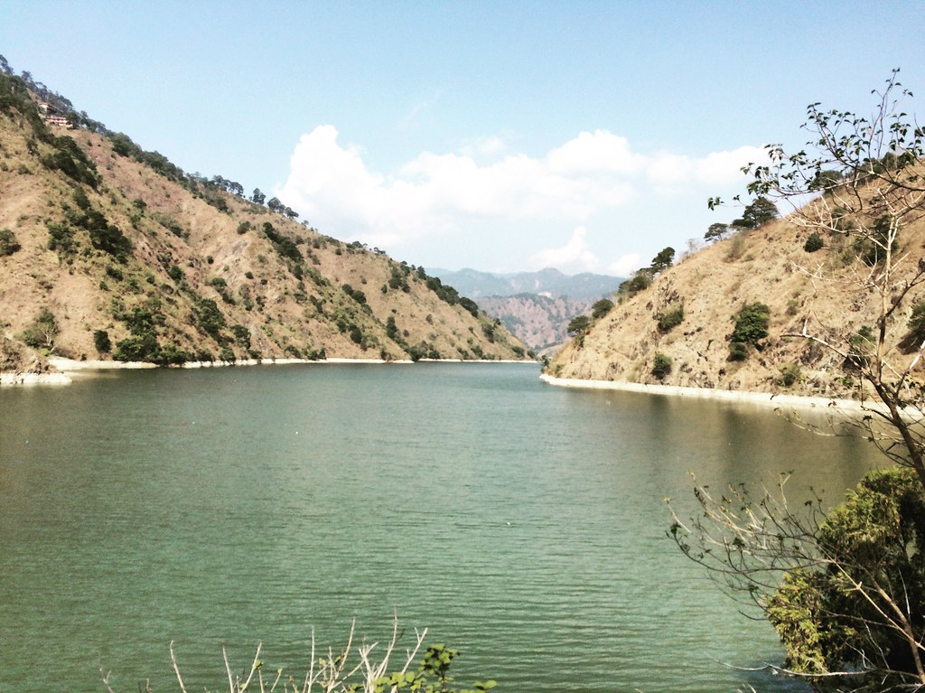
And here’s the scene of the lake.
Anything that difficult to trek should result to something beautiful and… It did!!! The view of the lake was really splendid up close. It’s a different perspective from seeing it from the view deck from the dam. The lake is huge and it may take several kilometers to navigate the lake fully.
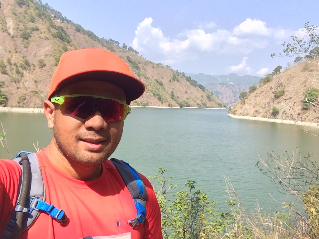
It was a really beautiful lake.
I was trekking by the lakeside. Compared to the trails going here, the trails at this area are more defined and more solid. Of course, if you fall at the lake. It’s definitely gonna test your swimming skills. There are a lot of ’tilapia’ in the lake too. Since we had three hours to trek, I took a u-turn after reaching 1:30 in my watch. That would ensure that we’re done with the trail within 3 hours.
One last look at the lake.
It was time to head back. The tough of going back was doing the hard part of the trail all over again. On my way back, I realized that there were more trail areas that were risky. I managed to crawl myself through those stretches. I managed to plan my steps and react immediately. When a soft surface breaks, I need to be alert and take the next stride to safety. It was a combination of good traction on my soles, good grip on the side of my shoes and presence of mind along the trail to survive this part.
The view is OK!!!
After surpassing the tougher parts, we were back at the bottom of the trail. We had the option to walk by the rocky and sandy surface and just enter the trail when we are near the bridge. I asked Rene to choose which he prefers since he was the one suffering cramps. He said, trails!!! He’s such a trooper. The steep drops we did earlier were now long uphill crawls. I had to go on all fours relying on the traction of my shoes and added balance in the crawling positing. We had to do that several times until we were back to the easier trails.

On the way back.
We took the last kilometer back on more solid trails. It was a fun, exciting and heart-beat stopping experience. Of course, we had to endure another round at the hanging bridge to finish within 3 hours.
After the trail, we headed to Daclan where Badekbek’s sulfur spring is located. It was 30 minutes coming from Jangjang’s eatery. Check the video above and it’s gonna amaze you. We didn’t really know what to expect. The sulfur was really boiling and it’s truly one of nature’s wonder. You’ll just have to make do with the foul smell though.
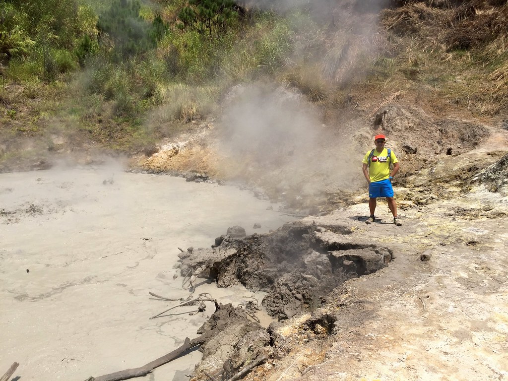
It’s hot in here!!!
After that, we had lunch in Bokod area and headed back to Baguio. We’re back in Baguio by mid-afternoon. That was a really nice and quick tour around Bokod, Benguet.
Outfit Of The Trail
- Top: Berghaus with #TaleOfTheTrail design by Breakout Design
- Shorts, Socks and Hydration Bag: Under Armour
- Shoes: Brooks Pure Grit 4
- GPS Watch: Suunto Ambit 3 Sports
- Cap and Eyewear: Oakley
40 Responses to #TaleOfTheTrail Ambuklao Dam (Ambuklao, Bokod, Benguet)