

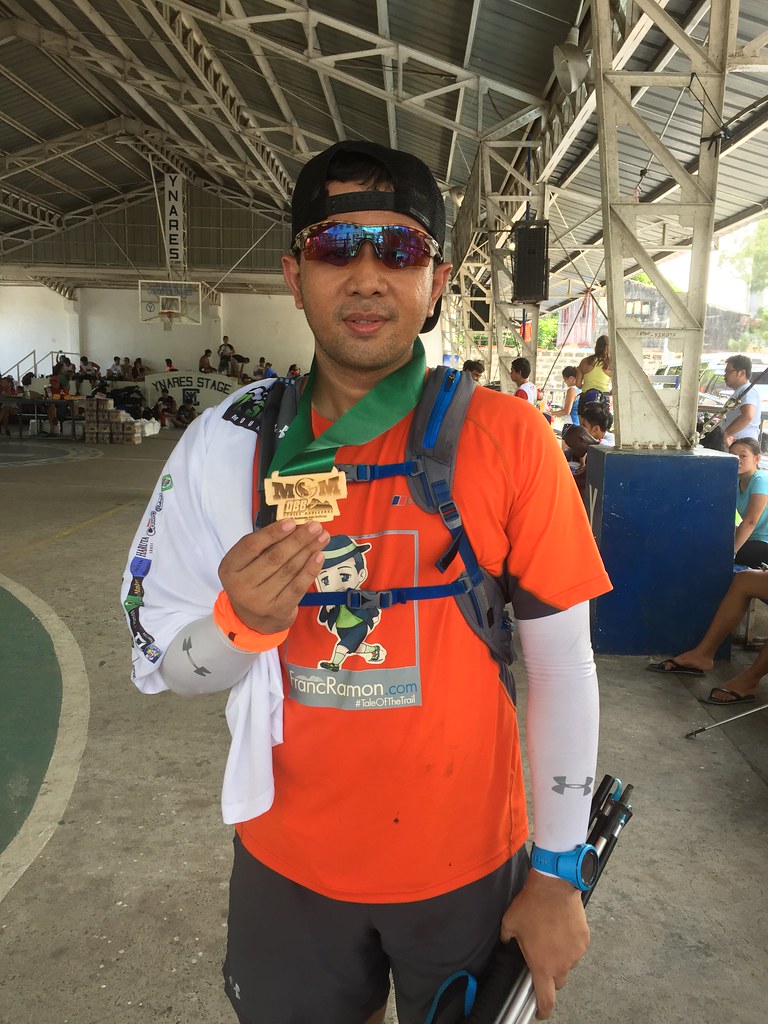
That was one tough race.
- Distance: 15 km
- Date: May 29, 2016
- Venue: Mount Sembrano, Malaya, Pililia, Rizal
Mount Sembrano Mountain Run just redefined an epic mountain run in my books. It had a long uphill climb that came with a technical terrain and a really steep incline. It also came with a very scenic route with the long ridge atop Mount Sembrano giving a high vantage point of the Pililia area.
Read About
Mount Sembrano Mountain Run
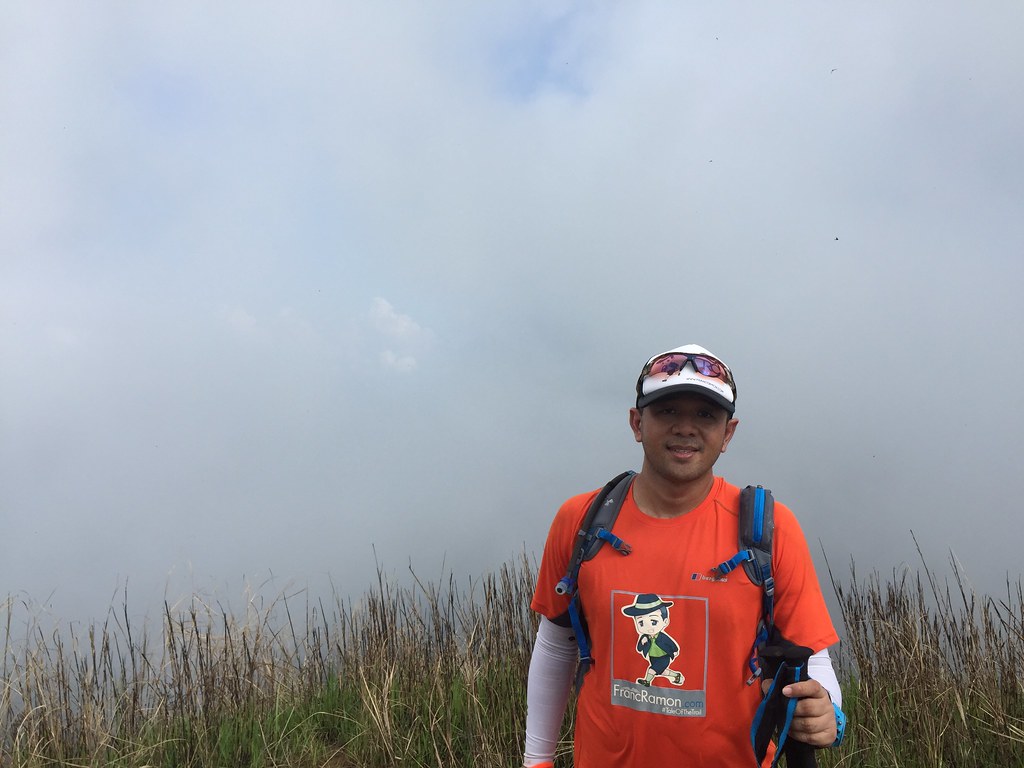
Mount Sembrano Summit
It has been an all trail summer for me. It was an easy choice to enter Mount Sembrano Mountain Run. I opted for the 15-kilometer category since it would be perfect preparation race for next week Cordillera where I’d be doing 21 kilometers. My friend Jose Ramizares of Running Photographers and Icar Hiponia of Team Smart told me that the 4K climb was really tough. It had me peeking through last year’s elevation profile which was 4K climb of more than 700 meters and rolling for several kilometers before it descends back to the finish line. The key to this race was surviving the first 4 kilometers and the race of the race would be a walk in the park.
Race Map and Elevation Profile
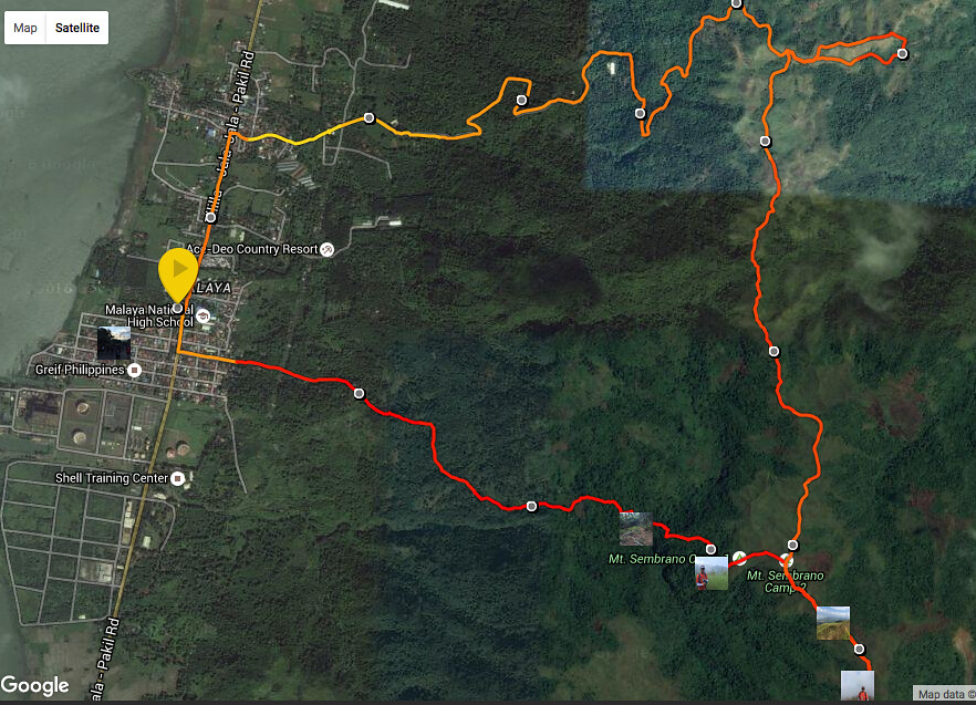
Race Map is powered by Suunto Ambit 3 Sports.
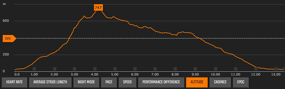
Elevation profile is powered by Suunto Ambit 3 Sports
The Race Starts at the Malaya, Pililia Barangay Hall and heads to Pililia – Jala Jala Pakli Road. It enters Belleza Street, which is the main access road heading to Mount Sembrano. The roads shifts to technical trails for the next 4 kilometers until the summit with a total climb of about 750 meters. The race then shifts to a rolling terrain across the ridge of Mount Sembrano for the next 4 kilometers heading to the aid station. There’s about a kilometer’s worth of a circular trail around another peak before the trails heads downward the rest of the way.
The Race
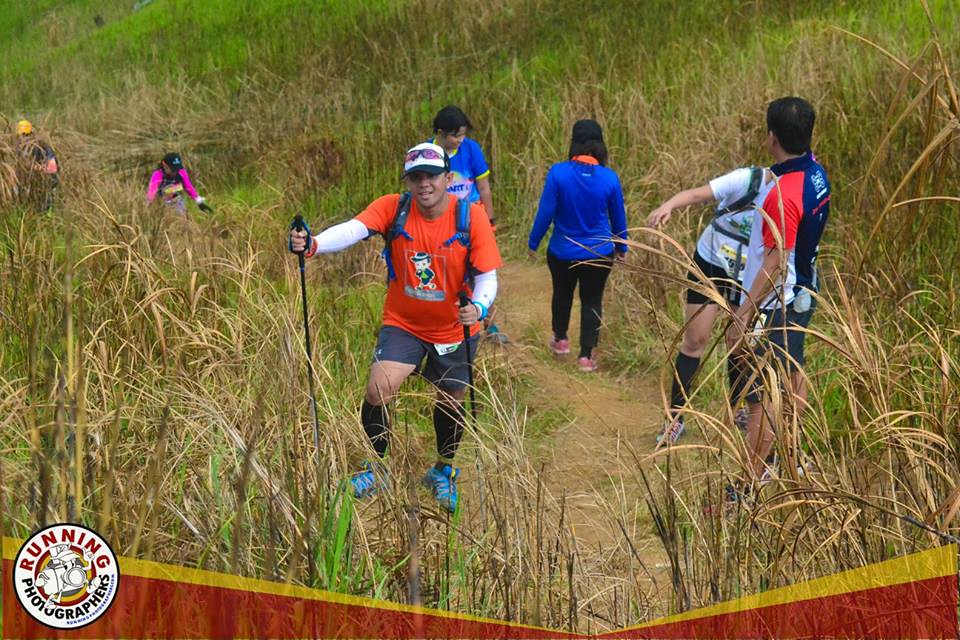
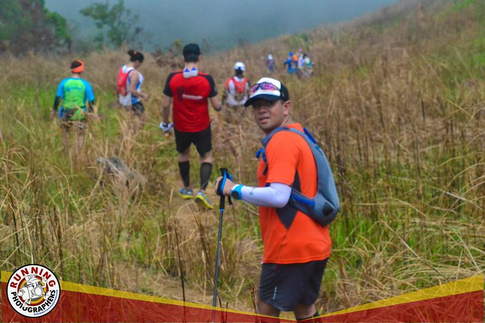
Entering the climb
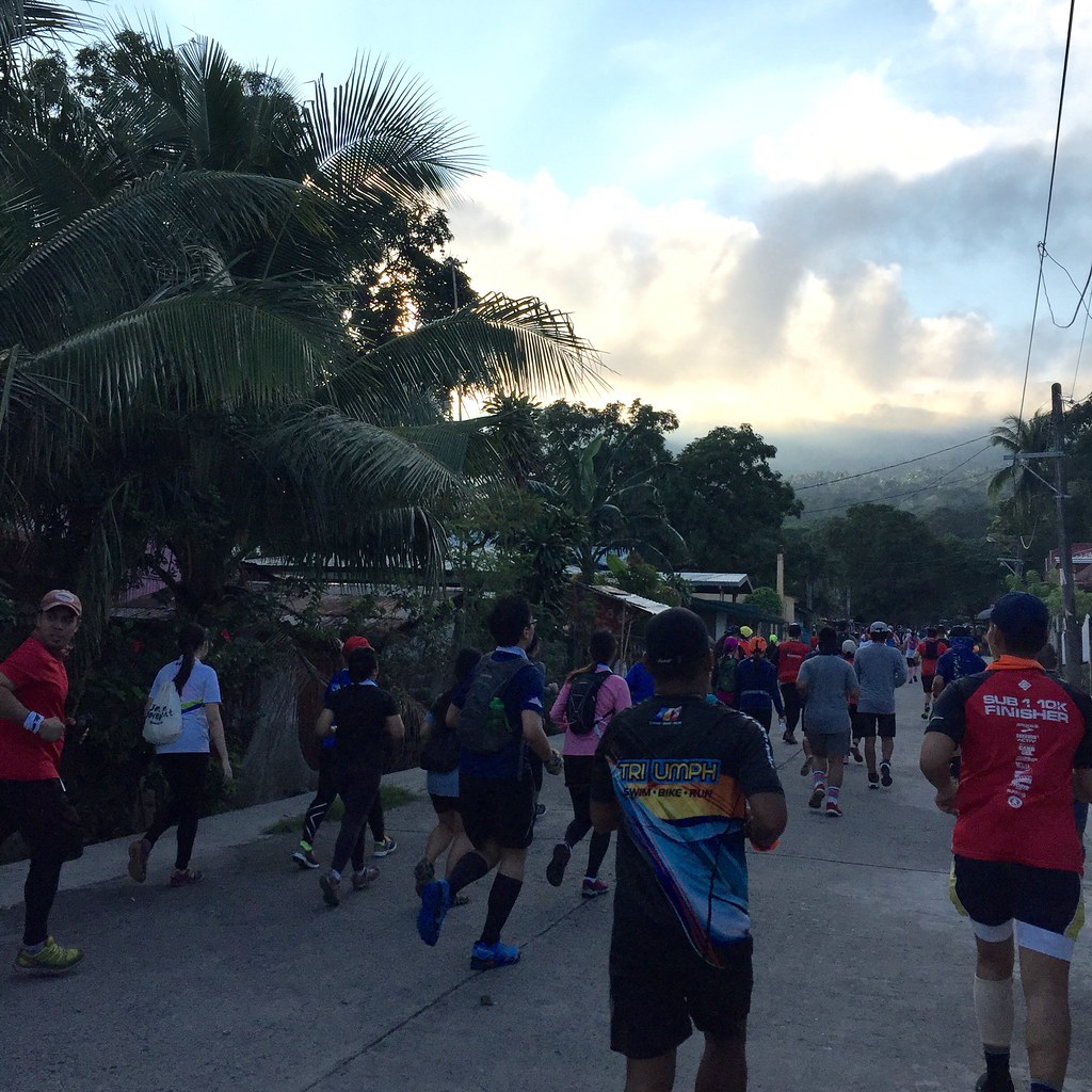
It starts early for me with a meet up with Team Smart, 2 am at Smart Towers in Makati since I would be riding with them going to the area. Thanks to Team Manager Ian Yu. It took us about two hours reaching the Pililia, Rizal for kit claiming and warming up. I had too much coffee the day before so I was a bit sleep deprived for this one. I was planning to enjoy this one and get the training effect of the long climb.
Battle Ready – Photo by Jose Ramizares of Running Photographers.
Our gun time was at 6:30 am and knowing that it was a difficult first 5 kilometers, I started out slow and relaxed. I wanted my heart rate to be steady when I started my climb. The first kilometer was from the Barangay Hall to the moderate stretch of the climb. The next kilometer became a bit tougher with a mix of single track uphill trails. It was not technical but it was still exhausting as the ascent is continuous. I usually recover on the flatter parts of the trail but the flat parts are as rare as you can get. As you go up, things get tougher.
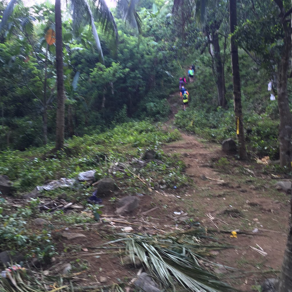
The start of the technical part of the trail.
After the second kilometer, you get to see a long climb above. It was the start of the more technical trails. It was a crawlfest from hereon. I’ve been checking my Suunto Ambit 3 Sports every now and then. The mileage is barely moving. The next two kilometers felt like forever. The trails was technical and you have to figure out what’s the best way to attack it. “Ayan, May forever!” I then switch the view of my Ambit to just show the altitude display rather than the distance. I knew I needed to cover about 750 meters of elevation and I was more than halfway, I guess that counts as a plus.
Trails are mental battles.
When ever I am in a climbing a tough stretch, I always try to visualize the toughest climbs I’ve been to. When it comes to technical trails, I try to remember the trails of Mount Kinabalu or the last 1.2 kilometers of Mount Makiling Summit. When it comes to long climbs, I think of the long 5 kilometer stretch of climbs of Tanay, Rizal. When it comes to steepness, I think of the 3rd kilometer of Mount Pulag via the Akiki trail. Mount Sembrano has it all. It was a long climb. It was a steep climb. It was a technical climb. Mount Sembrano has just redefined all the mental images of all these challenges.
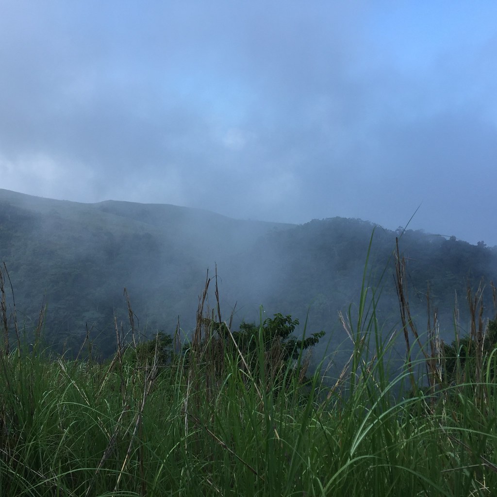
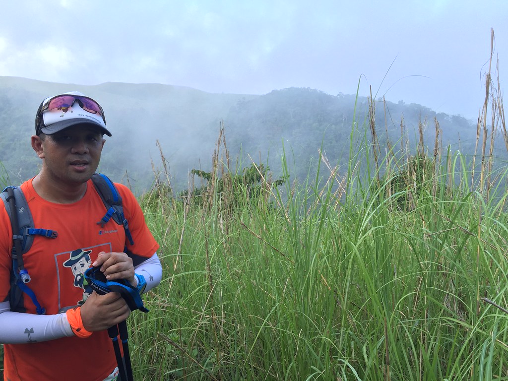
It was a foggy morning.
I took it a few steps at a time. I was just trying to be consistent on the climb and took a few seconds to rest once I felt winded. I wasn’t even thinking that it was a 15 kilometers race but I was just thinking that it was a 4 kilometers vertical challenge. You just have to be strategic on your steps as the steep ascent and the technical nature of the trail is really tough and can be punishing. It was a chess game planning the next few steps as you huff and puff your way to the climb. It was a covered trail so when I finally saw sunshine entering a part of the trail, I knew that the end of the tough part is near or so I thought.
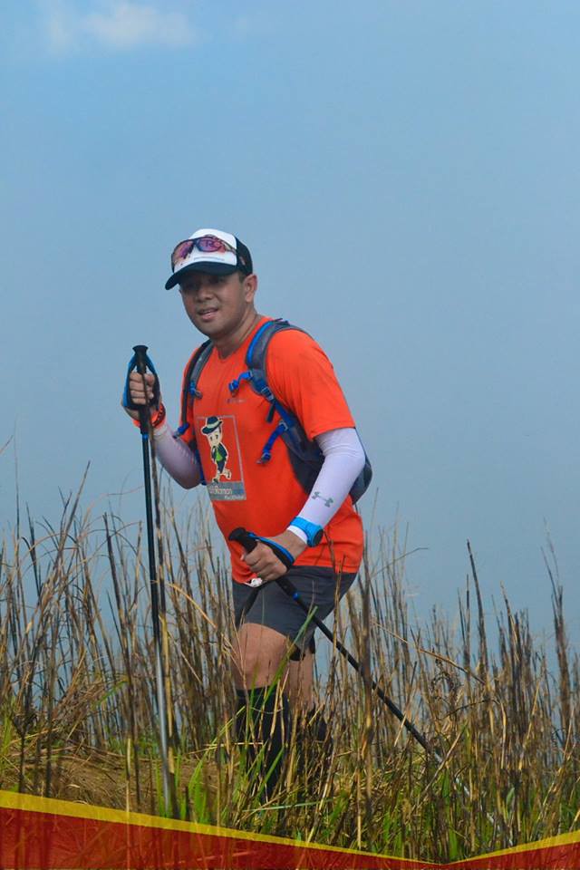
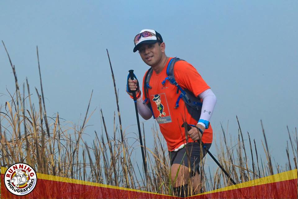
Tired and about to reach the summit – Photo by Jose Ramizares of Running Photographers.
We were out of the Forrest shade. Seeing the range of mountains surrounding you even on a foggy morning was a welcome sight. We’re just 3 kilometers into the race. There was a short stretch of flat area and guess what??? It was back to climbing again. Even if it was still a tough climb, the scenery was just refreshing. It was another 500 meters climb to the aid station. I took a short drink and some food at the aid station and then proceeded with the climb. It was another 500 meters worth of climb going to the summit.
To the Summit – Photo by Jose Ramizares of Running Photographers
It was a thin single track uphill trail with a lot of tall grass surrounding it. I went a bit faster on the short descent and remained consistent on the ascent. I saw some friends descending the trails and some on my way back to the aid station. The last 100 meters to the summit was probably the steepest part. Since I had trekking poles, I had more balance on that portion.

The Summit
It was a foggy summit but it was really great reaching this point after all the hardship. It’s always worth it when you work hard for it. I’m glad that it was foggy at this part as the heat would have made it a lot more difficult. This is the finish line of my 4 kilometers vertical challenge and now to start thinking of the rest of the race.
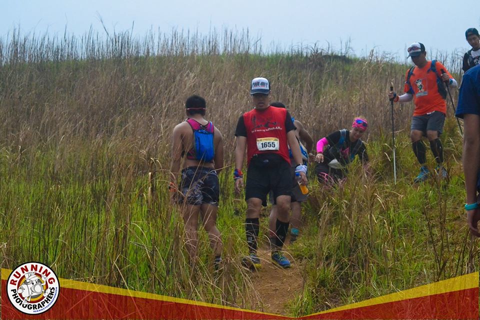
Going Down – Photo by Jose Ramizares
The first part of the descent was a bit tough with the steepness. I just trusted the traction of my shoes and the added support of my trekking poles. We headed back to the Aid Station and went on the rest of the race. From the Aid station, we shifted to the long ridge of Mount Sembrano. It was rolling from this point on. I wanted to fold my trekking pole as it was dragging me on the descent but I knew I would be using it again on the climbs. I just went on a brisk walk on the descending part instead and maintained the pace on the climbs.
The look back shot. – Photo by Jose Ramizares.
This part was a walk in the park and I love ridges since it gives you a panoramic view of your surroundings. You can see the mountains on one end. You can see the Laguna Bay at another. You can even see the Pililia windmills at some part of the course. Even if I had the option to speed up, I just opted to enjoy this part. It was about a 4-kilometer stretch heading to the next aid station. It felt brief since I was already moving faster and the views were amazing.
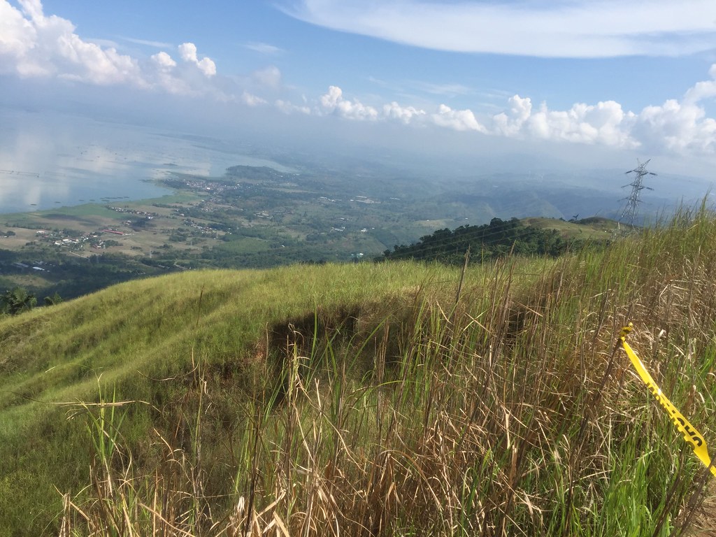
Laguna de Bay
We’ve reached the next aid station and we were given another surprise. It was a long loop with a steep climb at another peak. It was a struggle going up another steep incline but considering the climb during the first four kilometers, this is fine. The climb was just about 200 – 300 meters so had to do it with a few pushes. After this stretch it was all downhill.

Look I’ve been on the trails all Summer
I had a short stop at the aid station for another round of hydration. It was a straight downhill trek of about 5 – 6 kilometers from hereon. The first part of the descent was on technical and rocky surface. I just went on brisk walk pace at this point and just went steady on the descent. After the trails, there was a long stretch of descending paved roads. After being on mostly covered trails, it was this time that I felt the hot rays of the sun. I took a softdrinks break at one of the store and went on to finish the race.
Let’s do this again.
Thanks DBB for an redefining an EPIC race for me. I also love the circular loop, which gave us more views and challenges. It’s a race that will make you think why you are doing this but in hindsight, you would gladly do it again. Trail is like pag-ibig. Madalas masakit, minsan masarap pero gusto pa ring ulit-ulitin. #hugot
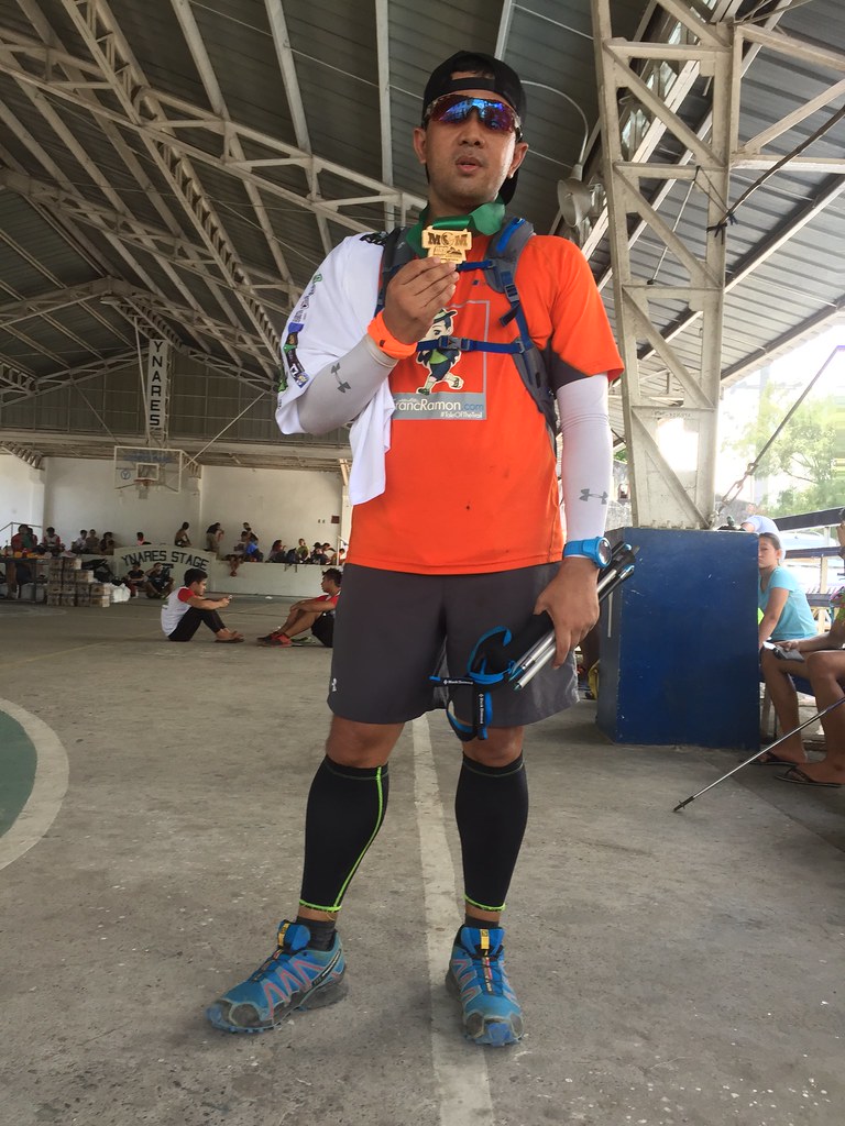
Outfit of the Trail
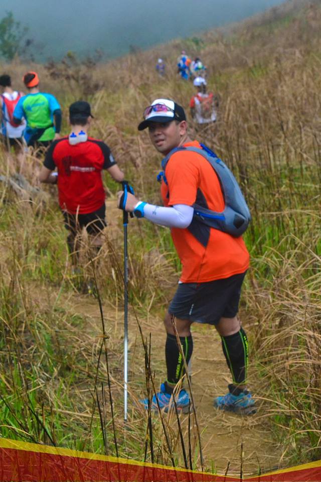
Photo by Jose Ramizares
- Top: Berghaus with #TaleOfTheTrail design by Breakout Design
- Shorts, arms sleeves, calf sleeves and hydration bag: Under Armour
- Shoes: Salomon Speed Cross
- GPS Watch: Suunto Ambit 3 Sports
- Trekking Pole: Black Diamond Distance Z Poles
- Trucker Cap: Gainz with #TaleOfTheTrail design
- Socks: Ahon
- Eyewear: Oakley Radarlock Path
64 Responses to Mount Sembrano Mountain Run